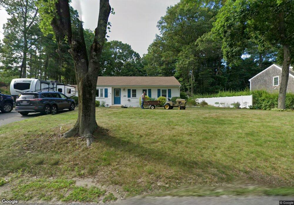
1251 Broadway Hanover, MA 02339
Estimated Value: $606,000 - $725,000
3
Beds
2
Baths
1,204
Sq Ft
$557/Sq Ft
Est. Value
About This Home
This home is located at 1251 Broadway, Hanover, MA 02339 and is currently estimated at $670,901, approximately $557 per square foot. 1251 Broadway is a home located in Plymouth County with nearby schools including Hanover High School, Cadence Academy Preschool - Hanover, and Cardinal Cushing Centers.
Ownership History
Date
Name
Owned For
Owner Type
Purchase Details
Closed on
Dec 16, 2013
Sold by
Hall Shawn J and Hall Ryan M
Bought by
Desreuisseau George W
Current Estimated Value
Home Financials for this Owner
Home Financials are based on the most recent Mortgage that was taken out on this home.
Original Mortgage
$138,000
Outstanding Balance
$102,860
Interest Rate
4.14%
Mortgage Type
New Conventional
Estimated Equity
$568,041
Purchase Details
Closed on
Jun 11, 2010
Sold by
Hutchinson Maryanne B
Bought by
Hall Shawn J and Hall Ryan M
Home Financials for this Owner
Home Financials are based on the most recent Mortgage that was taken out on this home.
Original Mortgage
$254,000
Interest Rate
5.11%
Mortgage Type
Purchase Money Mortgage
Purchase Details
Closed on
Jul 8, 2005
Sold by
Cullinan Mary Gail
Bought by
Hutchinson Maryanne B
Home Financials for this Owner
Home Financials are based on the most recent Mortgage that was taken out on this home.
Original Mortgage
$134,900
Interest Rate
5.71%
Mortgage Type
Purchase Money Mortgage
Purchase Details
Closed on
Jan 31, 2003
Sold by
Liuzzi Michael D and Liuzzi Valerie K
Bought by
Cullinane Mary G and Cullinane Mary Gail
Purchase Details
Closed on
Jun 17, 2002
Sold by
Liuzzi Michael D and Liuzzi Valerie K
Bought by
Fender Earl R
Purchase Details
Closed on
Oct 6, 2000
Sold by
Malone Charles P
Bought by
Liuzzi Michael D and Liuzzi Velerie K
Create a Home Valuation Report for This Property
The Home Valuation Report is an in-depth analysis detailing your home's value as well as a comparison with similar homes in the area
Home Values in the Area
Average Home Value in this Area
Purchase History
| Date | Buyer | Sale Price | Title Company |
|---|---|---|---|
| Desreuisseau George W | $350,000 | -- | |
| Desreuisseau George W | $350,000 | -- | |
| Hall Shawn J | $317,500 | -- | |
| Hutchinson Maryanne B | $356,900 | -- | |
| Cullinane Mary G | $310,000 | -- | |
| Fender Earl R | $1,215,000 | -- | |
| Liuzzi Michael D | $219,900 | -- |
Source: Public Records
Mortgage History
| Date | Status | Borrower | Loan Amount |
|---|---|---|---|
| Open | Desreuisseau George W | $138,000 | |
| Closed | Desreuisseau George W | $138,000 | |
| Previous Owner | Hall Shawn J | $254,000 | |
| Previous Owner | Liuzzi Michael D | $165,000 | |
| Previous Owner | Liuzzi Michael D | $134,900 | |
| Previous Owner | Liuzzi Michael D | $300,000 |
Source: Public Records
Tax History Compared to Growth
Tax History
| Year | Tax Paid | Tax Assessment Tax Assessment Total Assessment is a certain percentage of the fair market value that is determined by local assessors to be the total taxable value of land and additions on the property. | Land | Improvement |
|---|---|---|---|---|
| 2025 | $6,951 | $562,800 | $263,900 | $298,900 |
| 2024 | $7,226 | $562,800 | $263,900 | $298,900 |
| 2023 | $6,897 | $511,300 | $239,900 | $271,400 |
| 2022 | $6,898 | $452,300 | $239,900 | $212,400 |
| 2021 | $6,937 | $424,800 | $218,100 | $206,700 |
| 2020 | $6,837 | $419,200 | $218,100 | $201,100 |
| 2019 | $6,511 | $396,800 | $218,100 | $178,700 |
| 2018 | $6,339 | $389,400 | $218,100 | $171,300 |
| 2017 | $5,789 | $350,400 | $199,200 | $151,200 |
| 2016 | $5,603 | $332,300 | $181,100 | $151,200 |
| 2015 | $5,076 | $314,300 | $181,100 | $133,200 |
Source: Public Records
Map
Nearby Homes
- 1251 Broadway
- 41 Gail Rd
- Lot 22 Adams Cir
- 553 Center St
- 436 Center St
- 842 E Washington St
- 15 Elm Place
- 154 Winter St
- 114 Graham Hill Dr
- 51 Cervelli Farm Dr
- 37 Dr
- 23 Cervelli Farm Dr
- 38 Cervelli Farm Dr
- 9 Cervelli Farm Dr
- 250 Center St
- 37 Brook St
- 67 School St
- 418 E Washington St
- 21 King St
- 456 Gorwin Dr