Estimated Value: $515,000 - $655,000
4
Beds
3
Baths
4,104
Sq Ft
$144/Sq Ft
Est. Value
About This Home
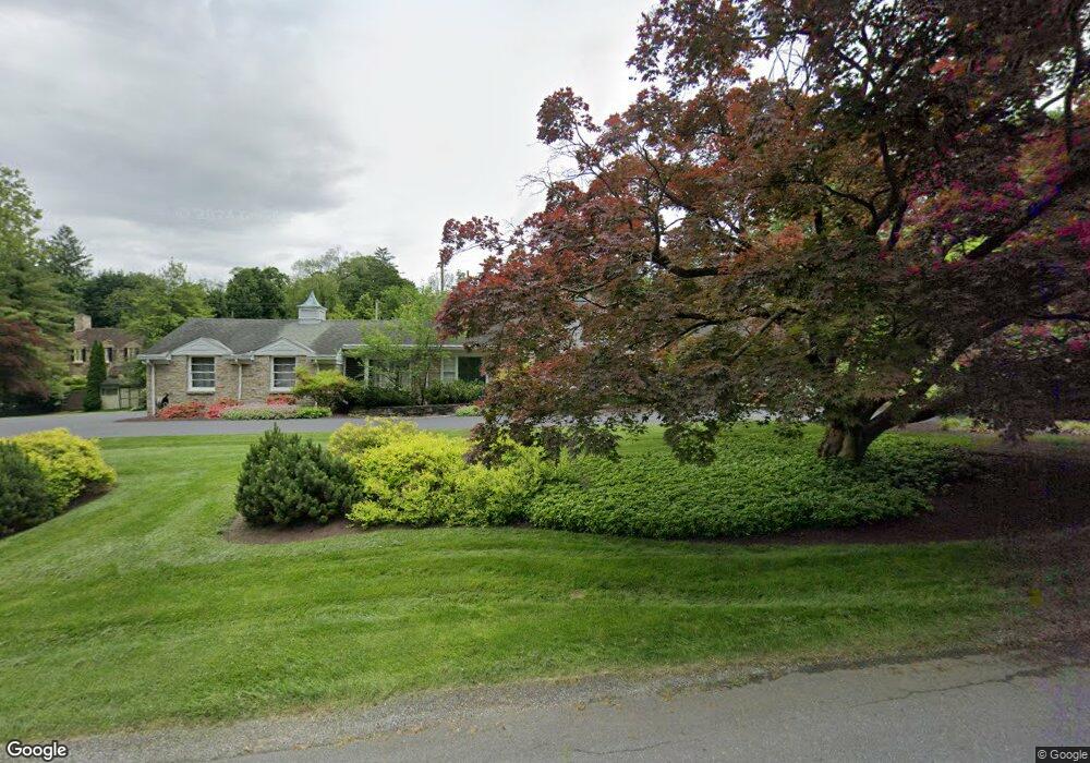
This home is located at 1251 Brockie Dr, York, PA 17403 and is currently estimated at $592,604, approximately $144 per square foot. 1251 Brockie Dr is a home located in York County with nearby schools including York Suburban Middle School, York Suburban Senior High School, and Lincoln Charter School.
Ownership History
Date
Name
Owned For
Owner Type
Purchase Details
Closed on
Feb 18, 2021
Sold by
Miller Darren M and Miller Jessica M
Bought by
Miller Darren M
Current Estimated Value
Home Financials for this Owner
Home Financials are based on the most recent Mortgage that was taken out on this home.
Original Mortgage
$284,800
Outstanding Balance
$209,647
Interest Rate
2.7%
Mortgage Type
New Conventional
Estimated Equity
$382,957
Purchase Details
Closed on
May 31, 2011
Sold by
Kline Max E and Blake Kline Bonnie
Bought by
Miller Darren M and Miller Jessica M
Home Financials for this Owner
Home Financials are based on the most recent Mortgage that was taken out on this home.
Original Mortgage
$228,000
Interest Rate
4.85%
Mortgage Type
New Conventional
Purchase Details
Closed on
Mar 18, 1993
Bought by
Kline Max E
Create a Home Valuation Report for This Property
The Home Valuation Report is an in-depth analysis detailing your home's value as well as a comparison with similar homes in the area
Home Values in the Area
Average Home Value in this Area
Purchase History
| Date | Buyer | Sale Price | Title Company |
|---|---|---|---|
| Miller Darren M | -- | Nationallink | |
| Miller Darren M | $285,000 | None Available | |
| Kline Max E | $195,000 | -- |
Source: Public Records
Mortgage History
| Date | Status | Borrower | Loan Amount |
|---|---|---|---|
| Open | Miller Darren M | $284,800 | |
| Closed | Miller Darren M | $228,000 |
Source: Public Records
Tax History Compared to Growth
Tax History
| Year | Tax Paid | Tax Assessment Tax Assessment Total Assessment is a certain percentage of the fair market value that is determined by local assessors to be the total taxable value of land and additions on the property. | Land | Improvement |
|---|---|---|---|---|
| 2025 | $11,631 | $307,210 | $50,320 | $256,890 |
| 2024 | $11,329 | $307,210 | $50,320 | $256,890 |
| 2023 | $10,983 | $307,210 | $50,320 | $256,890 |
| 2022 | $10,687 | $307,210 | $50,320 | $256,890 |
| 2021 | $10,268 | $307,210 | $50,320 | $256,890 |
| 2020 | $10,196 | $307,210 | $50,320 | $256,890 |
| 2019 | $9,409 | $290,790 | $50,320 | $240,470 |
| 2018 | $9,211 | $290,790 | $50,320 | $240,470 |
| 2017 | $9,088 | $290,790 | $50,320 | $240,470 |
| 2016 | $0 | $290,790 | $50,320 | $240,470 |
| 2015 | -- | $290,790 | $50,320 | $240,470 |
| 2014 | -- | $290,790 | $50,320 | $240,470 |
Source: Public Records
Map
Nearby Homes
- 1142 Wyndham Dr
- 300 Spring Ln
- 330 Spring Ln
- 350 Spring Ln
- 310 Spring Ln
- 380 Spring Ln
- 360 Spring Ln
- 410 Spring Ln
- 390 Spring Ln
- 1000 Country Club Rd Unit 10
- 1000 Country Club Rd Unit A13
- 1000 Country Club Rd Unit B-2
- 1000 Country Club Rd Unit 8
- 1101 Smallbrook Ln
- 633 Country Club Rd
- 1028 Rosecroft Ln
- 1149 Rosecroft Ln Unit 58
- 1058 Rosecroft Ln Unit 25
- 1133 Rosecroft Ln
- 1138 Rosecroft Ln
- 1239 Brockie Dr
- 1263 Brockie Dr
- 850 Clubhouse Rd
- 1250 Brockie Dr
- 1238 Brockie Dr
- 860 Clubhouse Rd
- 1269 Brockie Dr
- 1231 Brockie Dr
- 1256 Brockie Dr
- 840 Clubhouse Rd
- 870 Clubhouse Rd
- 845 Clubhouse Rd
- 1262 Brockie Dr
- 1275 Brockie Dr
- 1230 Brockie Dr
- 900 Brockie Ln
- 1225 Brockie Dr
- 1120 Wyndham Dr
- 1210 Brockie Dr
- 880 Clubhouse Rd