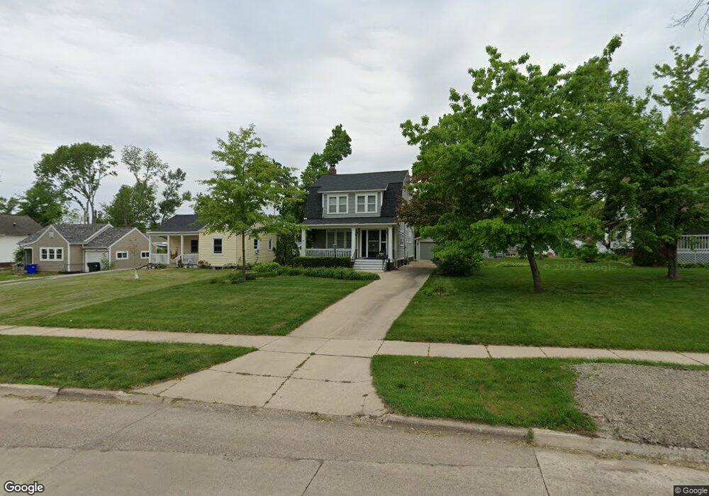
1251 Elmhurst Dr NE Cedar Rapids, IA 52402
Mound View NeighborhoodEstimated Value: $240,910 - $272,000
4
Beds
4
Baths
2,584
Sq Ft
$98/Sq Ft
Est. Value
About This Home
This home is located at 1251 Elmhurst Dr NE, Cedar Rapids, IA 52402 and is currently estimated at $252,978, approximately $97 per square foot. 1251 Elmhurst Dr NE is a home located in Linn County with nearby schools including Franklin Middle School, George Washington High School, and St. Matthew School.
Ownership History
Date
Name
Owned For
Owner Type
Purchase Details
Closed on
Nov 13, 2024
Sold by
Hutchins Rita A
Bought by
Rita A Hutchins Trust and Hutchins
Current Estimated Value
Create a Home Valuation Report for This Property
The Home Valuation Report is an in-depth analysis detailing your home's value as well as a comparison with similar homes in the area
Home Values in the Area
Average Home Value in this Area
Purchase History
| Date | Buyer | Sale Price | Title Company |
|---|---|---|---|
| Rita A Hutchins Trust | -- | None Listed On Document | |
| Rita A Hutchins Trust | -- | None Listed On Document |
Source: Public Records
Tax History Compared to Growth
Tax History
| Year | Tax Paid | Tax Assessment Tax Assessment Total Assessment is a certain percentage of the fair market value that is determined by local assessors to be the total taxable value of land and additions on the property. | Land | Improvement |
|---|---|---|---|---|
| 2025 | $3,610 | $237,200 | $35,700 | $201,500 |
| 2024 | $3,980 | $230,100 | $32,400 | $197,700 |
| 2023 | $3,980 | $230,100 | $32,400 | $197,700 |
| 2022 | $3,616 | $201,000 | $32,400 | $168,600 |
| 2021 | $3,740 | $186,900 | $32,400 | $154,500 |
| 2020 | $3,740 | $181,400 | $25,900 | $155,500 |
| 2019 | $3,656 | $181,400 | $25,900 | $155,500 |
| 2018 | $3,228 | $181,400 | $25,900 | $155,500 |
| 2017 | $3,429 | $163,800 | $25,900 | $137,900 |
| 2016 | $3,429 | $164,700 | $27,600 | $137,100 |
| 2015 | $3,733 | $178,739 | $32,436 | $146,303 |
| 2014 | $3,623 | $187,883 | $32,436 | $155,447 |
| 2013 | $3,736 | $187,883 | $32,436 | $155,447 |
Source: Public Records
Map
Nearby Homes
- 1522 J Ave NE
- 1839 K Ave NE
- 1115 27th St NE
- 1047 27th St NE
- 910 Maplewood Dr NE
- 2935 Wildwood Ct NE
- 1046 12th St NE
- 2944 Oakland Rd NE
- 909 Daniels St NE
- 2019 G Ave NE
- 1815 E Ave NE
- 1857 E Ave NE
- 517 18th St NE
- 514 16th St NE
- 832 Daniels St NE
- 3028 Center Point Rd NE Unit 202
- 826 Daniels St NE
- 3050 Center Point Rd NE
- 2435 Franklin Ave NE
- 2000 Sierra Cir NE
- 1247 Elmhurst Dr NE
- 1245 Elmhurst Dr NE
- 1243 Elmhurst Dr NE
- 1267 Elmhurst Dr NE
- 1242 Maplewood Dr NE
- 1248 Maplewood Dr NE
- 1238 Maplewood Dr NE
- 1235 Elmhurst Dr NE
- 1269 Elmhurst Dr NE
- 1230 Maplewood Dr NE
- 1248 Elmhurst Dr NE
- 1254 Elmhurst Dr NE
- 1260 Elmhurst Dr NE
- 1246 Elmhurst Dr NE
- 1231 Elmhurst Dr NE
- 1274 Elmhurst Dr NE
- 1224 Maplewood Dr NE
- 1310 Maplewood Dr NE
- 1279 Elmhurst Dr NE
- 1240 Elmhurst Dr NE