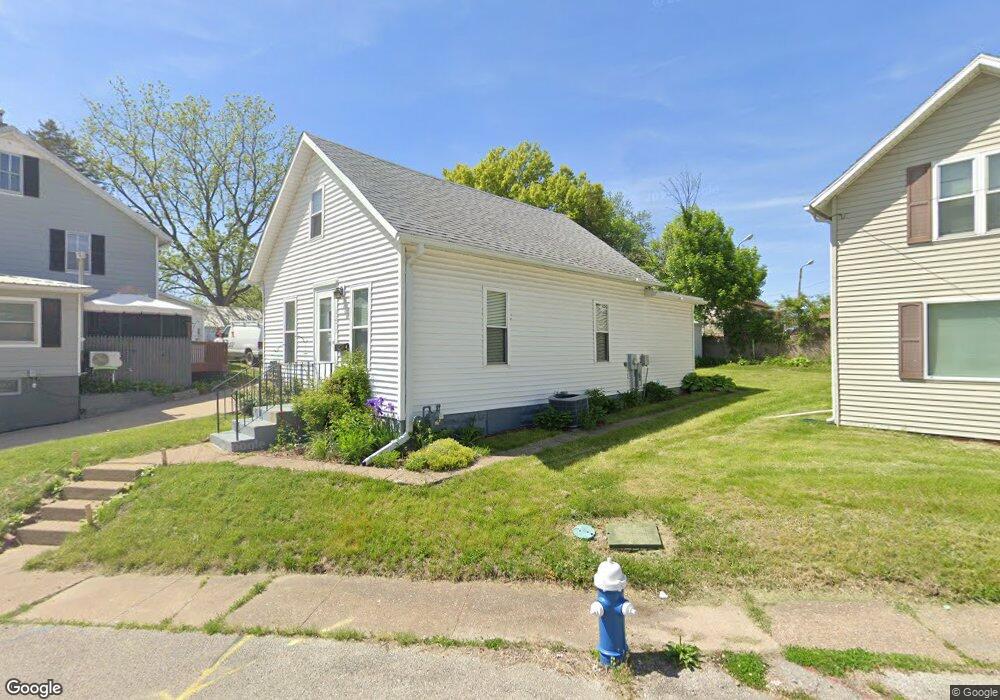
1251 Halstead St Muscatine, IA 52761
Estimated Value: $83,000 - $106,000
3
Beds
1
Bath
902
Sq Ft
$103/Sq Ft
Est. Value
About This Home
This home is located at 1251 Halstead St, Muscatine, IA 52761 and is currently estimated at $92,757, approximately $102 per square foot. 1251 Halstead St is a home located in Muscatine County with nearby schools including Muskie Early Learning Center, Central Middle School, and Muscatine High School.
Ownership History
Date
Name
Owned For
Owner Type
Purchase Details
Closed on
Jul 27, 2022
Sold by
Vipond Bruce L
Bought by
Roush Jerry L and Roush Carolyn
Current Estimated Value
Home Financials for this Owner
Home Financials are based on the most recent Mortgage that was taken out on this home.
Original Mortgage
$47,500
Outstanding Balance
$40,105
Interest Rate
4.81%
Mortgage Type
New Conventional
Estimated Equity
$52,652
Purchase Details
Closed on
May 22, 2003
Sold by
Theobald Dennis L and Theobald Connie J
Bought by
Vipond Bruce L
Create a Home Valuation Report for This Property
The Home Valuation Report is an in-depth analysis detailing your home's value as well as a comparison with similar homes in the area
Home Values in the Area
Average Home Value in this Area
Purchase History
| Date | Buyer | Sale Price | Title Company |
|---|---|---|---|
| Roush Jerry L | $62,500 | None Listed On Document | |
| Vipond Bruce L | $27,000 | None Available |
Source: Public Records
Mortgage History
| Date | Status | Borrower | Loan Amount |
|---|---|---|---|
| Open | Roush Jerry L | $47,500 |
Source: Public Records
Tax History Compared to Growth
Tax History
| Year | Tax Paid | Tax Assessment Tax Assessment Total Assessment is a certain percentage of the fair market value that is determined by local assessors to be the total taxable value of land and additions on the property. | Land | Improvement |
|---|---|---|---|---|
| 2025 | $1,130 | $65,760 | $7,670 | $58,090 |
| 2024 | $1,130 | $62,280 | $7,670 | $54,610 |
| 2023 | $1,080 | $61,999 | $7,674 | $54,325 |
| 2022 | $1,058 | $53,670 | $7,240 | $46,430 |
| 2021 | $1,058 | $51,870 | $7,240 | $44,630 |
| 2020 | $830 | $48,260 | $7,240 | $41,020 |
| 2019 | $854 | $47,140 | $0 | $0 |
| 2018 | $834 | $47,030 | $0 | $0 |
| 2017 | $816 | $44,690 | $0 | $0 |
| 2016 | $814 | $44,690 | $0 | $0 |
| 2015 | $814 | $43,080 | $0 | $0 |
| 2014 | $782 | $39,630 | $0 | $0 |
Source: Public Records
Map
Nearby Homes
- 140 Sheridan St
- 1554 Washington St
- 318 Monroe St
- 0 Fillmore St Parcel
- 205 Fairview Ave
- 416 Jackson St
- 514 Jackson St
- 1414 Lincoln Blvd
- 1416 Lincoln Blvd
- 610 Jackson St
- 1010 Lombard St
- 630 Jackson St
- 1005 Cypress St
- 901 E 11th St
- 811 Hershey Ct
- 1704 Grand Ave
- 1707 Lincoln Blvd
- 1017 Oak St
- 1708 Cobblestone Dr
- 806 E 6th St
- 1253 Halstead St
- 1247 Halstead St
- 1239 Halstead St
- 1255 Halstead St
- 1254 Halstead St
- 1245 Halstead St
- 1548 Grant St
- 1546 Grant St
- 716 Park Ave
- 1252 Halstead St
- 1544 Grant St
- 720 Park Ave
- 1250 Halstead St
- 1248 Halstead St
- 710 Park Ave
- 1538 Grant St
- 1201 Halstead St
- 1244 Halstead St
- 1502 Washington St
- 711 Park Ave