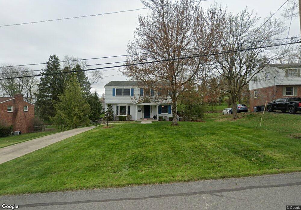
1251 Satellite Cir Pittsburgh, PA 15241
Estimated Value: $401,000 - $479,000
4
Beds
3
Baths
2,035
Sq Ft
$212/Sq Ft
Est. Value
About This Home
This home is located at 1251 Satellite Cir, Pittsburgh, PA 15241 and is currently estimated at $432,250, approximately $212 per square foot. 1251 Satellite Cir is a home located in Allegheny County with nearby schools including Upper St. Clair High School and St. Louise De Marillac School.
Ownership History
Date
Name
Owned For
Owner Type
Purchase Details
Closed on
Apr 25, 1990
Bought by
Ferneding Joseph C and Ferneding Maryann
Current Estimated Value
Create a Home Valuation Report for This Property
The Home Valuation Report is an in-depth analysis detailing your home's value as well as a comparison with similar homes in the area
Home Values in the Area
Average Home Value in this Area
Purchase History
| Date | Buyer | Sale Price | Title Company |
|---|---|---|---|
| Ferneding Joseph C | $121,000 | -- |
Source: Public Records
Tax History Compared to Growth
Tax History
| Year | Tax Paid | Tax Assessment Tax Assessment Total Assessment is a certain percentage of the fair market value that is determined by local assessors to be the total taxable value of land and additions on the property. | Land | Improvement |
|---|---|---|---|---|
| 2025 | $6,825 | $178,700 | $40,100 | $138,600 |
| 2024 | $6,825 | $178,700 | $40,100 | $138,600 |
| 2023 | $6,634 | $178,700 | $40,100 | $138,600 |
| 2022 | $6,476 | $178,700 | $40,100 | $138,600 |
| 2021 | $1,530 | $178,700 | $40,100 | $138,600 |
| 2020 | $6,243 | $178,700 | $40,100 | $138,600 |
| 2019 | $6,151 | $178,700 | $40,100 | $138,600 |
| 2018 | $845 | $178,700 | $40,100 | $138,600 |
| 2017 | $5,878 | $178,700 | $40,100 | $138,600 |
| 2016 | $845 | $178,700 | $40,100 | $138,600 |
| 2015 | $845 | $178,700 | $40,100 | $138,600 |
| 2014 | $5,497 | $178,700 | $40,100 | $138,600 |
Source: Public Records
Map
Nearby Homes
- 1331 Morrow Rd
- 1435 Morrow Rd
- 1005 Tall Trees Dr
- 250 Portman Ln Unit A
- 1560 Mayview Rd
- 1251 Greystone Dr
- 1109 Bank St
- 2370 Morrow Rd
- 2301 Southampton Dr
- 412 Winfield St
- 2350 Morrow Rd
- 2013 Ashton Row
- 2122 Westcott Ln
- 1115 Sray Ln
- Ashby Plan at Hastings - Single Family
- Royston Plan at Hastings - Single Family
- Corby Plan at Hastings - Single Family
- Helston Plan at Hastings - Single Family
- Marlow Plan at Hastings - Single Family
- Bromley Plan at Hastings - Single Family
- 1249 Satellite Cir
- 1255 Satellite Cir
- 1245 Satellite Cir
- 1220 Star Ridge Dr
- 1228 Star Ridge Dr
- 1236 Star Ridge Dr
- 1256 Satellite Cir
- 1257 Satellite Cir
- 1240 Satellite Cir
- 1212 Star Ridge Dr
- 1248 Star Ridge Dr
- 1259 Satellite Cir
- 1241 Satellite Cir
- 1447 Mayview Rd
- 1232 Satellite Cir
- 1252 Star Ridge Dr
- 1237 Sky Ridge Dr
- 1204 Star Ridge Dr
- 1261 Satellite Cir
- 1233 Satellite Cir