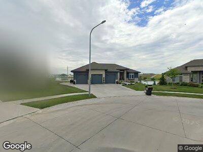
12515 Pheasant Run Ln Papillion, NE 68046
Estimated Value: $706,000 - $833,837
3
Beds
3
Baths
1,993
Sq Ft
$385/Sq Ft
Est. Value
About This Home
This home is located at 12515 Pheasant Run Ln, Papillion, NE 68046 and is currently estimated at $766,959, approximately $384 per square foot. 12515 Pheasant Run Ln is a home located in Sarpy County with nearby schools including Prairie Queen Elementary School, Liberty Middle School, and Papillion La Vista Senior High School.
Ownership History
Date
Name
Owned For
Owner Type
Purchase Details
Closed on
Nov 16, 2018
Sold by
Woodland Homes Inc
Bought by
Niles Robert and Niles Krista
Current Estimated Value
Home Financials for this Owner
Home Financials are based on the most recent Mortgage that was taken out on this home.
Original Mortgage
$64,400
Interest Rate
4.7%
Create a Home Valuation Report for This Property
The Home Valuation Report is an in-depth analysis detailing your home's value as well as a comparison with similar homes in the area
Home Values in the Area
Average Home Value in this Area
Purchase History
| Date | Buyer | Sale Price | Title Company |
|---|---|---|---|
| Niles Robert | $576,000 | Builders Title Co |
Source: Public Records
Mortgage History
| Date | Status | Borrower | Loan Amount |
|---|---|---|---|
| Open | Niles Robert E | $210,500 | |
| Open | Niles Robert | $451,000 | |
| Closed | Niles Robert E | $64,400 | |
| Closed | Niles Robert | $453,100 | |
| Previous Owner | Woodland Homes Inc | $24,500,000 |
Source: Public Records
Tax History Compared to Growth
Tax History
| Year | Tax Paid | Tax Assessment Tax Assessment Total Assessment is a certain percentage of the fair market value that is determined by local assessors to be the total taxable value of land and additions on the property. | Land | Improvement |
|---|---|---|---|---|
| 2024 | $13,659 | $714,770 | $127,000 | $587,770 |
| 2023 | $13,659 | $630,883 | $123,000 | $507,883 |
| 2022 | $11,987 | $509,660 | $123,000 | $386,660 |
| 2021 | $12,265 | $501,263 | $123,000 | $378,263 |
| 2020 | $12,725 | $501,623 | $120,000 | $381,623 |
| 2019 | $12,625 | $488,272 | $120,000 | $368,272 |
| 2018 | $1,619 | $60,000 | $60,000 | $0 |
| 2017 | $456 | $16,780 | $16,780 | $0 |
| 2016 | $457 | $16,780 | $16,780 | $0 |
| 2015 | $64 | $2,344 | $2,344 | $0 |
Source: Public Records
Map
Nearby Homes
- 12413 Pheasant Run Ln
- 10209 S 124th Ave
- 12359 Elk Ridge Cir
- 10309 S 125th St
- 9715 S 123rd Ave
- 12308 Windward Ave
- 12351 Elk Ridge Cir
- 12356 Elk Ridge Cir
- 10311 S 124th St
- 12106 Montauk Dr
- 10620 S 127th Plaza
- 10610 S 126th Ct
- 10712 S 127th Terrace
- 10208 S 118th St
- 10102 S 118th St
- 10008 S 118th St
- 10004 S 118th St
- 9956 S 118th St
- 10358 S 118th St
- 10402 S 118th St
- 12515 Pheasant Run Ln
- 12513 Pheasant Run Ln
- 12517 Pheasant Run Ln
- 12509 Pheasant Run Ln
- 12505 Pheasant Run Cir
- 12522 Pheasant Run Cir
- 12506 Windward Cir
- 12506 Pheasant Run Cir
- 12518 Pheasant Run Cir
- 12502 Windward Cir
- 12510 Windward Cir
- 12510 Pheasant Run Cir
- 12514 Pheasant Run Cir
- 12466 Pheasant Run Ln
- 12463 Pheasant Run Ln
- 12464 Windward Ave
- 12462 Pheasant Run Ln
- 12507 Windward Cir
- 12459 Pheasant Run Ln
- 12503 Windward Cir