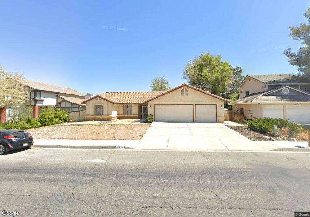
12521 Cobalt Rd Victorville, CA 92392
Estimated Value: $397,000 - $426,000
3
Beds
2
Baths
1,584
Sq Ft
$258/Sq Ft
Est. Value
About This Home
This home is located at 12521 Cobalt Rd, Victorville, CA 92392 and is currently estimated at $408,296, approximately $257 per square foot. 12521 Cobalt Rd is a home located in San Bernardino County with nearby schools including Liberty Elementary School, Park View Elementary School, and Imogene Garner Hook Junior High School.
Ownership History
Date
Name
Owned For
Owner Type
Purchase Details
Closed on
May 16, 1996
Sold by
Castro Felix and Castro Gabriela
Bought by
Vigil Robert
Current Estimated Value
Home Financials for this Owner
Home Financials are based on the most recent Mortgage that was taken out on this home.
Original Mortgage
$64,000
Outstanding Balance
$3,580
Interest Rate
7.8%
Estimated Equity
$404,716
Create a Home Valuation Report for This Property
The Home Valuation Report is an in-depth analysis detailing your home's value as well as a comparison with similar homes in the area
Home Values in the Area
Average Home Value in this Area
Purchase History
| Date | Buyer | Sale Price | Title Company |
|---|---|---|---|
| Vigil Robert | -- | Orange Coast Title |
Source: Public Records
Mortgage History
| Date | Status | Borrower | Loan Amount |
|---|---|---|---|
| Open | Vigil Robert | $64,000 |
Source: Public Records
Tax History Compared to Growth
Tax History
| Year | Tax Paid | Tax Assessment Tax Assessment Total Assessment is a certain percentage of the fair market value that is determined by local assessors to be the total taxable value of land and additions on the property. | Land | Improvement |
|---|---|---|---|---|
| 2025 | $1,634 | $142,868 | $33,227 | $109,641 |
| 2024 | $1,634 | $140,066 | $32,575 | $107,491 |
| 2023 | $1,615 | $137,319 | $31,936 | $105,383 |
| 2022 | $1,586 | $134,627 | $31,310 | $103,317 |
| 2021 | $1,556 | $131,987 | $30,696 | $101,291 |
| 2020 | $1,527 | $130,633 | $30,381 | $100,252 |
| 2019 | $1,500 | $128,071 | $29,785 | $98,286 |
| 2018 | $1,595 | $125,560 | $29,201 | $96,359 |
| 2017 | $1,561 | $123,098 | $28,628 | $94,470 |
| 2016 | $1,528 | $120,685 | $28,067 | $92,618 |
| 2015 | $1,474 | $118,872 | $27,645 | $91,227 |
| 2014 | $1,445 | $116,543 | $27,103 | $89,440 |
Source: Public Records
Map
Nearby Homes
- 12650 Cobalt Rd
- 12565 High Desert Rd
- 13400 Solitude Cir
- 12421 Kirkwood Dr
- 12462 Kirkwood Dr
- 12404 Mammoth Dr
- 0 Mesa Linda Unit CV25121235
- 0 Mesa Dr Unit IG25017852
- 0 Verde 11th St Unit HD24081944
- 12545 Ironstone Ct
- 13463 Desert Primrose Ln
- 0 Cobalt Rd Unit HD25073625
- 13186 Blue Mesa Ct
- 13198 Blue Mesa Ct
- 12326 Goldstone Cir
- 13590 Mica Ave
- 12841 Cobalt Rd
- 13489 Buggy Whip Ct
- 13026 Canta Loma Ln
- 12873 Cobalt Rd
- 12511 Cobalt Rd
- 12533 Cobalt Rd
- 12522 Aspenview St
- 12532 Aspenview St
- 12510 Aspenview St
- 13289 Soft Cloud Way
- 12549 Cobalt Rd
- 13290 Northstar Ave
- 12544 Aspenview St
- 13279 Soft Cloud Way
- 13280 Northstar Ave
- 12487 Cobalt Rd
- 12557 Cobalt Rd
- 12556 Aspenview St
- 12488 Aspenview Cir
- 13350 Northstar Ave
- 12550 Cobalt Rd
- 12525 Aspenview St
- 12535 Aspenview St
- 13291 Northstar Ave