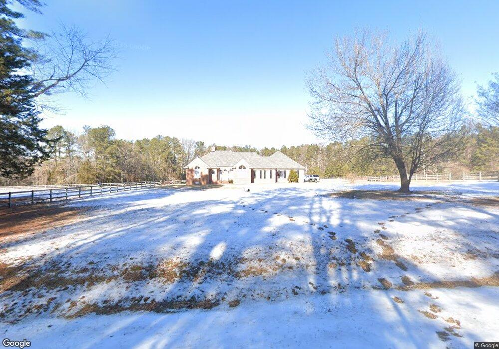
12526 Moates Dr Ashland, VA 23005
Estimated Value: $728,000 - $838,000
3
Beds
3
Baths
2,725
Sq Ft
$286/Sq Ft
Est. Value
About This Home
This home is located at 12526 Moates Dr, Ashland, VA 23005 and is currently estimated at $778,186, approximately $285 per square foot. 12526 Moates Dr is a home located in Hanover County with nearby schools including Henry Clay Elementary School, Liberty Middle School, and Patrick Henry High School.
Ownership History
Date
Name
Owned For
Owner Type
Purchase Details
Closed on
Mar 12, 2010
Sold by
Richmond Douglas A
Bought by
Gayle A Blake
Current Estimated Value
Home Financials for this Owner
Home Financials are based on the most recent Mortgage that was taken out on this home.
Original Mortgage
$336,000
Outstanding Balance
$223,138
Interest Rate
5.02%
Mortgage Type
New Conventional
Estimated Equity
$555,048
Purchase Details
Closed on
Apr 8, 2005
Sold by
Wall Carolyn
Bought by
Richmond Douglas
Home Financials for this Owner
Home Financials are based on the most recent Mortgage that was taken out on this home.
Original Mortgage
$93,100
Interest Rate
5.78%
Mortgage Type
Credit Line Revolving
Create a Home Valuation Report for This Property
The Home Valuation Report is an in-depth analysis detailing your home's value as well as a comparison with similar homes in the area
Home Values in the Area
Average Home Value in this Area
Purchase History
| Date | Buyer | Sale Price | Title Company |
|---|---|---|---|
| Gayle A Blake | $420,000 | -- | |
| Richmond Douglas | $465,500 | -- |
Source: Public Records
Mortgage History
| Date | Status | Borrower | Loan Amount |
|---|---|---|---|
| Open | Gayle A Blake | $336,000 | |
| Previous Owner | Richmond Douglas | $93,100 | |
| Previous Owner | Richmond Douglas | $372,400 |
Source: Public Records
Tax History
| Year | Tax Paid | Tax Assessment Tax Assessment Total Assessment is a certain percentage of the fair market value that is determined by local assessors to be the total taxable value of land and additions on the property. | Land | Improvement |
|---|---|---|---|---|
| 2025 | $5,749 | $709,700 | $191,000 | $518,700 |
| 2024 | $5,480 | $676,600 | $173,500 | $503,100 |
| 2023 | $4,117 | $591,700 | $150,200 | $441,500 |
| 2022 | $3,728 | $513,100 | $131,000 | $382,100 |
| 2021 | $3,580 | $494,800 | $131,000 | $363,800 |
| 2020 | $3,266 | $456,000 | $126,000 | $330,000 |
| 2019 | $3,266 | $456,000 | $126,000 | $330,000 |
| 2018 | $3,266 | $456,000 | $126,000 | $330,000 |
| 2017 | $2,984 | $422,400 | $125,300 | $297,100 |
| 2016 | $2,984 | $422,400 | $125,300 | $297,100 |
| 2015 | $2,984 | $422,400 | $125,300 | $297,100 |
| 2014 | $2,984 | $422,400 | $125,300 | $297,100 |
Source: Public Records
Map
Nearby Homes
- 13486 Lower Lakes Place
- 13335 Farm View Dr
- 12298 Melton Rd
- 11503 Ashcake Rd
- 14009 Tribe Ln
- 814 Chapman St
- 102 Brookneal Aly
- 11375 Otter Run Dr
- Lot 73 Lauradell Rd
- 215 Lauradell Rd
- 118 Lauradell Rd
- 728 Chapman St
- 12316 Kilbourne Hill Dr
- 720 Chapman St
- 408 John St
- 14469 St Andrews Ln
- 408 Wesley St
- 14106 Falcon Crest Ct
- 12262 Cedar Ln
- 14335 Horseshoe Ford Rd
- 12546 Moates Dr
- 13125 Stagfield Ct
- 0 Moates Dr Unit 1223097
- 0 Moates Dr Unit 1312047
- 12482 Moates Dr
- 13135 Stagfield Ct
- 13115 Robinson Forest Trail Rd
- 12447 Stagfield Rd
- 12465 Moates Dr
- 13137 Stagfield Ct
- 0 Robinson Forest Trail Unit OLD2719115
- 0 Robinson Forest Trail Unit 1915278
- 0 Robinson Forest Trail Unit 1936512
- 0 Robinson Forest Trail Unit 2005145
- 0 Robinson Forest Trail
- 12474 Moates Dr
- 12451 Moates Dr
- 13143 Robinson Forest Trail Rd
- 12475 Stagfield Rd
- 12460 Moates Dr
Your Personal Tour Guide
Ask me questions while you tour the home.