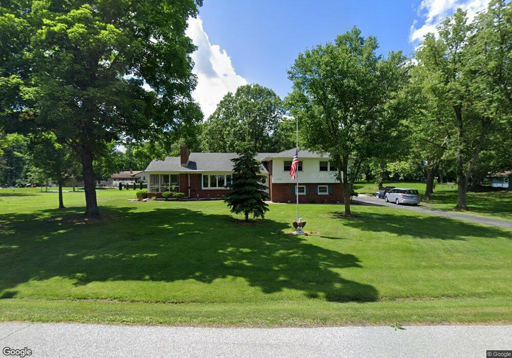
12526 Polk St Crown Point, IN 46307
Estimated Value: $399,000 - $532,000
3
Beds
3
Baths
2,742
Sq Ft
$162/Sq Ft
Est. Value
About This Home
This home is located at 12526 Polk St, Crown Point, IN 46307 and is currently estimated at $443,698, approximately $161 per square foot. 12526 Polk St is a home located in Lake County with nearby schools including Dwight D. Eisenhower Elementary School, Colonel John Wheeler Middle School, and Crown Point High School.
Ownership History
Date
Name
Owned For
Owner Type
Purchase Details
Closed on
Jan 5, 2021
Sold by
Kaminski Edward P and Kaminski Kristine H
Bought by
Schuett James A
Current Estimated Value
Home Financials for this Owner
Home Financials are based on the most recent Mortgage that was taken out on this home.
Original Mortgage
$140,000
Outstanding Balance
$124,950
Interest Rate
2.71%
Mortgage Type
New Conventional
Estimated Equity
$318,748
Create a Home Valuation Report for This Property
The Home Valuation Report is an in-depth analysis detailing your home's value as well as a comparison with similar homes in the area
Home Values in the Area
Average Home Value in this Area
Purchase History
| Date | Buyer | Sale Price | Title Company |
|---|---|---|---|
| Schuett James A | -- | Chicago Title Insurance Co |
Source: Public Records
Mortgage History
| Date | Status | Borrower | Loan Amount |
|---|---|---|---|
| Open | Schuett James A | $140,000 |
Source: Public Records
Tax History Compared to Growth
Tax History
| Year | Tax Paid | Tax Assessment Tax Assessment Total Assessment is a certain percentage of the fair market value that is determined by local assessors to be the total taxable value of land and additions on the property. | Land | Improvement |
|---|---|---|---|---|
| 2024 | $6,191 | $304,900 | $64,900 | $240,000 |
| 2023 | $3,021 | $291,300 | $64,900 | $226,400 |
| 2022 | $3,021 | $281,600 | $64,900 | $216,700 |
| 2021 | $2,224 | $241,300 | $51,900 | $189,400 |
| 2020 | $2,256 | $233,800 | $51,900 | $181,900 |
| 2019 | $2,275 | $227,600 | $51,900 | $175,700 |
| 2018 | $2,338 | $222,600 | $51,900 | $170,700 |
| 2017 | $2,336 | $220,300 | $51,900 | $168,400 |
| 2016 | $2,404 | $224,300 | $51,900 | $172,400 |
| 2014 | $2,090 | $214,200 | $51,900 | $162,300 |
| 2013 | $1,990 | $206,300 | $51,900 | $154,400 |
Source: Public Records
Map
Nearby Homes
- 809 W 126th Ct
- 12819 Grant St
- 253 W 129th Ave Unit 1
- 12938 Hayes St
- 300 W 128th Place
- 183 W 126th Ave
- 1220 Stillwater Pkwy
- 1152 S Ridge St
- 12492 Washington St
- 1191 Churchill Ln
- 425 Sherwood Dr
- 12566 Massachusetts St
- 642 Omega Dr
- 13192 Hayes St
- 11152 Putnam Dr
- 2439 W 127th Ave
- 1150 Greenview Place
- 1285 Greenview Place
- 991 Greenview Dr
- 300 Omega Dr
- 12529 Buchanan St
- 12520 Polk St
- 12506 Buchanan St
- 20 Buchanan St
- 12605 Polk St
- 12514 Polk St
- 12527 Polk St
- 12515 Buchanan St
- 1010 W 126th Ct
- 12526 Buchanan St
- 12508 Polk St
- 12512 Buchanan St
- 912 W 126th Ave
- 1103 W 126th Ct
- 913 W 126th Ave
- 12651 Buchanan Ln
- 12515 Polk St
- 1009 W 126th Ct
- 912 W 126th Ct
- 1209 W 124th Place