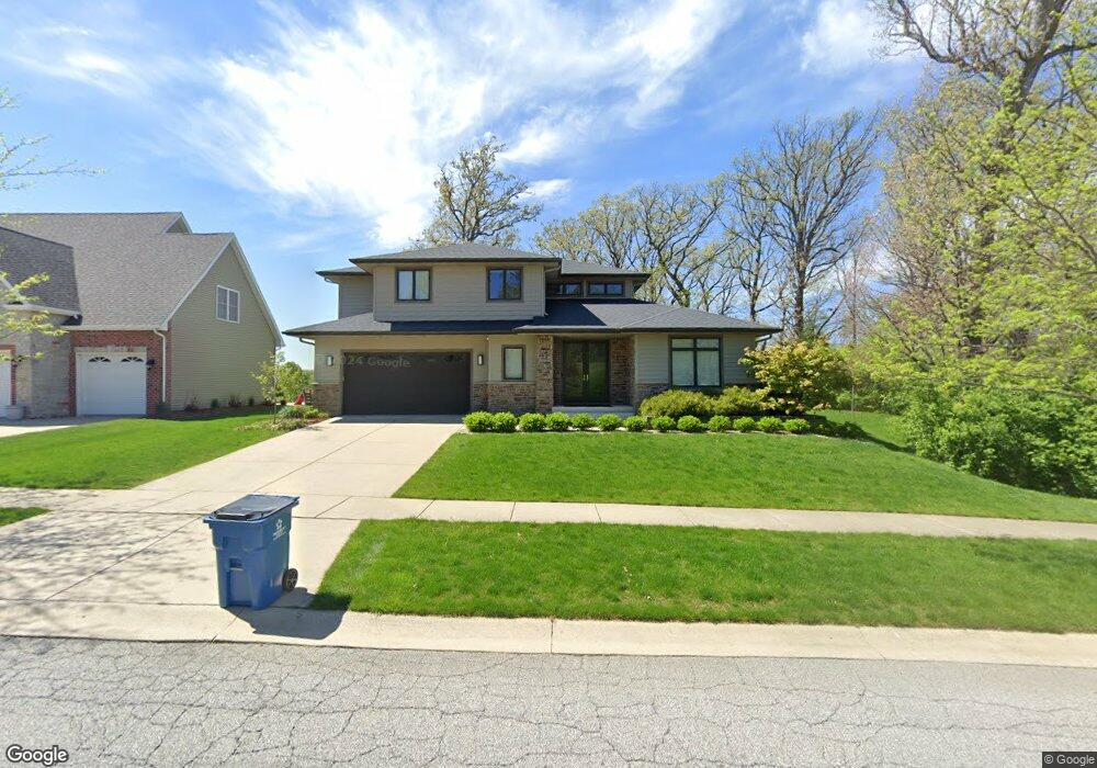
12536 Massachusetts St Crown Point, IN 46307
Estimated Value: $483,644 - $659,000
6
Beds
3
Baths
2,940
Sq Ft
$200/Sq Ft
Est. Value
About This Home
This home is located at 12536 Massachusetts St, Crown Point, IN 46307 and is currently estimated at $588,661, approximately $200 per square foot. 12536 Massachusetts St is a home located in Lake County with nearby schools including Dwight D. Eisenhower Elementary School, Colonel John Wheeler Middle School, and Crown Point High School.
Ownership History
Date
Name
Owned For
Owner Type
Purchase Details
Closed on
Apr 23, 2009
Sold by
Hennessey Development Inc
Bought by
Hurley Jason
Current Estimated Value
Purchase Details
Closed on
Oct 6, 2006
Sold by
Schmidt Farms Development Llc
Bought by
Hennessey Development Inc
Home Financials for this Owner
Home Financials are based on the most recent Mortgage that was taken out on this home.
Original Mortgage
$750,000
Interest Rate
6.49%
Mortgage Type
Credit Line Revolving
Create a Home Valuation Report for This Property
The Home Valuation Report is an in-depth analysis detailing your home's value as well as a comparison with similar homes in the area
Home Values in the Area
Average Home Value in this Area
Purchase History
| Date | Buyer | Sale Price | Title Company |
|---|---|---|---|
| Hurley Jason | -- | Chicago Title Insurance Co | |
| Hennessey Development Inc | -- | Ticor Scher |
Source: Public Records
Mortgage History
| Date | Status | Borrower | Loan Amount |
|---|---|---|---|
| Previous Owner | Hennessey Development Inc | $750,000 |
Source: Public Records
Tax History Compared to Growth
Tax History
| Year | Tax Paid | Tax Assessment Tax Assessment Total Assessment is a certain percentage of the fair market value that is determined by local assessors to be the total taxable value of land and additions on the property. | Land | Improvement |
|---|---|---|---|---|
| 2024 | $10,694 | $426,900 | $64,300 | $362,600 |
| 2023 | $4,211 | $389,100 | $64,300 | $324,800 |
| 2022 | $4,211 | $376,500 | $64,300 | $312,200 |
| 2021 | $4,078 | $364,800 | $49,400 | $315,400 |
| 2020 | $4,045 | $361,900 | $49,400 | $312,500 |
| 2019 | $4,032 | $356,800 | $49,400 | $307,400 |
| 2018 | $4,974 | $347,200 | $49,400 | $297,800 |
| 2017 | $4,848 | $336,000 | $49,400 | $286,600 |
| 2016 | $4,868 | $332,200 | $43,100 | $289,100 |
| 2014 | $4,353 | $319,100 | $43,100 | $276,000 |
| 2013 | $4,223 | $308,000 | $43,100 | $264,900 |
Source: Public Records
Map
Nearby Homes
- 12566 Massachusetts St
- 12492 Washington St
- 183 W 126th Ave
- 1433 Rainy Brook Way
- 1220 Stillwater Pkwy
- 10981 Thomas St
- 300 W 128th Place
- Norfolk Plan at The Fountains
- Grant Plan at The Fountains
- 11152 Putnam Dr
- 980 Stillwater Pkwy
- 809 W 126th Ct
- 12929 Delaware St
- 557 E 130th Place
- 7382 Brookhaven Dr
- 10 Terrano Way
- 253 W 129th Ave Unit 1
- S-3142-3 Willow Plan at The Willows - Single Family Homes
- S-1965-3 Sage Plan at The Willows - Single Family Homes
- 499 E 131st Place
- 12556 Massachusetts St
- Lot 69 Massachusetts St
- 12566 Massachusetts St
- 12563 Massachusetts St
- 275 E 125th Place
- 12576 Massachusetts St
- 270 E 125th Place
- 12573 Massachusetts St
- 285 E 125th Place
- 12583 Massachusetts St
- 12586 Massachusetts St
- 211 E 125th Ave
- 280 W 125th Place
- 290 E 125th Place
- 280 E 125th Place
- 241 E 125th Ave
- 201 E 125th Ave
- 251 E 125th Ave
- 191 E 125th Ave
- 295 E 125th Place