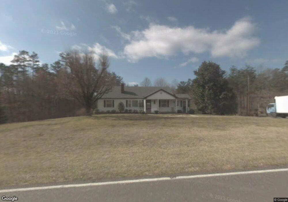
1254 Old Us 52 S Mount Airy, NC 27030
Estimated Value: $196,000 - $367,000
2
Beds
1
Bath
1,520
Sq Ft
$181/Sq Ft
Est. Value
About This Home
This home is located at 1254 Old Us 52 S, Mount Airy, NC 27030 and is currently estimated at $275,869, approximately $181 per square foot. 1254 Old Us 52 S is a home located in Surry County with nearby schools including Pilot Mountain Elementary School, Pilot Mountain Middle School, and East Surry High School.
Ownership History
Date
Name
Owned For
Owner Type
Purchase Details
Closed on
Jun 3, 2020
Sold by
Marshall Randy D and Marshall Margaret A
Bought by
Marshall Randy D
Current Estimated Value
Purchase Details
Closed on
Aug 30, 2007
Sold by
Homer Lillian R
Bought by
Marshall Randy D and Marshall Margaret A
Home Financials for this Owner
Home Financials are based on the most recent Mortgage that was taken out on this home.
Original Mortgage
$140,000
Interest Rate
6.7%
Mortgage Type
New Conventional
Purchase Details
Closed on
Dec 30, 2005
Sold by
Reeves Thomas C and Reeves Ruth M
Bought by
Reeves Thomas C
Purchase Details
Closed on
Jan 1, 1949
Create a Home Valuation Report for This Property
The Home Valuation Report is an in-depth analysis detailing your home's value as well as a comparison with similar homes in the area
Home Values in the Area
Average Home Value in this Area
Purchase History
| Date | Buyer | Sale Price | Title Company |
|---|---|---|---|
| Marshall Randy D | -- | None Available | |
| Marshall Randy D | $175,000 | None Available | |
| Reeves Thomas C | -- | None Available | |
| -- | -- | -- | |
| -- | -- | -- |
Source: Public Records
Mortgage History
| Date | Status | Borrower | Loan Amount |
|---|---|---|---|
| Previous Owner | Marshall Randy D | $140,000 |
Source: Public Records
Tax History Compared to Growth
Tax History
| Year | Tax Paid | Tax Assessment Tax Assessment Total Assessment is a certain percentage of the fair market value that is determined by local assessors to be the total taxable value of land and additions on the property. | Land | Improvement |
|---|---|---|---|---|
| 2025 | $1,322 | $219,380 | $69,050 | $150,330 |
| 2024 | $1,084 | $167,120 | $62,780 | $104,340 |
| 2023 | $1,066 | $167,120 | $62,780 | $104,340 |
| 2022 | $1,066 | $167,120 | $62,780 | $104,340 |
| 2021 | $1,084 | $167,120 | $62,780 | $104,340 |
| 2020 | $1,067 | $157,900 | $59,640 | $98,260 |
| 2019 | $1,064 | $157,900 | $59,640 | $98,260 |
| 2018 | $1,061 | $157,900 | $0 | $0 |
| 2017 | $1,061 | $157,900 | $0 | $0 |
| 2016 | $1,061 | $157,900 | $0 | $0 |
| 2013 | -- | $161,390 | $0 | $0 |
Source: Public Records
Map
Nearby Homes
- 115 Stout Ln
- 138 Arthur Needham Rd
- 181 Fox Walk Ln
- 0 Old Us Highway 52 S
- TBD Marbury Trail
- TBD Eddington Ln
- TBD Ingleside Way
- 211 Service Rd
- 906 Long Hill Rd
- 0 Chestnut Ridge Rd
- 278 Old Us Highway 52
- 208 Holly Ave
- 177 Janice Dr
- 201 Circle View Rd
- 00 Simmons Rd
- 366 Sheep Farm Rd
- 250 High Meadow Trail
- xx Gilley Rd Unit 20.63 acres
- 1265 Old Us 52 S
- 148 S Reeves Mill Rd
- 00 S Reeves Mill Rd
- 106 Chads Way
- 1128 Old Us 52 S
- 1305 Old Us 52 S
- 26 Stoney Creek
- 9 Stoney Creek
- 1305 Old Us Highway 52 S
- 1153 Old Us 52 S
- TBD Preston Ln
- 1319 Old Us 52 S
- 111 Preston Ln
- 134 Preston Ln
- 1336 Old Us 52 S
- 197 Storey Ln
- 1119 Old Us 52 S
- 178 Preston Ln
- 132 Stuart Ln
- 137 Storey Ln