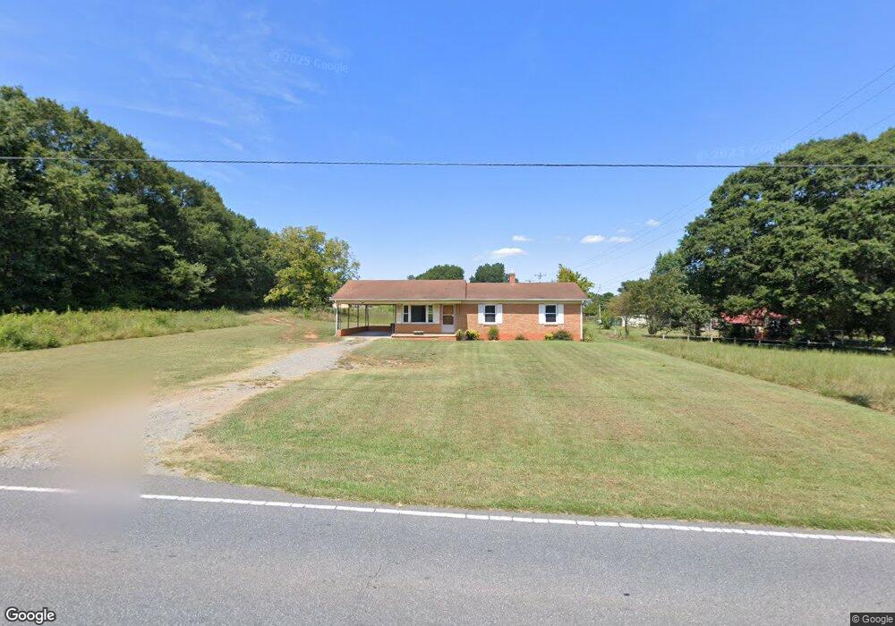
1254 W Highway 27 Lincolnton, NC 28092
Estimated Value: $198,657 - $230,000
3
Beds
1
Bath
1,125
Sq Ft
$192/Sq Ft
Est. Value
About This Home
This home is located at 1254 W Highway 27, Lincolnton, NC 28092 and is currently estimated at $215,914, approximately $191 per square foot. 1254 W Highway 27 is a home located in Lincoln County with nearby schools including Norris S. Childers Elementary School, West Lincoln Middle, and West Lincoln High School.
Ownership History
Date
Name
Owned For
Owner Type
Purchase Details
Closed on
Apr 20, 2021
Sold by
Yarbrough Phyllis R
Bought by
Appalachian Walnut Co Llc
Current Estimated Value
Home Financials for this Owner
Home Financials are based on the most recent Mortgage that was taken out on this home.
Original Mortgage
$750,000
Outstanding Balance
$677,701
Interest Rate
3.05%
Mortgage Type
Purchase Money Mortgage
Estimated Equity
-$461,787
Create a Home Valuation Report for This Property
The Home Valuation Report is an in-depth analysis detailing your home's value as well as a comparison with similar homes in the area
Home Values in the Area
Average Home Value in this Area
Purchase History
| Date | Buyer | Sale Price | Title Company |
|---|---|---|---|
| Appalachian Walnut Co Llc | $155,000 | None Available |
Source: Public Records
Mortgage History
| Date | Status | Borrower | Loan Amount |
|---|---|---|---|
| Open | Appalachian Walnut Co Llc | $750,000 |
Source: Public Records
Tax History Compared to Growth
Tax History
| Year | Tax Paid | Tax Assessment Tax Assessment Total Assessment is a certain percentage of the fair market value that is determined by local assessors to be the total taxable value of land and additions on the property. | Land | Improvement |
|---|---|---|---|---|
| 2025 | $1,021 | $138,869 | $29,784 | $109,085 |
| 2024 | $1,001 | $138,869 | $29,784 | $109,085 |
| 2023 | $996 | $138,869 | $29,784 | $109,085 |
| 2022 | $737 | $82,449 | $23,000 | $59,449 |
| 2021 | $737 | $82,449 | $23,000 | $59,449 |
| 2020 | $303 | $82,449 | $23,000 | $59,449 |
| 2019 | $606 | $82,449 | $23,000 | $59,449 |
| 2018 | $672 | $77,813 | $21,000 | $56,813 |
| 2017 | $571 | $77,813 | $21,000 | $56,813 |
| 2016 | $571 | $77,813 | $21,000 | $56,813 |
| 2015 | $644 | $77,813 | $21,000 | $56,813 |
| 2014 | $637 | $78,813 | $22,000 | $56,813 |
Source: Public Records
Map
Nearby Homes
- 1338 Pell Dr
- 1070 N Carolina 182
- 217 Blossom Hill Rd
- 0 N Carolina 182 Unit CAR4246688
- 536 Lincolnview Rd
- 000 Blossom Hill Rd Unit 138
- 1231 Better Brook Ln
- 000 Better Brook Ln
- 00 George Brown Rd Unit 10
- 00 George Brown Rd Unit 9
- 00 George Brown Rd Unit 8
- 00 George Brown Rd Unit 7
- 00 George Brown Rd Unit 6
- 00 George Brown Rd Unit 5
- 00 George Brown Rd Unit 4
- 00 George Brown Rd Unit 3
- 00 George Brown Rd Unit 2
- #168 Rolling Rd
- 743 Lore Rd
- 792 Mace Ln
- 123 Rock Hill Ln
- 1267 W Highway 27
- 1237 W Highway 27
- 131 Rock Hill Ln
- 1229 W Highway 27
- 1282 Hwy 27 Hwy
- 1216 W Highway 27
- 219 Rock Hill Ln
- 203 Rock Hill Ln
- 1206 W Highway 27
- 34 & 35 Rolling Rd
- 161 Rock Hill Ln
- 1205 W Highway 27
- 233 Rock Hill Ln
- 1312 W Highway 27
- 202 Rock Hill Ln
- 1181 W Highway 27
- 130 Bob Burgin Rd
- 1346 Highway 182
- 1308 Highway 182