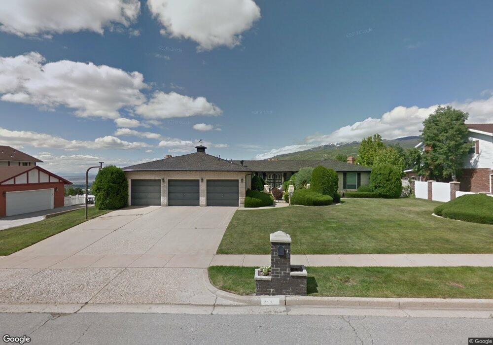
1255 E 2050 S Bountiful, UT 84010
Estimated Value: $720,000 - $806,983
3
Beds
3
Baths
2,357
Sq Ft
$322/Sq Ft
Est. Value
About This Home
This home is located at 1255 E 2050 S, Bountiful, UT 84010 and is currently estimated at $759,746, approximately $322 per square foot. 1255 E 2050 S is a home located in Davis County with nearby schools including Valley View School, Mueller Park Junior High School, and Bountiful High School.
Ownership History
Date
Name
Owned For
Owner Type
Purchase Details
Closed on
May 2, 2019
Sold by
Larry And Sharen Johnson Family Trust
Bought by
Christensen Adam K and Christensen Amy J
Current Estimated Value
Home Financials for this Owner
Home Financials are based on the most recent Mortgage that was taken out on this home.
Original Mortgage
$322,000
Outstanding Balance
$282,519
Interest Rate
4.2%
Mortgage Type
New Conventional
Estimated Equity
$477,227
Purchase Details
Closed on
Mar 24, 2005
Sold by
Johnson Larry W and Johnson Sharen A
Bought by
Johnson Larry W and Johnson Sharen A
Create a Home Valuation Report for This Property
The Home Valuation Report is an in-depth analysis detailing your home's value as well as a comparison with similar homes in the area
Purchase History
| Date | Buyer | Sale Price | Title Company |
|---|---|---|---|
| Christensen Adam K | -- | Us Title Co | |
| Johnson Larry W | -- | None Available |
Source: Public Records
Mortgage History
| Date | Status | Borrower | Loan Amount |
|---|---|---|---|
| Open | Christensen Adam K | $322,000 |
Source: Public Records
Tax History
| Year | Tax Paid | Tax Assessment Tax Assessment Total Assessment is a certain percentage of the fair market value that is determined by local assessors to be the total taxable value of land and additions on the property. | Land | Improvement |
|---|---|---|---|---|
| 2025 | $4,612 | $425,700 | $149,536 | $276,164 |
| 2024 | $4,282 | $407,000 | $137,618 | $269,382 |
| 2023 | $4,190 | $723,000 | $252,881 | $470,119 |
| 2022 | $4,233 | $400,400 | $135,128 | $265,272 |
| 2021 | $3,896 | $565,000 | $201,128 | $363,872 |
| 2020 | $3,506 | $511,000 | $183,063 | $327,937 |
| 2019 | $3,154 | $446,000 | $172,936 | $273,064 |
| 2018 | $2,974 | $414,000 | $161,634 | $252,366 |
| 2016 | $2,590 | $195,305 | $55,329 | $139,976 |
| 2015 | $2,736 | $195,855 | $55,329 | $140,526 |
| 2014 | $2,796 | $206,214 | $55,329 | $150,885 |
| 2013 | -- | $166,635 | $61,874 | $104,761 |
Source: Public Records
Map
Nearby Homes
- 2115 S Ridgewood Way
- 1888 S 1150 E
- 1087 Arlington Way
- 2156 Elaine Dr
- 1987 Mapleview Dr
- 1785 1450 E
- 994 Deborah Dr
- 2136 S 900 E
- 0 Bountiful Blvd
- 1735 S Temple Ct Unit 203
- 1596 E Millbrook Way
- 1812 S 900 E
- 831 E San Simeon Way S
- 2768 S 1500 E
- 761 San Simeon Way
- 1761 S Davis Blvd
- 1742 E Ridge Point Dr
- 775 E 1500 S
- 1878 E Ridge Point Dr
- 631 E 1700 S
- 1255 E 2050 S Unit 45
- 1273 E 2050 S
- 1235 E 2050 S
- 1272 Beverly Way
- 1260 Beverly Way
- 1256 E 2050 S
- 1291 E 2050 S
- 2045 Browns Park Dr
- 1236 E 2050 S
- 2007 Browns Park Dr
- 1296 E 2050 S
- 1284 Beverly Way
- 1284 Beverly Way
- 1987 Browns Park Dr
- 1275 Golf Course Dr
- 1255 Golf Course Dr
- 1216 E 2050 S
- 1235 Golf Course Dr
- 1295 Golf Course Dr
- 1296 Beverly Way
Your Personal Tour Guide
Ask me questions while you tour the home.