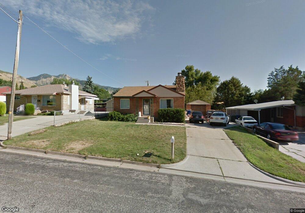
1255 Sheridan Dr Ogden, UT 84404
Horace Mann NeighborhoodEstimated Value: $338,000 - $360,000
2
Beds
1
Bath
855
Sq Ft
$410/Sq Ft
Est. Value
About This Home
This home is located at 1255 Sheridan Dr, Ogden, UT 84404 and is currently estimated at $350,243, approximately $409 per square foot. 1255 Sheridan Dr is a home located in Weber County with nearby schools including Mound Fort Junior High School and Ben Lomond High School.
Ownership History
Date
Name
Owned For
Owner Type
Purchase Details
Closed on
Feb 15, 2010
Sold by
Mcallister Sherry B
Bought by
Mecham Jeremy Duane
Current Estimated Value
Home Financials for this Owner
Home Financials are based on the most recent Mortgage that was taken out on this home.
Original Mortgage
$111,854
Outstanding Balance
$74,324
Interest Rate
5.11%
Mortgage Type
VA
Estimated Equity
$275,919
Purchase Details
Closed on
Apr 24, 2006
Sold by
Maw Carl W and Maw Gayle M
Bought by
Mcallister Sherry B
Home Financials for this Owner
Home Financials are based on the most recent Mortgage that was taken out on this home.
Original Mortgage
$110,000
Interest Rate
6.35%
Mortgage Type
Fannie Mae Freddie Mac
Purchase Details
Closed on
Aug 10, 2001
Sold by
Maw Gayle M
Bought by
Maw Carl W and Maw Gayle M
Home Financials for this Owner
Home Financials are based on the most recent Mortgage that was taken out on this home.
Original Mortgage
$53,000
Interest Rate
6.61%
Purchase Details
Closed on
Aug 21, 1995
Sold by
Mckinney Alta H
Bought by
Maw Gayle M
Create a Home Valuation Report for This Property
The Home Valuation Report is an in-depth analysis detailing your home's value as well as a comparison with similar homes in the area
Home Values in the Area
Average Home Value in this Area
Purchase History
| Date | Buyer | Sale Price | Title Company |
|---|---|---|---|
| Mecham Jeremy Duane | -- | Mountainside Title Ins A | |
| Mcallister Sherry B | -- | Backman Ntp | |
| Maw Carl W | -- | Bonneville Title | |
| Maw Gayle M | -- | -- |
Source: Public Records
Mortgage History
| Date | Status | Borrower | Loan Amount |
|---|---|---|---|
| Open | Mecham Jeremy Duane | $111,854 | |
| Previous Owner | Mcallister Sherry B | $110,000 | |
| Previous Owner | Maw Carl W | $53,000 |
Source: Public Records
Tax History Compared to Growth
Tax History
| Year | Tax Paid | Tax Assessment Tax Assessment Total Assessment is a certain percentage of the fair market value that is determined by local assessors to be the total taxable value of land and additions on the property. | Land | Improvement |
|---|---|---|---|---|
| 2025 | $2,354 | $327,247 | $120,000 | $207,247 |
| 2024 | $2,354 | $169,398 | $66,002 | $103,396 |
| 2023 | $2,466 | $180,950 | $60,410 | $120,540 |
| 2022 | $2,726 | $203,500 | $52,253 | $151,247 |
| 2021 | $2,061 | $250,000 | $60,060 | $189,940 |
| 2020 | $1,952 | $218,000 | $45,009 | $172,991 |
| 2019 | $1,911 | $200,000 | $40,008 | $159,992 |
| 2018 | $1,648 | $169,000 | $34,967 | $134,033 |
| 2017 | $1,432 | $135,000 | $32,051 | $102,949 |
| 2016 | $1,453 | $74,423 | $15,096 | $59,327 |
| 2015 | $1,230 | $61,052 | $15,096 | $45,956 |
| 2014 | $1,244 | $61,053 | $15,096 | $45,957 |
Source: Public Records
Map
Nearby Homes
- 3088 N 3075 W
- 1363 Lewis Dr
- 1302 Harrop St
- 1427 Sheridan Dr
- 131 Taylor Ave
- 261 Van Buren Ave
- 1274 5th St
- 1272 Earl Dr
- 1034 1st St
- 1024 1st St
- 223 N Harrison Blvd
- 1243 Hudson St
- 1011 Rancho Blvd
- 3270 N 3325 W Unit 386B
- 1115 Collins Blvd
- 446 Robins Ave
- 462 Hiland Rd
- 1149 Dan St
- 931 Rancho Blvd
- 112 N Quincy Ave
- 1263 Sheridan Dr
- 1247 Sheridan Dr
- 1239 Sheridan Dr
- 1271 Sheridan Dr
- 1258 Lewis Dr
- 1250 Lewis Dr
- 1266 Lewis Dr
- 1231 Sheridan Dr
- 1279 Sheridan Dr
- 1254 Sheridan Dr
- 1262 Sheridan Dr
- 1246 Sheridan Dr
- 1274 Lewis Dr
- 1236 Sheridan Dr
- 1272 Sheridan Dr
- 255 Iowa Ave
- 1225 Sheridan Dr
- 1282 Lewis Dr
- 1278 Sheridan Dr
- 1230 Sheridan Dr