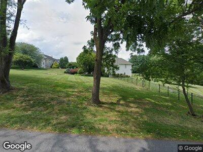
1255 Twaddell Dr West Chester, PA 19382
Thornbury NeighborhoodEstimated Value: $1,298,000 - $2,033,000
4
Beds
5
Baths
5,906
Sq Ft
$282/Sq Ft
Est. Value
About This Home
This home is located at 1255 Twaddell Dr, West Chester, PA 19382 and is currently estimated at $1,664,543, approximately $281 per square foot. 1255 Twaddell Dr is a home located in Chester County with nearby schools including Sarah W Starkweather Elementary School, Stetson Middle School, and Bayard Rustin High School.
Ownership History
Date
Name
Owned For
Owner Type
Purchase Details
Closed on
Feb 8, 2025
Sold by
Kirby Christopher H and Kirby Jacqueline P
Bought by
Kirby Family 2024 Trust and Kirby
Current Estimated Value
Purchase Details
Closed on
Aug 26, 2019
Sold by
Rodgers Ronald H and Rodgers Mary Ellen T
Bought by
Severance Kevin Michael and Severance Dana Kathryn
Home Financials for this Owner
Home Financials are based on the most recent Mortgage that was taken out on this home.
Original Mortgage
$948,000
Interest Rate
3.7%
Mortgage Type
New Conventional
Purchase Details
Closed on
Dec 23, 2010
Sold by
Malvern Federal Savings Bank
Bought by
Kirby Christopher H and Kirby Jacqueline P
Home Financials for this Owner
Home Financials are based on the most recent Mortgage that was taken out on this home.
Original Mortgage
$854,000
Interest Rate
4.37%
Mortgage Type
Construction
Purchase Details
Closed on
Dec 17, 2010
Sold by
Johnson Timothy N and Johnson Lora
Bought by
Malvern Federal Savings Bank
Home Financials for this Owner
Home Financials are based on the most recent Mortgage that was taken out on this home.
Original Mortgage
$854,000
Interest Rate
4.37%
Mortgage Type
Construction
Purchase Details
Closed on
Aug 18, 1998
Sold by
Johnson Timothy and Warmouth Lora
Bought by
Johnson Timothy and Johnson Lora
Purchase Details
Closed on
Mar 17, 1997
Sold by
Theobald Mark A and Theobald Ruth Anne
Bought by
Johnson Timothy and Warmouth Lora
Home Financials for this Owner
Home Financials are based on the most recent Mortgage that was taken out on this home.
Original Mortgage
$350,000
Interest Rate
7.26%
Purchase Details
Closed on
May 9, 1994
Sold by
Anastasiadis Constantine and Anastasiadis Eleni
Bought by
Theobald Mark A and Theobald Ruth Anne
Home Financials for this Owner
Home Financials are based on the most recent Mortgage that was taken out on this home.
Original Mortgage
$260,000
Interest Rate
7.7%
Create a Home Valuation Report for This Property
The Home Valuation Report is an in-depth analysis detailing your home's value as well as a comparison with similar homes in the area
Home Values in the Area
Average Home Value in this Area
Purchase History
| Date | Buyer | Sale Price | Title Company |
|---|---|---|---|
| Kirby Family 2024 Trust | -- | None Listed On Document | |
| Kirby Family 2024 Trust | -- | None Listed On Document | |
| Severance Kevin Michael | $1,185,000 | Noble Abstract Company | |
| Kirby Christopher H | $650,000 | None Available | |
| Malvern Federal Savings Bank | $905,000 | None Available | |
| Johnson Timothy | -- | -- | |
| Johnson Timothy | $485,000 | -- | |
| Theobald Mark A | $585,000 | -- |
Source: Public Records
Mortgage History
| Date | Status | Borrower | Loan Amount |
|---|---|---|---|
| Previous Owner | Kirby Christopher H | $723,500 | |
| Previous Owner | Kirby Christopher H | $722,910 | |
| Previous Owner | Severance Kevin Michael | $948,000 | |
| Previous Owner | Kirby Christopher H | $854,000 | |
| Previous Owner | Kirby Christopher H | $854,000 | |
| Previous Owner | Johnson Timothy | $350,000 | |
| Previous Owner | Theobald Mark A | $260,000 |
Source: Public Records
Tax History Compared to Growth
Tax History
| Year | Tax Paid | Tax Assessment Tax Assessment Total Assessment is a certain percentage of the fair market value that is determined by local assessors to be the total taxable value of land and additions on the property. | Land | Improvement |
|---|---|---|---|---|
| 2024 | $16,887 | $603,480 | $105,040 | $498,440 |
| 2023 | $16,887 | $603,480 | $105,040 | $498,440 |
| 2022 | $16,660 | $603,480 | $105,040 | $498,440 |
| 2021 | $16,420 | $603,480 | $105,040 | $498,440 |
| 2020 | $16,310 | $603,480 | $105,040 | $498,440 |
| 2019 | $16,074 | $603,480 | $105,040 | $498,440 |
| 2018 | $14,944 | $573,690 | $105,040 | $468,650 |
| 2017 | $14,607 | $573,690 | $105,040 | $468,650 |
| 2016 | $12,515 | $573,690 | $105,040 | $468,650 |
| 2015 | $12,515 | $573,690 | $105,040 | $468,650 |
| 2014 | $12,515 | $573,690 | $105,040 | $468,650 |
Source: Public Records
Map
Nearby Homes
- 603 S Westbourne Rd
- 1 Huntrise Ln
- 3 Zachary Dr
- 222 Green Tree Dr
- 1275 Southgate Rd
- 1261 Buck Ln
- 1174 Blenheim Rd
- 123 E Street Rd
- 855 Meadow Croft Cir
- 113 Forelock Ct
- 119 Augusta Dr
- 1109 Fielding Dr
- 129 Stirrup Cir
- 131 Stirrup Cir
- 235 Caleb Dr Unit 19
- 4 Judith Ln
- 186 Dilworthtown Rd
- 149 Leadline Ln
- 621 Jaeger Cir
- 1303 Circle Dr Unit 87B
- 1255 Twaddell Dr
- 341 Old Bailey Ln
- 1245 Twaddell Dr
- 343 Old Bailey Ln
- 340 Old Bailey Ln
- 342 Old Bailey Ln
- 1280 S Concord Rd
- 1235 Twaddell Dr
- 1290 Old Woods Rd
- 1260 S Concord Rd
- 1300 S Concord Rd
- 100 Rokeby Farm Ln
- 337 Old Bailey Ln
- 510 Day Spring Ln
- 1230 Twaddell Dr
- 104 Rokeby Farm Ln
- 1225 Twaddell Dr
- 105 Rokeby Farm Ln
- 1280 Old Woods Rd
- 1285 Old Woods Rd
