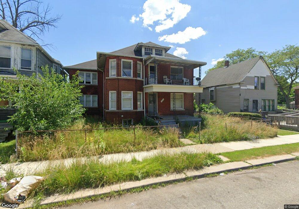
1255 W Euclid St Detroit, MI 48202
Virginia Park Community NeighborhoodEstimated Value: $155,000 - $510,000
4
Beds
4
Baths
3,040
Sq Ft
$92/Sq Ft
Est. Value
About This Home
This home is located at 1255 W Euclid St, Detroit, MI 48202 and is currently estimated at $278,998, approximately $91 per square foot. 1255 W Euclid St is a home located in Wayne County with nearby schools including Thirkell Elementary School, Charles L. Spain Elementary-Middle School, and Edward 'Duke' Ellington Conservatory of Music and Art.
Ownership History
Date
Name
Owned For
Owner Type
Purchase Details
Closed on
Jan 3, 2024
Sold by
333 In Ammatour Corp
Bought by
1255 W Euclid St Llc
Current Estimated Value
Purchase Details
Closed on
May 6, 2016
Sold by
Anders Luther J and Anders Stella
Bought by
Ahmed Salman Tasneem
Create a Home Valuation Report for This Property
The Home Valuation Report is an in-depth analysis detailing your home's value as well as a comparison with similar homes in the area
Home Values in the Area
Average Home Value in this Area
Purchase History
| Date | Buyer | Sale Price | Title Company |
|---|---|---|---|
| 1255 W Euclid St Llc | -- | None Listed On Document | |
| 1255 W Euclid St Llc | -- | None Listed On Document | |
| 333 In Ammatour Corp | $130,000 | None Listed On Document | |
| 333 In Ammatour Corp | $130,000 | None Listed On Document | |
| Ahmed Salman Tasneem | $36,000 | Regions Title Agency Llc | |
| Anders Luther J | -- | Regions Title Agency Llc |
Source: Public Records
Tax History Compared to Growth
Tax History
| Year | Tax Paid | Tax Assessment Tax Assessment Total Assessment is a certain percentage of the fair market value that is determined by local assessors to be the total taxable value of land and additions on the property. | Land | Improvement |
|---|---|---|---|---|
| 2025 | $1,204 | $49,900 | $0 | $0 |
| 2024 | $1,204 | $41,100 | $0 | $0 |
| 2023 | $1,169 | $32,500 | $0 | $0 |
| 2022 | $1,244 | $26,300 | $0 | $0 |
| 2021 | $1,211 | $19,200 | $0 | $0 |
| 2020 | $1,211 | $16,500 | $0 | $0 |
| 2019 | $1,193 | $12,300 | $0 | $0 |
| 2018 | $1,150 | $10,600 | $0 | $0 |
| 2017 | $195 | $10,300 | $0 | $0 |
| 2016 | $1,173 | $40,400 | $0 | $0 |
| 2015 | $934 | $14,400 | $0 | $0 |
| 2013 | $904 | $20,060 | $0 | $0 |
| 2010 | -- | $28,743 | $900 | $27,843 |
Source: Public Records
Map
Nearby Homes
- 1452 W Euclid St
- 1163 Virginia Park St
- 1343 Seward St
- 1613 Virginia Park St
- 1623 Gladstone St
- 1639 Gladstone St
- 824 Delaware St
- 1709 Pallister Unit 28
- 1675 Gladstone St
- 1703 Pallister Unit P30
- 736 W Philadelphia St
- 7633 Woodrow Wilson St
- 708 W Euclid St
- 1473 Taylor St
- 740 Pingree St
- 1536 Hazelwood St
- 1501 Taylor St
- 1714 Gladstone St
- 701 Pingree St
- 7759 Rosa Parks Blvd
- 1247 W Euclid St
- 1259 W Euclid St
- 1241 W Euclid St
- 1310 Virginia Park St
- 1235 W Euclid St
- 1231 W Euclid St
- 1405 W Euclid St
- 1216 Virginia Park St
- 1318 Virginia Park St
- 1300 Virginia Park St
- 1223 W Euclid St
- 1328 Virginia Park St
- 1409 W Euclid St
- 1226 W Euclid St
- 1224 Virginia Park St
- 1218 W Euclid St
- 1215 W Euclid St
- 1420 W Euclid St
- 1423 W Euclid St
- 1214 W Euclid St