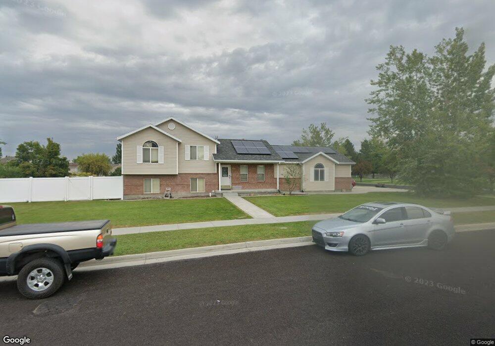
1255 W Henrys Pt Dr Logan, UT 84321
Woodruff NeighborhoodEstimated Value: $416,000 - $444,000
4
Beds
3
Baths
1,821
Sq Ft
$236/Sq Ft
Est. Value
About This Home
This home is located at 1255 W Henrys Pt Dr, Logan, UT 84321 and is currently estimated at $429,438, approximately $235 per square foot. 1255 W Henrys Pt Dr is a home located in Cache County with nearby schools including Woodruff School, Mount Logan Middle School, and Logan High School.
Ownership History
Date
Name
Owned For
Owner Type
Purchase Details
Closed on
May 21, 2021
Sold by
Dehek Kresta
Bought by
Dehek Brandon L
Current Estimated Value
Home Financials for this Owner
Home Financials are based on the most recent Mortgage that was taken out on this home.
Original Mortgage
$208,587
Outstanding Balance
$188,329
Interest Rate
3%
Mortgage Type
FHA
Estimated Equity
$241,109
Purchase Details
Closed on
Jul 6, 2005
Sold by
Spence Matthew J and Spence Tawnee T
Bought by
Dehek Brandon L
Home Financials for this Owner
Home Financials are based on the most recent Mortgage that was taken out on this home.
Original Mortgage
$132,000
Interest Rate
7.6%
Mortgage Type
New Conventional
Purchase Details
Closed on
Sep 4, 2002
Sold by
Blanchard Michael B
Bought by
Spence Matthew J and Spence Tawnee T
Home Financials for this Owner
Home Financials are based on the most recent Mortgage that was taken out on this home.
Original Mortgage
$146,501
Interest Rate
6.29%
Mortgage Type
FHA
Create a Home Valuation Report for This Property
The Home Valuation Report is an in-depth analysis detailing your home's value as well as a comparison with similar homes in the area
Home Values in the Area
Average Home Value in this Area
Purchase History
| Date | Buyer | Sale Price | Title Company |
|---|---|---|---|
| Dehek Brandon L | -- | Metro National Title | |
| Dehek Brandon L | -- | Cache Title Company | |
| Spence Matthew J | -- | Cache Title Company |
Source: Public Records
Mortgage History
| Date | Status | Borrower | Loan Amount |
|---|---|---|---|
| Open | Dehek Brandon L | $208,587 | |
| Closed | Dehek Brandon L | $132,000 | |
| Previous Owner | Spence Matthew J | $146,501 |
Source: Public Records
Tax History Compared to Growth
Tax History
| Year | Tax Paid | Tax Assessment Tax Assessment Total Assessment is a certain percentage of the fair market value that is determined by local assessors to be the total taxable value of land and additions on the property. | Land | Improvement |
|---|---|---|---|---|
| 2025 | $1,664 | $215,200 | $0 | $0 |
| 2024 | $172 | $215,495 | $0 | $0 |
| 2023 | $1,777 | $212,185 | $0 | $0 |
| 2022 | $1,587 | $176,980 | $0 | $0 |
| 2021 | $1,550 | $267,030 | $48,000 | $219,030 |
| 2020 | $1,647 | $255,345 | $48,000 | $207,345 |
| 2019 | $1,722 | $255,345 | $48,000 | $207,345 |
| 2018 | $1,686 | $228,300 | $48,000 | $180,300 |
| 2017 | $1,369 | $98,010 | $0 | $0 |
| 2016 | $1,419 | $98,010 | $0 | $0 |
| 2015 | $1,220 | $84,160 | $0 | $0 |
| 2014 | $1,103 | $84,160 | $0 | $0 |
| 2013 | -- | $84,160 | $0 | $0 |
Source: Public Records
Map
Nearby Homes
- 1239 W 575 S Unit 152
- 1220 W 575 S
- 548 S 1225 W Unit 115
- Hemlock Plan at Sugar Creek - Logan
- Eucalyptus Plan at Sugar Creek - Logan
- Blackberry Plan at Sugar Creek - Logan
- Magnolia Plan at Sugar Creek - Logan
- 542 S 1225 W Unit 116
- 518 S 1225 W
- 506 S 1225 W
- 1227 W 500 S Unit 151
- 1506 Silver Canoe Loop
- 1506 Silver Canoe Loop Unit 102
- 763 S 1500 W
- 552 Rivergate Dr
- 524 Rivergate Dr
- 420 S 1400 W
- 1585 W Silver Canoe Way
- 1615 Silver Canoe Way
- 1603 Silver Canoe Way
- 667 S 1250 W
- 1307 W Henrys Pt Dr
- 705 S 1250 W
- 1292 Stuart Ct
- 1298 Henry's Point Dr
- 641 S 1250 W
- 1294 Stuart Ct
- 1330 W Henry's Point Dr
- 1330 Henrys Point Dr
- 708 S 1250 W
- 1296 Stuart Ct
- 1244 W 630 S
- 10 Stuart Ct Unit 26
- 15 Stuart Ct Unit 36
- 709 S 1250 W
- 686 S 1360 W
- 1242 W 710 S Unit 15
- 694 S 1360 W
- 627 S 1250 W Unit 63
- 627 S 1250 W