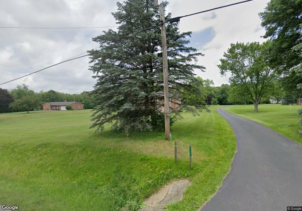
12550 Doylestown Rd Rittman, OH 44270
Estimated Value: $367,000 - $465,000
3
Beds
2
Baths
2,944
Sq Ft
$138/Sq Ft
Est. Value
About This Home
This home is located at 12550 Doylestown Rd, Rittman, OH 44270 and is currently estimated at $407,407, approximately $138 per square foot. 12550 Doylestown Rd is a home located in Wayne County with nearby schools including Rittman Elementary School, Rittman Middle School, and Rittman High School.
Ownership History
Date
Name
Owned For
Owner Type
Purchase Details
Closed on
Nov 6, 2025
Sold by
Twinem Judy F
Bought by
Coso Steven Michael and Coso Traci
Current Estimated Value
Home Financials for this Owner
Home Financials are based on the most recent Mortgage that was taken out on this home.
Original Mortgage
$318,250
Outstanding Balance
$317,951
Interest Rate
6.3%
Mortgage Type
New Conventional
Estimated Equity
$89,456
Purchase Details
Closed on
Sep 2, 2016
Sold by
Twinem Paul D
Bought by
Judy Twinem
Purchase Details
Closed on
Sep 16, 2015
Sold by
Twinem Ii Paul D
Bought by
Twinem Ii Paul D and Twinem Judy
Purchase Details
Closed on
May 14, 2013
Sold by
Simpson Orion and Simpson Sara
Bought by
Twinem Paul D
Home Financials for this Owner
Home Financials are based on the most recent Mortgage that was taken out on this home.
Original Mortgage
$53,000
Interest Rate
3.52%
Mortgage Type
Commercial
Purchase Details
Closed on
Jan 13, 1989
Sold by
Twinem Catherine B
Bought by
Twinem Catherine B and Twinem Judi
Create a Home Valuation Report for This Property
The Home Valuation Report is an in-depth analysis detailing your home's value as well as a comparison with similar homes in the area
Home Values in the Area
Average Home Value in this Area
Purchase History
| Date | Buyer | Sale Price | Title Company |
|---|---|---|---|
| Coso Steven Michael | $335,000 | None Listed On Document | |
| Judy Twinem | -- | -- | |
| Twinem Ii Paul D | -- | Attorney | |
| Twinem Paul D | $86,000 | Attorney | |
| Twinem Catherine B | -- | -- |
Source: Public Records
Mortgage History
| Date | Status | Borrower | Loan Amount |
|---|---|---|---|
| Open | Coso Steven Michael | $318,250 | |
| Previous Owner | Twinem Paul D | $53,000 |
Source: Public Records
Tax History Compared to Growth
Tax History
| Year | Tax Paid | Tax Assessment Tax Assessment Total Assessment is a certain percentage of the fair market value that is determined by local assessors to be the total taxable value of land and additions on the property. | Land | Improvement |
|---|---|---|---|---|
| 2024 | $4,768 | $125,860 | $26,990 | $98,870 |
| 2023 | $4,768 | $125,860 | $26,990 | $98,870 |
| 2022 | $3,850 | $91,870 | $19,700 | $72,170 |
| 2021 | $3,909 | $91,870 | $19,700 | $72,170 |
| 2020 | $3,986 | $91,870 | $19,700 | $72,170 |
| 2019 | $3,266 | $73,420 | $18,190 | $55,230 |
| 2018 | $3,292 | $73,420 | $18,190 | $55,230 |
| 2017 | $3,273 | $73,420 | $18,190 | $55,230 |
| 2016 | $3,658 | $70,590 | $17,490 | $53,100 |
| 2015 | $3,620 | $70,590 | $17,490 | $53,100 |
| 2014 | $3,123 | $70,590 | $17,490 | $53,100 |
| 2013 | $3,141 | $71,450 | $17,950 | $53,500 |
Source: Public Records
Map
Nearby Homes
- 13270 Doylestown Rd
- 0 E Ohio Ave Unit 5118655
- 247 E Sunset Dr
- 22, 23 Gish Rd
- 200 Industrial St
- 245 Industrial St
- 42 N State St
- 13293 Hatfield Rd
- 41 E Ohio Ave
- 16 S State St
- 53 Grant St
- 176 N Main St
- 27 S State St
- 53 Thonen St
- 56 Salt St
- 54 Salt St
- 355 N Main St
- 34 Fairlawn Ave
- 64 Sheldon St
- 109 W Sunset Dr
- 12524 Doylestown Rd
- 12592 Doylestown Rd
- 12555 Doylestown Rd
- 12583 Doylestown Rd
- 12640 Doylestown Rd
- 12491 Doylestown Rd
- 12468 Doylestown Rd
- 12603 Doylestown Rd
- 12570 Doylestown Rd
- 12662 Doylestown Rd
- 12458 Doylestown Rd
- 12451 Doylestown Rd
- 12459 Doylestown Rd
- 12675 Doylestown Rd
- 12718 Doylestown Rd
- 12723 Doylestown Rd
- 12382 Doylestown Rd
- 12340 Doylestown Rd
- 12308 Doylestown Rd
- 12814 Doylestown Rd
