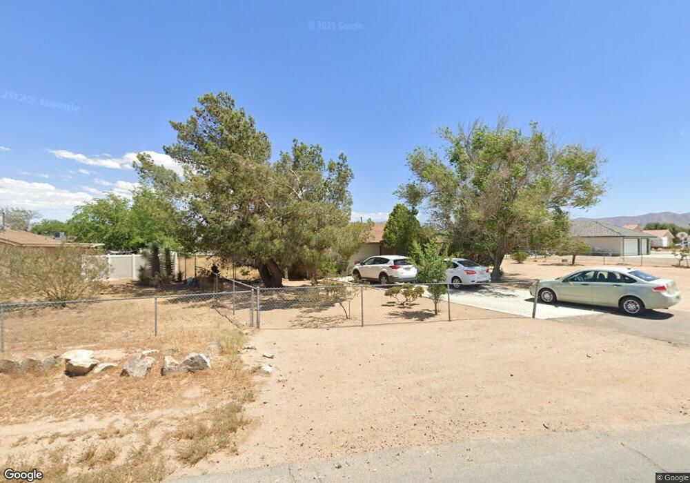
12555 Sholic Rd Apple Valley, CA 92308
High Desert NeighborhoodEstimated Value: $377,941 - $410,000
3
Beds
2
Baths
1,454
Sq Ft
$273/Sq Ft
Est. Value
About This Home
This home is located at 12555 Sholic Rd, Apple Valley, CA 92308 and is currently estimated at $397,485, approximately $273 per square foot. 12555 Sholic Rd is a home located in San Bernardino County with nearby schools including Sitting Bull Academy and Apple Valley High School.
Ownership History
Date
Name
Owned For
Owner Type
Purchase Details
Closed on
Oct 6, 2003
Sold by
Nassiri Mohammad Ali
Bought by
Bryant Christopher and Bryant Julie
Current Estimated Value
Home Financials for this Owner
Home Financials are based on the most recent Mortgage that was taken out on this home.
Original Mortgage
$113,600
Outstanding Balance
$51,334
Interest Rate
5.75%
Mortgage Type
Purchase Money Mortgage
Estimated Equity
$346,151
Create a Home Valuation Report for This Property
The Home Valuation Report is an in-depth analysis detailing your home's value as well as a comparison with similar homes in the area
Home Values in the Area
Average Home Value in this Area
Purchase History
| Date | Buyer | Sale Price | Title Company |
|---|---|---|---|
| Bryant Christopher | $142,000 | Fidelity National Title |
Source: Public Records
Mortgage History
| Date | Status | Borrower | Loan Amount |
|---|---|---|---|
| Open | Bryant Christopher | $113,600 | |
| Closed | Bryant Christopher | $28,400 |
Source: Public Records
Tax History Compared to Growth
Tax History
| Year | Tax Paid | Tax Assessment Tax Assessment Total Assessment is a certain percentage of the fair market value that is determined by local assessors to be the total taxable value of land and additions on the property. | Land | Improvement |
|---|---|---|---|---|
| 2025 | $2,350 | $201,895 | $40,379 | $161,516 |
| 2024 | $2,350 | $197,936 | $39,587 | $158,349 |
| 2023 | $3,066 | $194,055 | $38,811 | $155,244 |
| 2022 | $3,275 | $190,250 | $38,050 | $152,200 |
| 2021 | $2,241 | $186,520 | $37,304 | $149,216 |
| 2020 | $2,559 | $184,607 | $36,921 | $147,686 |
| 2019 | $2,557 | $180,987 | $36,197 | $144,790 |
| 2018 | $2,525 | $177,438 | $35,487 | $141,951 |
| 2017 | $2,499 | $173,959 | $34,791 | $139,168 |
| 2016 | $2,450 | $170,548 | $34,109 | $136,439 |
| 2015 | -- | $167,987 | $33,597 | $134,390 |
| 2014 | $1,590 | $109,300 | $21,900 | $87,400 |
Source: Public Records
Map
Nearby Homes
- 12715 Tesuque Rd
- 12566 Iroquois Rd
- 12421 Lakota Rd
- 21018 Little Beaver Rd
- 0 Matawan Rd
- 12770 Lakota Rd
- 12520 Tamiani Rd
- 12409 Pocono Rd
- 21133 Pahute Rd
- 12625 Tamiani Rd
- 12310 Iroquois Rd
- 12835 Iroquois Rd
- 21109 Sioux Rd
- 12443 Bannock Dr
- 21255 Minnetonka Rd
- 0 Rancho Rd Unit HD25234535
- 21133 Multnomah Rd
- 20726 Nisqually Rd
- 21275 Pocomoke Ct
- 20361 Pahute Rd
- 12571 Sholic Rd
- 12535 Sholic Rd
- 12554 Kiowa Rd
- 12570 Kiowa Rd
- 12560 Sholic Rd
- 12534 Kiowa Rd
- 12587 Sholic Rd
- 12511 Sholic Rd
- 12578 Sholic Rd
- 12532 Sholic Rd
- 12588 Kiowa Rd
- 12510 Kiowa Rd Unit 1
- 12510 Kiowa Rd
- 12605 Sholic Rd
- 12512 Sholic Rd
- 12555 Tesuque Rd
- 12606 Kiowa Rd
- 12575 Tesuque Rd
- 20801 Geronimo Rd
- 12503 Sholic Rd