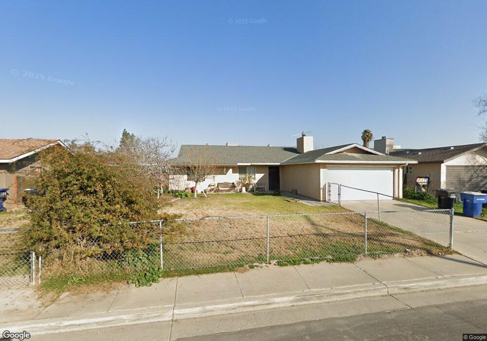
1256 Davis St Hanford, CA 93230
Estimated Value: $265,000 - $317,902
4
Beds
2
Baths
1,241
Sq Ft
$238/Sq Ft
Est. Value
About This Home
This home is located at 1256 Davis St, Hanford, CA 93230 and is currently estimated at $295,476, approximately $238 per square foot. 1256 Davis St is a home located in Kings County with nearby schools including Roosevelt Elementary School, Woodrow Wilson Junior High School, and Hanford West High School.
Ownership History
Date
Name
Owned For
Owner Type
Purchase Details
Closed on
Jun 24, 2024
Sold by
Rios Maria
Bought by
Rodriguez Marco Antonio Rios
Current Estimated Value
Purchase Details
Closed on
Sep 25, 2019
Sold by
Avila Jaramillo Juan Carlos
Bought by
Rios Maria
Purchase Details
Closed on
Apr 1, 2005
Sold by
Perez Abel R and Rodriguez Ramon Rios
Bought by
Rios Jose Luis and Rodriguez Marco Antonio Rios
Create a Home Valuation Report for This Property
The Home Valuation Report is an in-depth analysis detailing your home's value as well as a comparison with similar homes in the area
Home Values in the Area
Average Home Value in this Area
Purchase History
| Date | Buyer | Sale Price | Title Company |
|---|---|---|---|
| Rodriguez Marco Antonio Rios | -- | None Listed On Document | |
| Rios Maria | -- | None Listed On Document | |
| Rios Maria | -- | None Listed On Document | |
| Rios Jose Luis | -- | -- |
Source: Public Records
Tax History Compared to Growth
Tax History
| Year | Tax Paid | Tax Assessment Tax Assessment Total Assessment is a certain percentage of the fair market value that is determined by local assessors to be the total taxable value of land and additions on the property. | Land | Improvement |
|---|---|---|---|---|
| 2025 | $1,973 | $185,916 | $65,617 | $120,299 |
| 2023 | $1,973 | $178,699 | $63,070 | $115,629 |
| 2022 | $1,932 | $175,196 | $61,834 | $113,362 |
| 2021 | $1,890 | $171,762 | $60,622 | $111,140 |
| 2020 | $1,911 | $170,000 | $60,000 | $110,000 |
| 2019 | $1,395 | $130,789 | $42,076 | $88,713 |
| 2018 | $1,354 | $128,225 | $41,251 | $86,974 |
| 2017 | $1,332 | $125,711 | $40,442 | $85,269 |
| 2016 | $1,313 | $123,246 | $39,649 | $83,597 |
| 2015 | $1,303 | $121,394 | $39,053 | $82,341 |
| 2014 | $1,276 | $119,016 | $38,288 | $80,728 |
Source: Public Records
Map
Nearby Homes
- 573 Manor Ave
- 626 Kimball Ln
- 735 Manor Ave
- 1240 Washington St
- 558 Parsons St
- 670 Grant St
- 165 Walnut St
- 152 Walnut St
- 148 Walnut St
- 1405 Arthur St
- 650 S 11th Ave
- 930 W 7th St
- 1526 W Bison Ln Unit Ae 86
- 942 W 7th St
- 1121 W 6th St
- 1575 Bluejay Cir
- 8.11 Acres W Lacey Blvd
- 604 S Phillips St
- 1426 W Sidonia St
- 1765 Parkside Dr
- 1228 Davis St
- 1284 Davis St
- 569 S 11 1 2 Ave
- 1186 Davis St
- 569 S 11 1/2 Ave
- 1253 Sansome St
- 1229 Sansome St
- 614 Olive Ave
- 1183 Sansome St
- 1285 Sansome St
- 1172 Davis St
- 576 S 11 1/2 Ave
- 1251 Davis St
- 562 S 11 1/2 Ave
- 1189 Davis St
- 1154 Davis St
- 1171 Sansome St
- 1306 Davis St
- 1254 Sansome St
- 1226 Sansome St