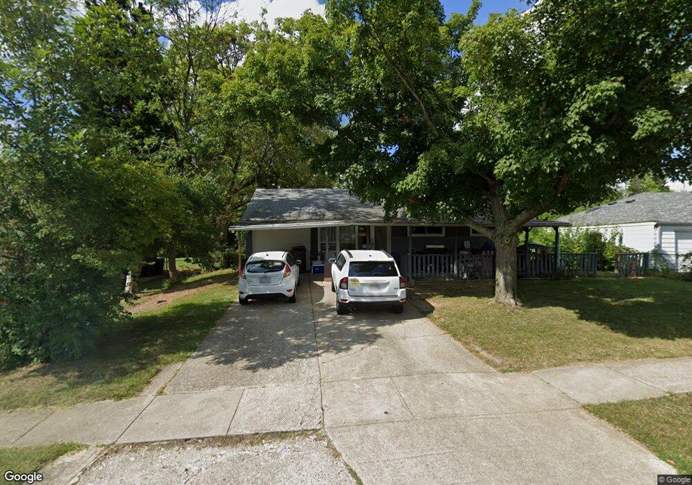
1256 Madeleine Cir Cincinnati, OH 45231
Finneytown NeighborhoodEstimated Value: $90,000 - $190,032
3
Beds
1
Bath
1,574
Sq Ft
$93/Sq Ft
Est. Value
About This Home
This home is located at 1256 Madeleine Cir, Cincinnati, OH 45231 and is currently estimated at $146,008, approximately $92 per square foot. 1256 Madeleine Cir is a home located in Hamilton County with nearby schools including Mt Healthy High School and John Paul II Catholic School.
Ownership History
Date
Name
Owned For
Owner Type
Purchase Details
Closed on
Jun 27, 2025
Sold by
Goans Ronald L and Goans Karen A
Bought by
Milford Capital Partners Llc
Current Estimated Value
Home Financials for this Owner
Home Financials are based on the most recent Mortgage that was taken out on this home.
Original Mortgage
$115,600
Outstanding Balance
$114,900
Interest Rate
6.81%
Mortgage Type
New Conventional
Estimated Equity
$31,108
Purchase Details
Closed on
Oct 1, 1991
Sold by
Weber Richard A and Weber Shirley
Bought by
Goans Ronald L and Goans Karen A
Create a Home Valuation Report for This Property
The Home Valuation Report is an in-depth analysis detailing your home's value as well as a comparison with similar homes in the area
Home Values in the Area
Average Home Value in this Area
Purchase History
| Date | Buyer | Sale Price | Title Company |
|---|---|---|---|
| Milford Capital Partners Llc | $87,500 | None Listed On Document | |
| Milford Capital Partners Llc | $87,500 | None Listed On Document | |
| Goans Ronald L | $49,000 | -- |
Source: Public Records
Mortgage History
| Date | Status | Borrower | Loan Amount |
|---|---|---|---|
| Open | Milford Capital Partners Llc | $115,600 | |
| Closed | Milford Capital Partners Llc | $115,600 |
Source: Public Records
Tax History
| Year | Tax Paid | Tax Assessment Tax Assessment Total Assessment is a certain percentage of the fair market value that is determined by local assessors to be the total taxable value of land and additions on the property. | Land | Improvement |
|---|---|---|---|---|
| 2025 | $2,467 | $42,326 | $5,243 | $37,083 |
| 2024 | $2,445 | $42,326 | $5,243 | $37,083 |
| 2023 | $2,323 | $42,326 | $5,243 | $37,083 |
| 2022 | $1,373 | $17,931 | $5,191 | $12,740 |
| 2021 | $1,336 | $17,931 | $5,191 | $12,740 |
| 2020 | $1,356 | $17,931 | $5,191 | $12,740 |
| 2019 | $1,343 | $16,601 | $4,806 | $11,795 |
| 2018 | $1,351 | $16,601 | $4,806 | $11,795 |
| 2017 | $1,282 | $16,601 | $4,806 | $11,795 |
| 2016 | $1,744 | $22,341 | $5,187 | $17,154 |
| 2015 | $1,758 | $22,341 | $5,187 | $17,154 |
| 2014 | $1,749 | $22,341 | $5,187 | $17,154 |
| 2013 | $1,802 | $23,517 | $5,460 | $18,057 |
Source: Public Records
Map
Nearby Homes
- 1125 Murkett Ct
- 1285 Landis Ln
- 8609 Balboa Dr
- 1116 Madeleine Cir
- 1101 Meadowind Ct
- 1144 Hempstead Dr
- 8693 Mockingbird Ln
- 8663 Mockingbird Ln
- 1123 Compton Rd
- 7227 Bernard Ave
- 1115 Compton Rd
- 1052 Vacationland Dr
- 8829 Mockingbird Ln
- 1202 Ashmore Ct
- 8491 Daly Rd
- 1461 Kinney Ave
- 1481 Saint Clair Ave
- 1476 Foxwood Dr
- 1500 Madison Ave
- 7508 Elizabeth St
- 1260 Madeleine Cir
- 1252 Madeleine Cir
- 8877 Cabot Dr
- 8879 Cabot Dr
- 1264 Madeleine Cir
- 1259 Madeleine Cir
- 1253 Madeleine Cir
- 8881 Cabot Dr
- 1268 Madeleine Cir
- 8848 Grenada Dr
- 1238 Madeleine Cir
- 8853 Cabot Dr
- 8876 Cabot Dr
- 8878 Cabot Dr
- 1267 Madeleine Cir
- 8883 Cabot Dr
- 1272 Madeleine Cir
- 8880 Cabot Dr
- 1239 Madeleine Cir
- 8847 Cabot Dr
Your Personal Tour Guide
Ask me questions while you tour the home.