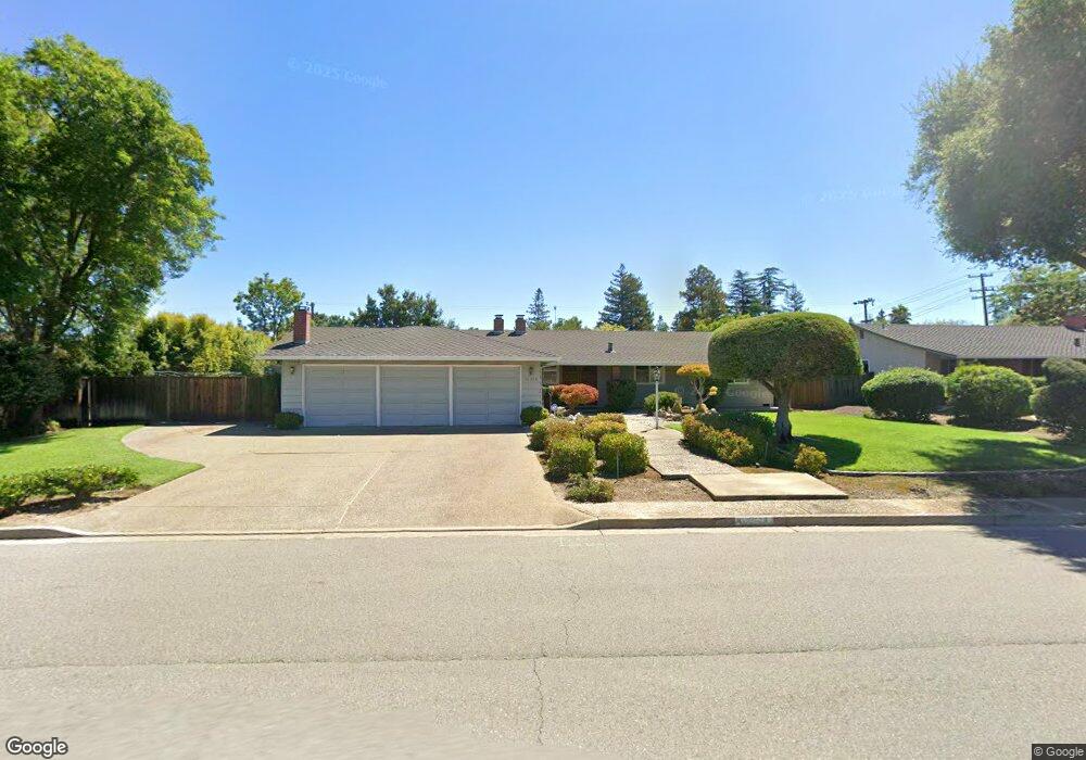
12568 Miller Ave Saratoga, CA 95070
West San Jose NeighborhoodEstimated Value: $3,705,000 - $4,029,145
4
Beds
2
Baths
2,320
Sq Ft
$1,657/Sq Ft
Est. Value
About This Home
This home is located at 12568 Miller Ave, Saratoga, CA 95070 and is currently estimated at $3,844,786, approximately $1,657 per square foot. 12568 Miller Ave is a home located in Santa Clara County with nearby schools including Blue Hills Elementary School, Joaquin Miller Middle, and Lynbrook High School.
Ownership History
Date
Name
Owned For
Owner Type
Purchase Details
Closed on
Jan 22, 2024
Sold by
Hatada George Tamio and Hatada Lorraine Etsuko
Bought by
Hatada Living Trust and Hatada
Current Estimated Value
Purchase Details
Closed on
Apr 18, 2020
Sold by
Hatada George Tamio and Hatada Lorraine Etsuko
Bought by
Hatada George Tamio and Hatada Lorraine Etsuko
Home Financials for this Owner
Home Financials are based on the most recent Mortgage that was taken out on this home.
Original Mortgage
$1,170,000
Interest Rate
4.62%
Mortgage Type
New Conventional
Purchase Details
Closed on
May 26, 1994
Sold by
Hatada George Tamio and Hatada Lorraine Etsuko
Bought by
Hatada George Tamio and Hatada Lorraine Etsuko
Home Financials for this Owner
Home Financials are based on the most recent Mortgage that was taken out on this home.
Original Mortgage
$400,000
Interest Rate
3.37%
Create a Home Valuation Report for This Property
The Home Valuation Report is an in-depth analysis detailing your home's value as well as a comparison with similar homes in the area
Home Values in the Area
Average Home Value in this Area
Purchase History
| Date | Buyer | Sale Price | Title Company |
|---|---|---|---|
| Hatada Living Trust | -- | None Listed On Document | |
| Hatada George Tamio | -- | Servicelink | |
| Hatada George Tamio | -- | Santa Clara Land Title Co |
Source: Public Records
Mortgage History
| Date | Status | Borrower | Loan Amount |
|---|---|---|---|
| Previous Owner | Hatada George Tamio | $1,170,000 | |
| Previous Owner | Hatada George Tamio | $400,000 |
Source: Public Records
Tax History Compared to Growth
Tax History
| Year | Tax Paid | Tax Assessment Tax Assessment Total Assessment is a certain percentage of the fair market value that is determined by local assessors to be the total taxable value of land and additions on the property. | Land | Improvement |
|---|---|---|---|---|
| 2025 | $2,947 | $171,287 | $41,554 | $129,733 |
| 2024 | $2,947 | $167,930 | $40,740 | $127,190 |
| 2023 | $2,903 | $164,639 | $39,942 | $124,697 |
| 2022 | $2,864 | $161,411 | $39,159 | $122,252 |
| 2021 | $2,802 | $158,247 | $38,392 | $119,855 |
| 2020 | $2,737 | $156,626 | $37,999 | $118,627 |
| 2019 | $2,657 | $153,555 | $37,254 | $116,301 |
| 2018 | $2,570 | $150,545 | $36,524 | $114,021 |
| 2017 | $2,529 | $147,594 | $35,808 | $111,786 |
| 2016 | $2,409 | $144,701 | $35,106 | $109,595 |
| 2015 | $2,343 | $142,528 | $34,579 | $107,949 |
| 2014 | $2,256 | $139,737 | $33,902 | $105,835 |
Source: Public Records
Map
Nearby Homes
- 13010 Glen Brae Dr
- 12140 Woodside Dr
- 19437 Via Real Dr
- 19423 Vineyard Ln
- 1681 Danromas Way
- 19113 Vineyard Ln
- 1587 Miller Ave
- 19662 Via Grande Dr
- 12790 Glen Arbor Ct
- 19920 Viewridge Dr
- 11010 Maple Place Unit 25-06 Plan 4
- 10750 Elm Cir Unit 88-17 Plan 2
- 10730 Elm Cir Unit 86-17 Plan 2
- 11315 Cottonwood Place Unit 39-09 Plan 3
- Plan 2 at The Elms
- Plan 3 at The Elms
- Plan 4 at The Elms
- 11645 Redwood Place Unit 56-12 Plan 4
- 11210 Cottonwood Place Unit 35-08 Plan 4
- 11220 Cottonwood Place Unit 36-08 Plan 2
- 12546 Miller Ave
- 12590 Miller Ave
- 12567 Northampton Ct
- 12579 Northampton Ct
- 19444 Dorchester Dr
- 12545 Northampton Ct
- 12612 Miller Ave
- 12524 Miller Ave
- 12591 Miller Ave
- 19371 Titus Ct
- 19445 Dorchester Dr
- 12596 Northampton Ct
- 19456 Dorchester Dr
- 12523 Northampton Ct
- 12603 Miller Ave
- 19359 Titus Ct
- 12634 Miller Ave
- 12568 Northampton Ct
- 12590 Northampton Ct
- 19467 Dorchester Dr