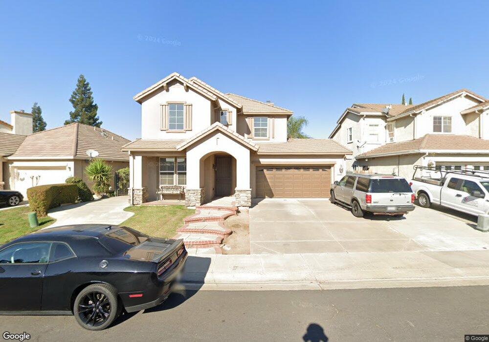
1257 Laurel Park Cir Manteca, CA 95337
Estimated Value: $499,000 - $691,000
4
Beds
3
Baths
2,479
Sq Ft
$257/Sq Ft
Est. Value
About This Home
This home is located at 1257 Laurel Park Cir, Manteca, CA 95337 and is currently estimated at $636,892, approximately $256 per square foot. 1257 Laurel Park Cir is a home located in San Joaquin County with nearby schools including Brock Elliott Elementary School and Sierra High School.
Ownership History
Date
Name
Owned For
Owner Type
Purchase Details
Closed on
Oct 18, 2011
Sold by
Godfrey Natalie
Bought by
Godfrey Natalie and Natalie Godfrey 2007 Revocable
Current Estimated Value
Purchase Details
Closed on
Feb 1, 2011
Sold by
Abaunza Nibaldo J
Bought by
Godfrey Natalie
Home Financials for this Owner
Home Financials are based on the most recent Mortgage that was taken out on this home.
Original Mortgage
$206,625
Outstanding Balance
$141,187
Interest Rate
4.75%
Mortgage Type
FHA
Estimated Equity
$495,705
Purchase Details
Closed on
Dec 19, 2005
Sold by
Abaunza Marylou
Bought by
Abaunza Nibaldo J
Purchase Details
Closed on
Mar 29, 2004
Sold by
Fcb Building Partners I Lp
Bought by
Abaunza Nibaldo J and Abaunza Marylou
Home Financials for this Owner
Home Financials are based on the most recent Mortgage that was taken out on this home.
Original Mortgage
$359,300
Interest Rate
4.5%
Mortgage Type
Purchase Money Mortgage
Create a Home Valuation Report for This Property
The Home Valuation Report is an in-depth analysis detailing your home's value as well as a comparison with similar homes in the area
Home Values in the Area
Average Home Value in this Area
Purchase History
| Date | Buyer | Sale Price | Title Company |
|---|---|---|---|
| Godfrey Natalie | -- | None Available | |
| Godfrey Natalie | $212,000 | Old Republic Title Company | |
| Abaunza Nibaldo J | -- | Fidelity Natl Title Ins | |
| Abaunza Nibaldo J | $378,500 | First Amer Title Co |
Source: Public Records
Mortgage History
| Date | Status | Borrower | Loan Amount |
|---|---|---|---|
| Open | Godfrey Natalie | $206,625 | |
| Previous Owner | Abaunza Nibaldo J | $359,300 |
Source: Public Records
Tax History Compared to Growth
Tax History
| Year | Tax Paid | Tax Assessment Tax Assessment Total Assessment is a certain percentage of the fair market value that is determined by local assessors to be the total taxable value of land and additions on the property. | Land | Improvement |
|---|---|---|---|---|
| 2025 | $3,989 | $271,599 | $67,898 | $203,701 |
| 2024 | $3,905 | $266,274 | $66,567 | $199,707 |
| 2023 | $3,850 | $261,054 | $65,262 | $195,792 |
| 2022 | $3,806 | $255,936 | $63,983 | $191,953 |
| 2021 | $3,775 | $250,919 | $62,729 | $188,190 |
| 2020 | $3,719 | $248,347 | $62,086 | $186,261 |
| 2019 | $3,679 | $243,478 | $60,869 | $182,609 |
| 2018 | $3,514 | $238,705 | $59,676 | $179,029 |
| 2017 | $3,440 | $234,025 | $58,506 | $175,519 |
| 2016 | $3,394 | $229,437 | $57,359 | $172,078 |
| 2014 | $3,202 | $221,565 | $55,391 | $166,174 |
Source: Public Records
Map
Nearby Homes
- 1749 Mary Augusta St
- 1026 Eleanor Ln
- 1587 Lenay Ct
- 1716 Wawona St
- 1602 Oleander Ave
- 1565 Blue Lupine Ln
- 1630 Red Ribbons Ln
- 1747 Gladwall Ave
- 1298 Hunt Rd
- 1957 W Woodward Ave
- 1353 Wawona St
- 1338 Alfa Romeo Ct
- 1770 Ettle St
- 2214 Milano St
- 1635 Langum Way
- 1432 Driftwood Way
- 1267 Christine Ct
- 1158 Mallard Ct
- 1877 Lateral Ave
- 1108 Mission Ridge Dr
- 1255 Laurel Park Cir
- 1263 Laurel Park Cir
- 1251 Laurel Park Cir
- 1267 Laurel Park Cir
- 1728 Daniels St
- 1734 Daniels St
- 1722 Daniels St
- 1746 Daniels St
- 1249 Laurel Park Cir
- 1271 Laurel Park Cir
- 1258 Laurel Park Cir
- 1256 Laurel Park Cir
- 1262 Laurel Park Cir
- 1254 Laurel Park Cir
- 1714 Daniels St
- 1750 Daniels St
- 1245 Laurel Park Cir
- 1250 Laurel Park Cir
- 1273 Laurel Park Cir
- 1708 Daniels St