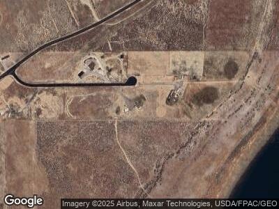
1257 W Hunsaker Ln Stockton, UT 84071
Estimated Value: $593,000 - $750,000
--
Bed
--
Bath
3,130
Sq Ft
$213/Sq Ft
Est. Value
About This Home
This home is located at 1257 W Hunsaker Ln, Stockton, UT 84071 and is currently estimated at $666,166, approximately $212 per square foot. 1257 W Hunsaker Ln is a home with nearby schools including Settlement Canyon Elementary School and Dugway.
Ownership History
Date
Name
Owned For
Owner Type
Purchase Details
Closed on
Oct 23, 2009
Sold by
Hunsaker Michael U and Hunsaker Sherry L
Bought by
Hunsaker Cody M and Hunsaker Jana E
Current Estimated Value
Purchase Details
Closed on
Aug 1, 2009
Sold by
Hunsaker Michael U and Hunsaker Cody M
Bought by
Hunsaker Cody M and Hunsaker Jana E
Create a Home Valuation Report for This Property
The Home Valuation Report is an in-depth analysis detailing your home's value as well as a comparison with similar homes in the area
Home Values in the Area
Average Home Value in this Area
Purchase History
| Date | Buyer | Sale Price | Title Company |
|---|---|---|---|
| Hunsaker Cody M | -- | B & D Title Co Of Tooele | |
| Hunsaker Cody M | -- | B & D Title Co |
Source: Public Records
Mortgage History
| Date | Status | Borrower | Loan Amount |
|---|---|---|---|
| Open | Hunsaker Cody M | $350,000 | |
| Closed | Hunsaker Cody M | $350,000 | |
| Closed | Hunsaker Cody M | $72,000 | |
| Closed | Hunsaker Jana E | $35,000 | |
| Closed | Hunsaker Cody M | $248,425 | |
| Closed | Hunsaker Cody M | $248,000 |
Source: Public Records
Tax History Compared to Growth
Tax History
| Year | Tax Paid | Tax Assessment Tax Assessment Total Assessment is a certain percentage of the fair market value that is determined by local assessors to be the total taxable value of land and additions on the property. | Land | Improvement |
|---|---|---|---|---|
| 2024 | $3,989 | $334,646 | $170,750 | $163,896 |
| 2023 | $3,989 | $321,876 | $170,750 | $151,126 |
| 2022 | $2,614 | $251,396 | $120,500 | $130,896 |
| 2021 | $2,887 | $230,837 | $105,750 | $125,087 |
| 2020 | $2,313 | $308,566 | $65,000 | $243,566 |
| 2019 | $2,148 | $267,972 | $65,000 | $202,972 |
| 2018 | $2,165 | $267,972 | $65,000 | $202,972 |
| 2017 | $1,831 | $241,486 | $65,000 | $176,486 |
| 2016 | $1,816 | $141,817 | $44,750 | $97,067 |
| 2015 | $1,816 | $141,817 | $0 | $0 |
| 2014 | -- | $141,817 | $0 | $0 |
Source: Public Records
Map
Nearby Homes
- 1843 W Big Sky Dr
- 1984 W Ridgeline Rd
- 2258 W Deer Run Dr Unit 174
- 2409 W Rim Rock Dr
- 291 N Sheridan St
- 609 E 900 S
- 3214 W Ridgeline Rd
- 0 E Bald Mountain Rd
- 1157 S 1050 W
- 1054 S 1050 W
- 923 W 1140 S
- 1081 S 900 W
- 799 3 O'Clock Dr
- 475 Utah 36
- 685 3 O'Clock Dr
- 765 1 O'Clock Dr
- 908 Timpie Rd
- 1082 Southland Dr
- 848 S 940 W
- 729 Timpie Rd
- 1257 W Hunsaker Ln
- 1211 W Hunsaker Ln
- 110 S Dont Walk St
- 1286 W Hunsaker Ln
- 111 Main St
- 1377 Hunsaker Ln S Unit 2
- 1100 W Silver Ave
- 1489 W Rim Rock Dr Unit 390
- 1489 W Rim Rock Dr Unit 390
- 1509 W Rim Rock Dr Unit 380
- 1509 W Rim Rock Dr Unit 389
- 1101 W Silver Ave
- 1529 W Rim Rock Dr
- 1502 W Rim Rock Dr
- 1547 W Rim Rock Dr
- 1522 W Rim Rock Dr
- 1567 W Rim Rock Dr Unit 386
- 1542 W Rim Rock Dr
- 1517 W Ridgeline Rd Unit 375
- 1572 W Ridgeline Rd Unit 394
