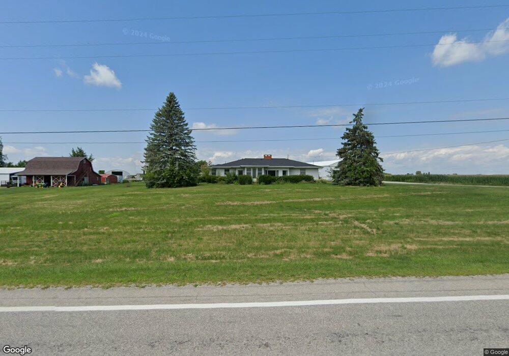
12571 Us Highway 127 West Unity, OH 43570
Estimated Value: $212,000 - $277,477
3
Beds
3
Baths
2,280
Sq Ft
$108/Sq Ft
Est. Value
About This Home
This home is located at 12571 Us Highway 127, West Unity, OH 43570 and is currently estimated at $245,619, approximately $107 per square foot. 12571 Us Highway 127 is a home located in Williams County with nearby schools including Hilltop Elementary School and Hilltop High School.
Ownership History
Date
Name
Owned For
Owner Type
Purchase Details
Closed on
Aug 8, 2019
Sold by
Meyers Daniel and Schroeder Pamela
Bought by
Schroeder Pamela Meyers
Current Estimated Value
Purchase Details
Closed on
Dec 21, 2018
Sold by
Estate Of Leland Meyers
Bought by
Meyers Daniel E and Schroeder Pamela
Purchase Details
Closed on
Sep 29, 2008
Sold by
Jacobs Susan D
Bought by
Meyers Leland J and Meyers Donna S
Purchase Details
Closed on
Sep 26, 2008
Sold by
Jacobs Douglas W
Bought by
Jacobs Susan D
Purchase Details
Closed on
Sep 25, 2000
Sold by
Jacobs Douglas W and Jacobs Susan D
Bought by
Jacobs Susan D
Purchase Details
Closed on
Aug 26, 1996
Bought by
Jacobs Douglas W and Jacobs Susan D
Create a Home Valuation Report for This Property
The Home Valuation Report is an in-depth analysis detailing your home's value as well as a comparison with similar homes in the area
Home Values in the Area
Average Home Value in this Area
Purchase History
| Date | Buyer | Sale Price | Title Company |
|---|---|---|---|
| Schroeder Pamela Meyers | $130,000 | None Available | |
| Meyers Daniel E | -- | None Available | |
| Meyers Leland J | -- | None Available | |
| Jacobs Susan D | -- | None Available | |
| Jacobs Susan D | -- | -- | |
| Jacobs Douglas W | $112,500 | -- |
Source: Public Records
Tax History Compared to Growth
Tax History
| Year | Tax Paid | Tax Assessment Tax Assessment Total Assessment is a certain percentage of the fair market value that is determined by local assessors to be the total taxable value of land and additions on the property. | Land | Improvement |
|---|---|---|---|---|
| 2024 | $2,932 | $77,740 | $8,750 | $68,990 |
| 2023 | $2,932 | $61,290 | $8,540 | $52,750 |
| 2022 | $2,754 | $61,290 | $8,540 | $52,750 |
| 2021 | $2,754 | $61,290 | $8,540 | $52,750 |
| 2020 | $2,362 | $51,100 | $7,140 | $43,960 |
| 2019 | $2,324 | $51,100 | $7,140 | $43,960 |
| 2018 | $2,247 | $51,100 | $7,140 | $43,960 |
| 2017 | $2,239 | $49,110 | $7,140 | $41,970 |
| 2016 | $2,142 | $49,110 | $7,140 | $41,970 |
| 2015 | $2,142 | $49,110 | $7,140 | $41,970 |
| 2014 | $2,125 | $44,630 | $6,480 | $38,150 |
| 2013 | $1,645 | $44,630 | $6,480 | $38,150 |
Source: Public Records
Map
Nearby Homes
- 311 W Rings St
- 000 W Jackson
- 205 Taylor Dr
- 340 S Main St
- 22227 Us Highway 20a
- 16806 US Highway 20a
- 16228 County Road N-30
- 0 U S 20
- 15664 County Road K
- 18 Cobblestone Rd
- 23161 County Road Jk
- 3063 County Road 26-2
- 305 W Mulberry St
- 7170 County Road 23
- 301 Horton St
- 14701 Us Highway 127
- 22018 County Road F
- 0 St Rt 15 Unit 10001011
- 10628 Ohio 15
- 612 Cynthia Dr
- 12525 Us Highway 127
- 12540 Us Highway 127
- 12484 Us Highway 127
- 12575 Us Highway 127
- 525 N Liberty St
- 21351 S 20-A
- 514 N Liberty St
- 520 N Liberty St
- 512 N Liberty St
- 510 N Liberty St
- 508 N Liberty St
- 506 N Liberty St
- 211 E Catherine St
- 209 E Catherine St
- 502 N Liberty St
- 207 E Catherine St
- 207 E Catherine St
- 205 E Catherine St
- 410 N Liberty St
- 203 E Catherine St