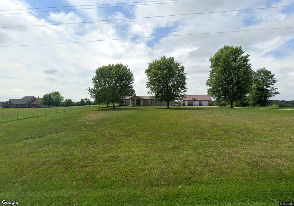
12575 State Route 125 West Union, OH 45693
Estimated Value: $152,000 - $211,345
3
Beds
2
Baths
1,872
Sq Ft
$99/Sq Ft
Est. Value
About This Home
This home is located at 12575 State Route 125, West Union, OH 45693 and is currently estimated at $185,586, approximately $99 per square foot. 12575 State Route 125 is a home located in Adams County with nearby schools including West Union Elementary School and West Union High School.
Ownership History
Date
Name
Owned For
Owner Type
Purchase Details
Closed on
Jul 2, 2021
Sold by
Hopkins Christen Kay and Mcintosh Christen Kay
Bought by
May David S and May Marla J
Current Estimated Value
Home Financials for this Owner
Home Financials are based on the most recent Mortgage that was taken out on this home.
Original Mortgage
$152,000
Outstanding Balance
$137,916
Interest Rate
2.9%
Mortgage Type
New Conventional
Estimated Equity
$47,670
Purchase Details
Closed on
Nov 8, 2018
Sold by
Calvert Michael T and Calvert Wendi L
Bought by
Hopkins Christen Kay
Home Financials for this Owner
Home Financials are based on the most recent Mortgage that was taken out on this home.
Original Mortgage
$104,000
Interest Rate
4.7%
Mortgage Type
Closed End Mortgage
Purchase Details
Closed on
Dec 10, 2001
Bought by
Calvert Michael T
Create a Home Valuation Report for This Property
The Home Valuation Report is an in-depth analysis detailing your home's value as well as a comparison with similar homes in the area
Home Values in the Area
Average Home Value in this Area
Purchase History
| Date | Buyer | Sale Price | Title Company |
|---|---|---|---|
| May David S | $160,000 | Stewart Title Company | |
| May David S | -- | Stewart Title | |
| Hopkins Christen Kay | -- | Stewart Title Company | |
| Calvert Michael T | -- | -- |
Source: Public Records
Mortgage History
| Date | Status | Borrower | Loan Amount |
|---|---|---|---|
| Open | May David S | $152,000 | |
| Closed | May David S | $152,000 | |
| Previous Owner | Hopkins Christen Kay | $104,000 |
Source: Public Records
Tax History Compared to Growth
Tax History
| Year | Tax Paid | Tax Assessment Tax Assessment Total Assessment is a certain percentage of the fair market value that is determined by local assessors to be the total taxable value of land and additions on the property. | Land | Improvement |
|---|---|---|---|---|
| 2024 | $1,377 | $41,550 | $3,500 | $38,050 |
| 2023 | $1,385 | $41,550 | $3,500 | $38,050 |
| 2022 | $1,375 | $36,050 | $2,590 | $33,460 |
| 2021 | $1,293 | $36,050 | $2,590 | $33,460 |
| 2020 | $1,321 | $36,050 | $2,590 | $33,460 |
| 2019 | $1,355 | $36,050 | $2,590 | $33,460 |
| 2018 | $1,138 | $31,680 | $2,590 | $29,090 |
| 2017 | $1,118 | $31,680 | $2,590 | $29,090 |
| 2016 | $1,116 | $31,680 | $2,590 | $29,090 |
| 2015 | $970 | $28,500 | $2,420 | $26,080 |
| 2014 | $970 | $28,500 | $2,420 | $26,080 |
Source: Public Records
Map
Nearby Homes
- 1011 Hafer Rd
- 598 Ohio 348
- 1064 Hafer Rd
- 108 Chirsdon Ln
- 410 Owens Rd
- 13465 State Route 41
- 1478 Robinson Hollow Rd
- 292 Larry Baynum Rd
- 216 Kurt St
- 260 Randy St
- 120 Randy St
- 405 Lookout View
- 1082 E Walnut St
- 3460 Logans Ln
- 3188 Ohio 125
- 175 Hidden Acres Dr
- 917 Logans Ln
- 725 E Walnut St
- 618 Maple St
- 601 E Main St
- 12577 State Route 125
- 12570 State Route 125
- 12494 State Route 125
- 0 Mack Rd Unit 1648608
- 12793 State Route 125
- 55 Compton Hill Rd
- 12573 State Route 125
- 12389 State Route 125
- 12895 State Route 125
- 100 Compton Hill Rd
- 5.003ac Mack Rd
- 114 Compton Hill Rd
- 12975 State Route 125
- 184 Mack Rd
- 166 Compton Hill Rd
- 12571 State Route 125
- 180 Compton Hill Rd
- 157 Cox Rd
- 200 Compton Hill Rd
- 12231 State Route 125