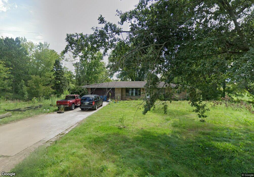
12580 C Dr N Ceresco, MI 49033
Estimated Value: $323,000 - $429,000
3
Beds
3
Baths
1,724
Sq Ft
$209/Sq Ft
Est. Value
About This Home
This home is located at 12580 C Dr N, Ceresco, MI 49033 and is currently estimated at $359,686, approximately $208 per square foot. 12580 C Dr N is a home located in Calhoun County with nearby schools including Harper Creek Middle School and Harper Creek High School.
Ownership History
Date
Name
Owned For
Owner Type
Purchase Details
Closed on
Jun 9, 2023
Sold by
Alpin Nicholas
Bought by
Marshall Area Economic Development Alliance
Current Estimated Value
Purchase Details
Closed on
Jun 5, 2023
Sold by
Maynard James R and Maynard Julie M
Bought by
Marshall Area Economic Development Alliance
Purchase Details
Closed on
Jul 31, 2017
Sold by
Schragg David A and Schragg Melvin F
Bought by
Maynard James R and Maynard Julie M
Home Financials for this Owner
Home Financials are based on the most recent Mortgage that was taken out on this home.
Original Mortgage
$171,190
Interest Rate
3.88%
Mortgage Type
New Conventional
Purchase Details
Closed on
Sep 22, 2015
Sold by
Schragg Melvin F and Schragg Elizabeth M
Bought by
Schragg David A
Create a Home Valuation Report for This Property
The Home Valuation Report is an in-depth analysis detailing your home's value as well as a comparison with similar homes in the area
Home Values in the Area
Average Home Value in this Area
Purchase History
| Date | Buyer | Sale Price | Title Company |
|---|---|---|---|
| Marshall Area Economic Development Alliance | -- | None Listed On Document | |
| Marshall Area Economic Dev All | -- | None Listed On Document | |
| Marshall Area Economic Development Alliance | -- | None Listed On Document | |
| Marshall Area Economic Dev All | -- | None Listed On Document | |
| Maynard James R | $180,200 | Chicago Title | |
| Schragg David A | -- | Attorney |
Source: Public Records
Mortgage History
| Date | Status | Borrower | Loan Amount |
|---|---|---|---|
| Previous Owner | Maynard James R | $171,190 |
Source: Public Records
Tax History Compared to Growth
Tax History
| Year | Tax Paid | Tax Assessment Tax Assessment Total Assessment is a certain percentage of the fair market value that is determined by local assessors to be the total taxable value of land and additions on the property. | Land | Improvement |
|---|---|---|---|---|
| 2025 | $7,558 | $151,700 | $0 | $0 |
| 2024 | $6,129 | $139,900 | $0 | $0 |
| 2023 | $3,411 | $128,800 | $0 | $0 |
| 2022 | $3,411 | $118,800 | $0 | $0 |
| 2021 | $3,305 | $111,200 | $0 | $0 |
| 2020 | $3,263 | $100,100 | $0 | $0 |
| 2019 | $0 | $90,300 | $0 | $0 |
| 2018 | $0 | $92,000 | $13,300 | $78,700 |
| 2017 | $0 | $91,200 | $0 | $0 |
| 2016 | $0 | $96,900 | $0 | $0 |
| 2015 | -- | $90,300 | $23,477 | $66,823 |
| 2014 | -- | $90,900 | $23,477 | $67,423 |
Source: Public Records
Map
Nearby Homes
- 275 Battle Creek St
- 15627 13 Mile Rd
- 0 V L H Dr N
- 11506 11 Mile Rd
- 16565 14 Mile Rd
- 0 N F Dr Unit 23021090
- 216 Winston Dr
- 218 Winston Dr
- 323 Wattles Rd S
- 11253 Wildwood Dr
- 213 Wattles Rd S
- 154 Hidden Forest Rd
- 0 15 1 2 Mile Rd Unit 25024661
- 119 Greenfield Blvd
- 10047 11 Mile Rd
- 732 W Hanover St
- 605 Turquoise Trail
- 734 Verona Rd
- 17579 14 Mile Rd
- 10660 D Dr S