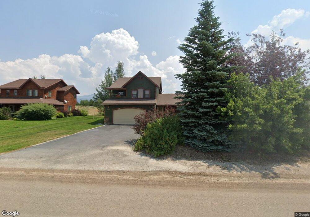
1259 Targhee Ranch Dr Driggs, ID 83422
Estimated Value: $793,000 - $955,000
3
Beds
3
Baths
1,669
Sq Ft
$509/Sq Ft
Est. Value
About This Home
This home is located at 1259 Targhee Ranch Dr, Driggs, ID 83422 and is currently estimated at $849,164, approximately $508 per square foot. 1259 Targhee Ranch Dr is a home located in Teton County with nearby schools including Driggs Elementary School, Teton High School, and The Learning Academy of Teton Valley.
Ownership History
Date
Name
Owned For
Owner Type
Purchase Details
Closed on
Dec 16, 2022
Sold by
Teton Land Group Llc
Bought by
Targhee Hill Estates Pud Llc
Current Estimated Value
Purchase Details
Closed on
Aug 2, 2018
Sold by
Campcole Llc
Bought by
Penn Bradley and Penn Virginia
Purchase Details
Closed on
Oct 30, 2014
Sold by
Rigsby Howard J and Rigsby Pamela S
Bought by
Campcole Llc
Purchase Details
Closed on
Jan 15, 2014
Sold by
Footprint Properties Llc
Bought by
Rigsby Howard J and Rigsby Pamela S
Purchase Details
Closed on
Jan 7, 2009
Sold by
Rigsby Howard J and Rigsby Pamela S
Bought by
Footprint Properties Llc
Home Financials for this Owner
Home Financials are based on the most recent Mortgage that was taken out on this home.
Original Mortgage
$261,000
Interest Rate
4.78%
Mortgage Type
New Conventional
Purchase Details
Closed on
Dec 18, 2008
Sold by
Manning Charles R
Bought by
Manning Peggy S
Home Financials for this Owner
Home Financials are based on the most recent Mortgage that was taken out on this home.
Original Mortgage
$261,000
Interest Rate
4.78%
Mortgage Type
New Conventional
Purchase Details
Closed on
Aug 18, 2006
Sold by
Rigsby Howard J and Rigsby Pamela S
Bought by
Rigsby Howard J
Home Financials for this Owner
Home Financials are based on the most recent Mortgage that was taken out on this home.
Original Mortgage
$262,000
Interest Rate
6.76%
Mortgage Type
New Conventional
Purchase Details
Closed on
Aug 16, 2006
Sold by
Rigsby Howard J and Manning Charles R
Bought by
Footprint Properties Llc
Home Financials for this Owner
Home Financials are based on the most recent Mortgage that was taken out on this home.
Original Mortgage
$262,000
Interest Rate
6.76%
Mortgage Type
New Conventional
Purchase Details
Closed on
Aug 17, 2005
Sold by
Targhee Ridge Estates Limited Liabilithy
Bought by
C D F Limited Liability Company
Home Financials for this Owner
Home Financials are based on the most recent Mortgage that was taken out on this home.
Original Mortgage
$200,000
Interest Rate
5.64%
Mortgage Type
Construction
Create a Home Valuation Report for This Property
The Home Valuation Report is an in-depth analysis detailing your home's value as well as a comparison with similar homes in the area
Home Values in the Area
Average Home Value in this Area
Purchase History
| Date | Buyer | Sale Price | Title Company |
|---|---|---|---|
| Targhee Hill Estates Pud Llc | -- | Alliance Title | |
| Penn Bradley | -- | First American Title Driggs | |
| Campcole Llc | -- | Teton County Title | |
| Rigsby Howard J | -- | First American Title | |
| Footprint Properties Llc | -- | -- | |
| Manning Peggy S | -- | -- | |
| Rigsby Howard J | -- | -- | |
| Rigsby Howard J | -- | -- | |
| Footprint Properties Llc | -- | -- | |
| Manning Charles R | -- | -- | |
| Rigsby Howard J | -- | -- | |
| Targhee Ridge Estates Llc | -- | -- | |
| C D F Limited Liability Company | -- | -- |
Source: Public Records
Mortgage History
| Date | Status | Borrower | Loan Amount |
|---|---|---|---|
| Previous Owner | Rigsby Howard J | $261,000 | |
| Previous Owner | Rigsby Howard J | $262,000 | |
| Previous Owner | C D F Limited Liability Company | $200,000 |
Source: Public Records
Tax History Compared to Growth
Tax History
| Year | Tax Paid | Tax Assessment Tax Assessment Total Assessment is a certain percentage of the fair market value that is determined by local assessors to be the total taxable value of land and additions on the property. | Land | Improvement |
|---|---|---|---|---|
| 2025 | $2,438 | $709,023 | $165,000 | $544,023 |
| 2024 | $2,438 | $699,023 | $155,000 | $544,023 |
| 2023 | $2,438 | $689,023 | $145,000 | $544,023 |
| 2022 | $2,504 | $598,168 | $125,000 | $473,168 |
| 2021 | $2,668 | $391,824 | $60,000 | $331,824 |
| 2020 | $2,607 | $312,638 | $40,000 | $272,638 |
| 2019 | $2,566 | $313,805 | $38,000 | $275,805 |
| 2018 | $2,556 | $288,677 | $35,000 | $253,677 |
| 2017 | $2,309 | $287,677 | $34,000 | $253,677 |
| 2016 | $2,262 | $260,566 | $34,000 | $226,566 |
| 2015 | $2,270 | $226,645 | $30,000 | $196,645 |
| 2011 | -- | $223,503 | $40,000 | $183,503 |
Source: Public Records
Map
Nearby Homes
- 1918 Targhee Ridge Dr
- 1830 Mount Davidson Dr
- 1515 Table Rock Dr
- 1604 Telemark Trail
- 1422 Whitetail Dr
- 250 N 2000 E
- 500 N 2000 E
- 1313 Whitetail Dr
- 2339 Talon Cir
- TBD Ski Hill Rd
- TBD Wildflower Way
- 1191 Prairie Dog Way
- 1121 Rainbow Loop
- 1044 Miller Ranch Rd
- TBD S Stateline Rd
- 1904 Paintbrush Cir
- TBD Sagebrush Rd
- 1185 Sorensen Way
- TBD 10 AC. Stateline Rd
- 910 Powder Valley Rd Unit UNT20
- 1279 Targhee Ranch Dr
- 1259 Targhee Ridge Dr
- 1793 Targhee Ridge Dr
- 1836 Targhee Ridge Dr
- 1813 Targhee Ridge Dr
- 1303 Targhee Ranch Dr
- 1831 Targhee Ridge Dr
- 1845 Targhee Ridge Dr
- 1854 Targhee Ridge Dr
- 1854 Targhee Ridge Dr
- 1703&1753 Mount Washburn
- 1329 Targhee Ranch Dr
- 1870 Targhee Ridge Dr
- 1831 Mount Davidson Dr
- 1705 Mount Washburn Dr
- 1875 Targhee Ridge Dr
- 1768 Mount Washburn Dr
- 1891 Targhee Ridge Dr
- 1857 Mount Davidson Dr
- 2697 L53 Telemark Trail