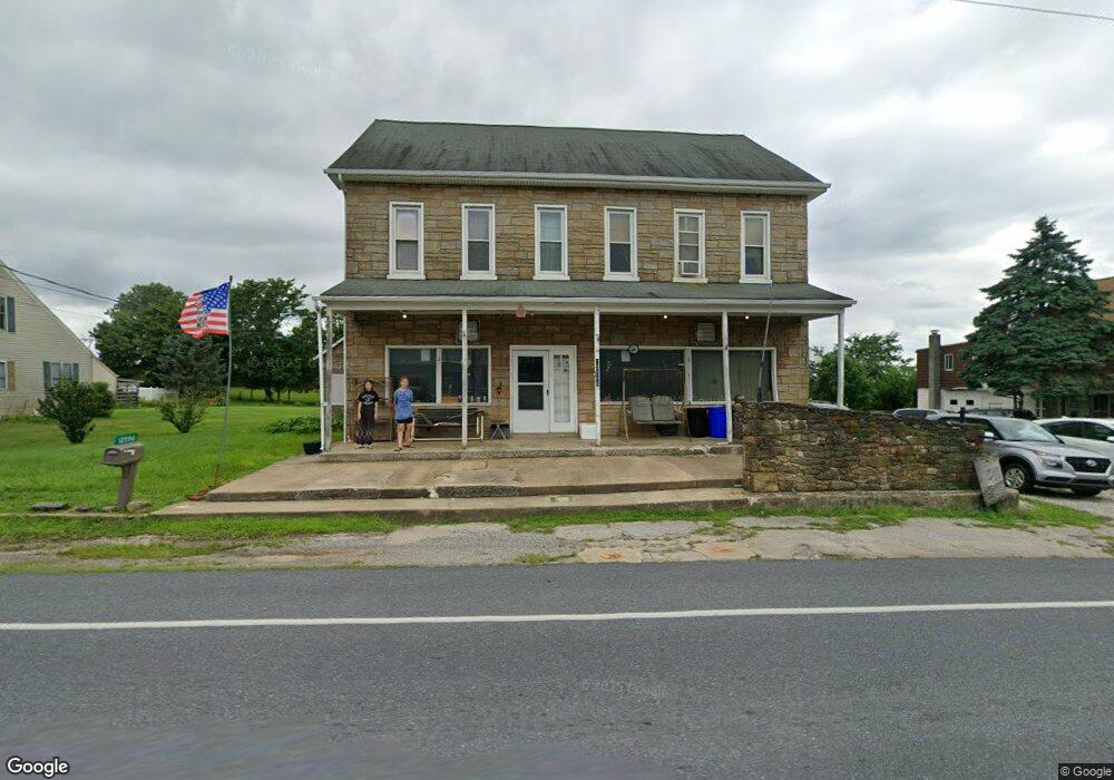
12596 Winterstown Rd Felton, PA 17322
Estimated Value: $215,270
2
Beds
3
Baths
3,576
Sq Ft
$60/Sq Ft
Est. Value
About This Home
This home is located at 12596 Winterstown Rd, Felton, PA 17322 and is currently estimated at $215,270, approximately $60 per square foot. 12596 Winterstown Rd is a home located in York County with nearby schools including North Hopewell-Winterstown Elementary School, Red Lion Area Junior High School, and Red Lion Area Senior High School.
Ownership History
Date
Name
Owned For
Owner Type
Purchase Details
Closed on
May 2, 2005
Sold by
Molinar Michael L and Molinar Nancy B
Bought by
Bowen Robert Lee
Current Estimated Value
Home Financials for this Owner
Home Financials are based on the most recent Mortgage that was taken out on this home.
Original Mortgage
$50,000
Interest Rate
6.01%
Mortgage Type
Fannie Mae Freddie Mac
Purchase Details
Closed on
Nov 8, 1995
Bought by
Molinar Michael L and Molinar John P
Create a Home Valuation Report for This Property
The Home Valuation Report is an in-depth analysis detailing your home's value as well as a comparison with similar homes in the area
Home Values in the Area
Average Home Value in this Area
Purchase History
| Date | Buyer | Sale Price | Title Company |
|---|---|---|---|
| Bowen Robert Lee | $115,000 | -- | |
| Molinar Michael L | $75,000 | -- |
Source: Public Records
Mortgage History
| Date | Status | Borrower | Loan Amount |
|---|---|---|---|
| Closed | Bowen Robert Lee | $50,000 |
Source: Public Records
Tax History Compared to Growth
Tax History
| Year | Tax Paid | Tax Assessment Tax Assessment Total Assessment is a certain percentage of the fair market value that is determined by local assessors to be the total taxable value of land and additions on the property. | Land | Improvement |
|---|---|---|---|---|
| 2025 | -- | $0 | $0 | $0 |
| 2024 | -- | $0 | $0 | $0 |
| 2023 | $4,405 | $0 | $0 | $0 |
| 2022 | $4,245 | $0 | $0 | $0 |
| 2021 | $4,260 | $0 | $0 | $0 |
| 2020 | $4,260 | $0 | $0 | $0 |
| 2019 | $4,245 | $0 | $0 | $0 |
| 2018 | $4,245 | $145,490 | $38,050 | $107,440 |
| 2017 | $4,245 | $145,490 | $38,050 | $107,440 |
| 2016 | $0 | $145,490 | $38,050 | $107,440 |
| 2015 | -- | $145,490 | $38,050 | $107,440 |
| 2014 | -- | $145,490 | $38,050 | $107,440 |
Source: Public Records
Map
Nearby Homes
- 0 Oak Ridge Ave
- 11983 Tree Ln
- 12706 High Point Rd
- 16434 Cross Roads Ave
- 13846 Ridge Rd
- 4389 Hess Rd
- 13859 Ebaugh Rd
- 1680 Wood Crest Ln
- 0 Seitz Rd
- 290 Neff Rd
- 786 Arbor Dr
- 0 Swamp Hollow Ln
- 8219 Lehman Rd
- 209 Forest Hills Rd
- 276 Oakbrook Dr
- 11201-11207 Susquehanna Trail S
- 1059 Main Street Extension
- 738 Wise Ave
- 175 Country Ridge Dr
- 171 Barclay Ln
- 12612 Winterstown Rd
- 12576 Winterstown Rd
- 12581 Winterstown Rd
- 12568 Winterstown Rd
- 12630 Winterstown Rd
- 12623 Winterstown Rd
- 12561 Winterstown Rd
- 12603 Winterstown Rd
- 12547 Winterstown Rd
- 12646 Winterstown Rd
- 12535 Winterstown Rd
- 12652 Winterstown Rd
- 12530 Winterstown Rd
- 12518 Winterstown Rd
- 12655 Winterstown Rd
- 12676 Winterstown Rd
- 4423 Apple St
- 12510 Winterstown Rd
- 12513 Winterstown Rd
- 12497 Winterstown Rd