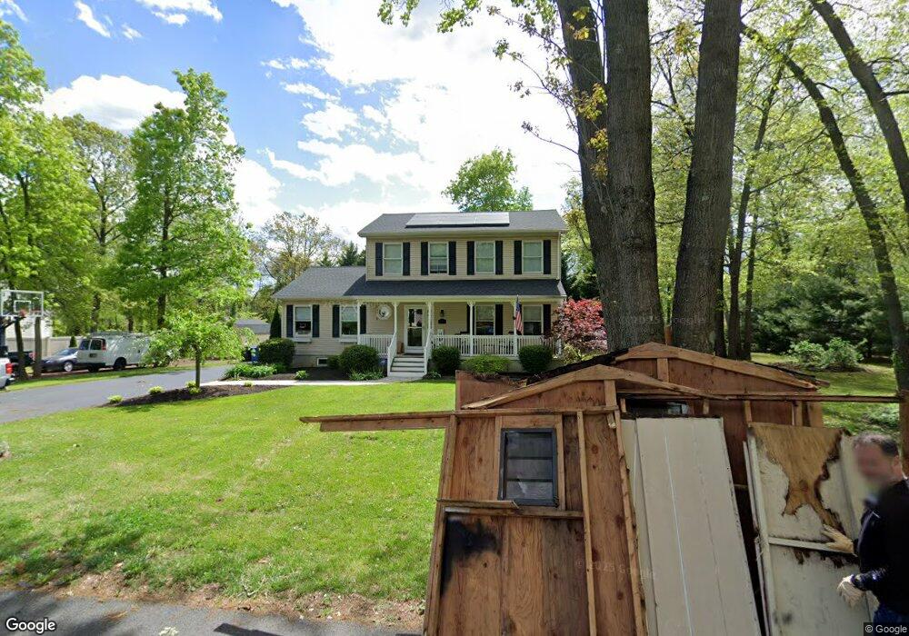
126 Adams Ave Mantua, NJ 08051
Mantua Township NeighborhoodEstimated Value: $344,000 - $490,000
--
Bed
--
Bath
2,072
Sq Ft
$206/Sq Ft
Est. Value
About This Home
This home is located at 126 Adams Ave, Mantua, NJ 08051 and is currently estimated at $426,198, approximately $205 per square foot. 126 Adams Ave is a home located in Gloucester County with nearby schools including Centre City School, Clearview Regional Middle School, and Clearview Regional High School.
Ownership History
Date
Name
Owned For
Owner Type
Purchase Details
Closed on
Nov 1, 1999
Sold by
J A R Investments Inc
Bought by
Deangelis Lauren
Current Estimated Value
Purchase Details
Closed on
Oct 1, 1999
Sold by
J A R Investments Inc
Bought by
J A R Investments Inc
Create a Home Valuation Report for This Property
The Home Valuation Report is an in-depth analysis detailing your home's value as well as a comparison with similar homes in the area
Home Values in the Area
Average Home Value in this Area
Purchase History
| Date | Buyer | Sale Price | Title Company |
|---|---|---|---|
| Deangelis Lauren | $30,000 | -- | |
| J A R Investments Inc | -- | Pilgrim Title Agency |
Source: Public Records
Tax History Compared to Growth
Tax History
| Year | Tax Paid | Tax Assessment Tax Assessment Total Assessment is a certain percentage of the fair market value that is determined by local assessors to be the total taxable value of land and additions on the property. | Land | Improvement |
|---|---|---|---|---|
| 2025 | $9,463 | $367,500 | $88,400 | $279,100 |
| 2024 | $9,364 | $367,500 | $88,400 | $279,100 |
| 2023 | $9,364 | $367,500 | $88,400 | $279,100 |
| 2022 | $8,423 | $240,800 | $68,700 | $172,100 |
| 2021 | $8,486 | $240,800 | $68,700 | $172,100 |
| 2020 | $8,418 | $240,800 | $68,700 | $172,100 |
| 2019 | $8,276 | $240,800 | $68,700 | $172,100 |
| 2018 | $8,158 | $240,800 | $68,700 | $172,100 |
| 2017 | $8,036 | $240,800 | $68,700 | $172,100 |
| 2016 | $7,944 | $240,800 | $68,700 | $172,100 |
| 2015 | $7,749 | $240,800 | $68,700 | $172,100 |
| 2014 | $7,489 | $240,800 | $68,700 | $172,100 |
Source: Public Records
Map
Nearby Homes
- 119 Monroe Ave
- 325 Bridgeton Pike
- 8 Barry Dr
- 1433 Tristram Cir
- 204 W Landing Rd
- 485 Harrison Ave
- 261 Tony Cir
- 1215 Tristram Cir
- 26 Woodstream Ct
- 1145 Tristram Cir
- 1147 Tristram Cir Unit 1147
- 1134 Tristram Cir Unit 4
- 36 Bluebird Rd
- 1121 Tristram Cir Unit 1
- 19 Marathon Dr
- 41 Woodbrook Dr Unit C041
- 190 Mockingbird Ln
- 205 Redbud Ln Unit 205
- 131 Firth Dr
- 590 Bridgeton Pike
- 132 Adams Ave
- 125 Adams Ave
- 209 Hampton Ave
- 131 Adams Ave
- 112 Adams Ave
- 119 Hampton Ave
- 111 Adams Ave
- 136 Adams Ave
- 211 Hampton Ave
- 124 Washington Ave
- 135 Adams Ave
- 207 Vermont Ave
- 130 Washington Ave
- 140 Adams Ave
- 109 Adams Ave
- 198 Vermont Ave
- 120 Washington Ave
- 134 Washington Ave
- 139 Adams Ave
- 210 Hampton Ave