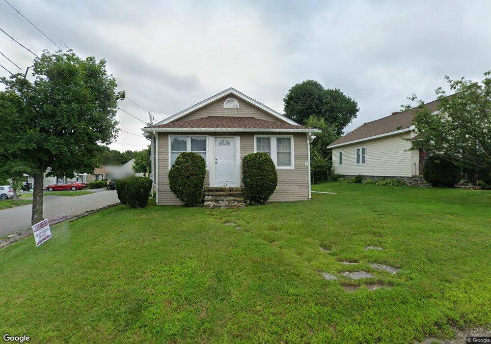
126 Clark St Worcester, MA 01606
Burncoat NeighborhoodEstimated Value: $339,000 - $369,000
2
Beds
2
Baths
1,033
Sq Ft
$346/Sq Ft
Est. Value
About This Home
This home is located at 126 Clark St, Worcester, MA 01606 and is currently estimated at $356,987, approximately $345 per square foot. 126 Clark St is a home located in Worcester County with nearby schools including Worcester Arts Magnet School, Jacob Hiatt Magnet School, and Chandler Magnet.
Create a Home Valuation Report for This Property
The Home Valuation Report is an in-depth analysis detailing your home's value as well as a comparison with similar homes in the area
Home Values in the Area
Average Home Value in this Area
Tax History
| Year | Tax Paid | Tax Assessment Tax Assessment Total Assessment is a certain percentage of the fair market value that is determined by local assessors to be the total taxable value of land and additions on the property. | Land | Improvement |
|---|---|---|---|---|
| 2025 | $3,912 | $296,600 | $103,500 | $193,100 |
| 2024 | $3,839 | $279,200 | $103,500 | $175,700 |
| 2023 | $3,698 | $257,900 | $90,000 | $167,900 |
| 2022 | $3,266 | $214,700 | $72,000 | $142,700 |
| 2021 | $3,129 | $192,200 | $57,600 | $134,600 |
| 2020 | $3,012 | $177,200 | $57,600 | $119,600 |
| 2019 | $2,828 | $157,100 | $51,800 | $105,300 |
| 2018 | $2,750 | $145,400 | $51,800 | $93,600 |
| 2017 | $2,773 | $144,300 | $51,800 | $92,500 |
| 2016 | $2,694 | $130,700 | $38,900 | $91,800 |
| 2015 | $2,623 | $130,700 | $38,900 | $91,800 |
| 2014 | $2,554 | $130,700 | $38,900 | $91,800 |
Source: Public Records
Map
Nearby Homes
- 55 Clark St
- 66 Eunice Ave
- 58 Osceola Ave
- 331 Burncoat St
- 323 Burncoat St
- 13 Fatima Ln
- 183 King Philip Rd
- 35 Arbutus Rd
- 30 Fales St
- 39 Whitmarsh Ave
- 30 Danielles Way
- 15 Ericsson St
- 45 Goldthwaite Rd
- 22 Huron Ave
- 53 Collins St
- 37 Kenwood Ave
- 30 Melrose St
- 655 Plantation St Unit 20B
- 44 Boardman St
- 9 Watt Rd
Your Personal Tour Guide
Ask me questions while you tour the home.