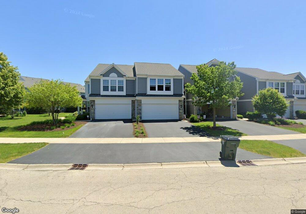
126 Devoe Dr Unit 484 Oswego, IL 60543
North Oswego NeighborhoodEstimated Value: $273,000 - $406,572
2
Beds
3
Baths
1,370
Sq Ft
$233/Sq Ft
Est. Value
About This Home
This home is located at 126 Devoe Dr Unit 484, Oswego, IL 60543 and is currently estimated at $318,893, approximately $232 per square foot. 126 Devoe Dr Unit 484 is a home located in Kendall County with nearby schools including Southbury Elementary School, Murphy Junior High School, and Oswego East High School.
Ownership History
Date
Name
Owned For
Owner Type
Purchase Details
Closed on
Aug 17, 2019
Sold by
Murray Richard R and Murray Sharla J
Bought by
Foust Kalena B
Current Estimated Value
Home Financials for this Owner
Home Financials are based on the most recent Mortgage that was taken out on this home.
Original Mortgage
$179,685
Outstanding Balance
$156,717
Interest Rate
3.5%
Mortgage Type
FHA
Estimated Equity
$162,176
Purchase Details
Closed on
Mar 29, 2007
Sold by
Pulte Home Corp
Bought by
Murray Richard R and Murray Sharla J
Home Financials for this Owner
Home Financials are based on the most recent Mortgage that was taken out on this home.
Original Mortgage
$39,288
Interest Rate
6.25%
Mortgage Type
Credit Line Revolving
Create a Home Valuation Report for This Property
The Home Valuation Report is an in-depth analysis detailing your home's value as well as a comparison with similar homes in the area
Home Values in the Area
Average Home Value in this Area
Purchase History
| Date | Buyer | Sale Price | Title Company |
|---|---|---|---|
| Foust Kalena B | $183,000 | Attorney | |
| Murray Richard R | $196,500 | None Available |
Source: Public Records
Mortgage History
| Date | Status | Borrower | Loan Amount |
|---|---|---|---|
| Open | Foust Kalena B | $179,685 | |
| Previous Owner | Murray Richard R | $39,288 |
Source: Public Records
Tax History
| Year | Tax Paid | Tax Assessment Tax Assessment Total Assessment is a certain percentage of the fair market value that is determined by local assessors to be the total taxable value of land and additions on the property. | Land | Improvement |
|---|---|---|---|---|
| 2024 | $5,776 | $77,777 | $16,496 | $61,281 |
| 2023 | $5,160 | $68,829 | $14,598 | $54,231 |
| 2022 | $5,160 | $63,146 | $13,393 | $49,753 |
| 2021 | $5,231 | $61,907 | $13,130 | $48,777 |
| 2020 | $5,225 | $61,294 | $13,000 | $48,294 |
| 2019 | $5,308 | $61,294 | $13,000 | $48,294 |
| 2018 | $5,206 | $59,793 | $9,456 | $50,337 |
| 2017 | $5,034 | $55,109 | $8,715 | $46,394 |
| 2016 | $4,683 | $51,026 | $8,069 | $42,957 |
| 2015 | $4,406 | $46,387 | $7,335 | $39,052 |
| 2014 | -- | $44,603 | $7,053 | $37,550 |
| 2013 | -- | $46,950 | $7,424 | $39,526 |
Source: Public Records
Map
Nearby Homes
- 464 Valentine Way
- 460 Valentine Way
- 608 Hawley Dr Unit 4342
- 240 Devoe Dr
- 314 Parker Place
- 605 Murdock Place
- 241 Cooney Way
- 601 Murdock Place
- 234 Cooney Way
- 602 Murdock Place
- 339 Danforth Dr
- 3017 Lundquist Dr
- 115 Henderson St
- 379 Danforth Dr
- 377 Danforth Dr
- 375 Danforth Dr
- 385 Danforth Dr
- 387 Danforth Dr
- 240 Cooney Way
- 242 Cooney Way
- 130 Devoe Dr Unit 4482
- 126 Devoe Dr Unit 4484
- 128 Devoe Dr Unit 448
- 124 Devoe Dr Unit 4485
- 130 Devoe Dr
- 128 Devoe Dr Unit 3
- 124 Devoe Dr Unit 4531
- 132 Devoe Dr Unit 4481
- 507 Valentine Way Unit 4494
- 509 Valentine Way Unit 495
- 505 Valentine Way Unit 4493
- 503 Valentine Way Unit 4492
- 511 Valentine Way Unit 4496
- 501 Valentine Way Unit 4491
- 112 Devoe Dr Unit 4471
- 112 Devoe Dr Unit 471
- 118 Devoe Dr Unit 4474
- 116 Devoe Dr Unit 4473
- 116 Devoe Dr Unit 473
- 120 Devoe Dr Unit 4475
Your Personal Tour Guide
Ask me questions while you tour the home.