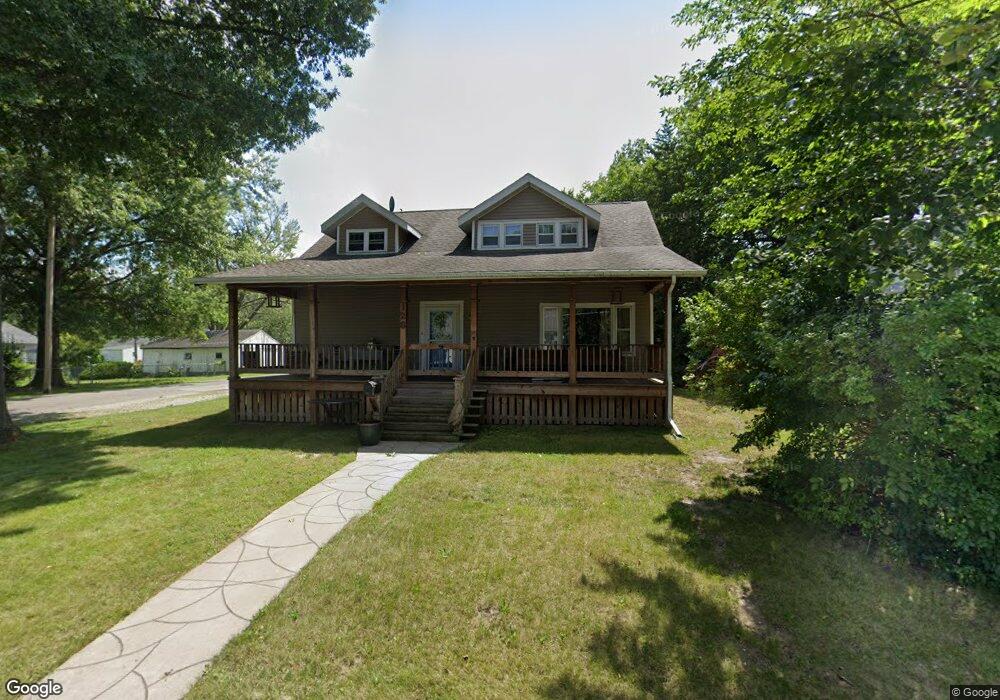
126 E Manning Ave Ottumwa, IA 52501
Estimated Value: $191,000 - $222,000
4
Beds
6
Baths
2,081
Sq Ft
$100/Sq Ft
Est. Value
About This Home
This home is located at 126 E Manning Ave, Ottumwa, IA 52501 and is currently estimated at $208,172, approximately $100 per square foot. 126 E Manning Ave is a home located in Wapello County with nearby schools including Horace Mann Elementary School, Evans Middle School, and Ottumwa High School.
Ownership History
Date
Name
Owned For
Owner Type
Purchase Details
Closed on
Jun 28, 2006
Sold by
Koettel Sonja
Bought by
Perry Scott W and Stam Stephanie L
Current Estimated Value
Home Financials for this Owner
Home Financials are based on the most recent Mortgage that was taken out on this home.
Original Mortgage
$79,000
Outstanding Balance
$46,860
Interest Rate
6.73%
Mortgage Type
New Conventional
Estimated Equity
$161,312
Create a Home Valuation Report for This Property
The Home Valuation Report is an in-depth analysis detailing your home's value as well as a comparison with similar homes in the area
Home Values in the Area
Average Home Value in this Area
Purchase History
| Date | Buyer | Sale Price | Title Company |
|---|---|---|---|
| Perry Scott W | $79,000 | None Available |
Source: Public Records
Mortgage History
| Date | Status | Borrower | Loan Amount |
|---|---|---|---|
| Open | Perry Scott W | $79,000 |
Source: Public Records
Tax History Compared to Growth
Tax History
| Year | Tax Paid | Tax Assessment Tax Assessment Total Assessment is a certain percentage of the fair market value that is determined by local assessors to be the total taxable value of land and additions on the property. | Land | Improvement |
|---|---|---|---|---|
| 2025 | $4,546 | $237,130 | $7,840 | $229,290 |
| 2024 | $4,546 | $219,890 | $7,840 | $212,050 |
| 2023 | $3,388 | $199,770 | $7,840 | $191,930 |
| 2022 | $3,380 | $150,710 | $7,840 | $142,870 |
| 2021 | $3,593 | $140,200 | $7,840 | $132,360 |
| 2020 | $2,904 | $121,780 | $7,840 | $113,940 |
| 2019 | $2,974 | $121,780 | $0 | $0 |
| 2018 | $2,882 | $121,780 | $0 | $0 |
| 2017 | $2,944 | $121,780 | $0 | $0 |
| 2016 | $1,514 | $69,296 | $0 | $0 |
| 2015 | $1,516 | $69,296 | $0 | $0 |
| 2014 | $1,516 | $71,910 | $0 | $0 |
Source: Public Records
Map
Nearby Homes
- 203 E Golf Ave
- 260 Grandview Ave
- 2009 N Jefferson St
- 409 Grandview Ave
- 31 Weaver Dr
- 418 Carter Ave
- 2 Woodshire Dr
- 101 W Alta Vista Ave
- 160 E Alta Vista Ave
- 6 Country Club Place
- 427 Elmdale Ave
- 444 Crestview Ave
- 1621 N Elm St
- 1412 Prairie Ave
- 000 Iowa 149
- 14 Raynan Dr
- 2540 Kenwood St
- 2604 Meadowdale St
- 622 E Alta Vista Ave
- 1309 Castle St
- 122 E Manning Ave
- 202 E Manning Ave
- 110 E Manning Ave
- 111 E Golf Ave
- 127 E Manning Ave
- 214 E Manning Ave
- 107 E Golf Ave
- 201 E Manning Ave
- 209 E Manning Ave
- 201 E Golf Ave
- 103 E Golf Ave
- 111 E Manning Ave
- 213 E Manning Ave
- 1910 N Court St
- 1908 N Court St
- 223 E Manning Ave
- 1906 N Court St
- 220 E Manning Ave
- 101 E Golf Ave
- 1904 N Court St