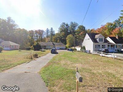
126 Long Ln Bristol, CT 06010
North Bristol NeighborhoodEstimated Value: $436,284 - $463,000
3
Beds
3
Baths
2,005
Sq Ft
$223/Sq Ft
Est. Value
About This Home
This home is located at 126 Long Ln, Bristol, CT 06010 and is currently estimated at $447,761, approximately $223 per square foot. 126 Long Ln is a home located in Hartford County with nearby schools including Edgewood School, Chippens Hill Middle School, and Bristol Eastern High School.
Ownership History
Date
Name
Owned For
Owner Type
Purchase Details
Closed on
Jul 1, 1998
Sold by
Brown Paul E and Brown Judith M
Bought by
Seamour Jon A and Seamour Denise M
Current Estimated Value
Purchase Details
Closed on
Dec 1, 1989
Sold by
Knight George F
Bought by
Brown Paul E
Create a Home Valuation Report for This Property
The Home Valuation Report is an in-depth analysis detailing your home's value as well as a comparison with similar homes in the area
Home Values in the Area
Average Home Value in this Area
Purchase History
| Date | Buyer | Sale Price | Title Company |
|---|---|---|---|
| Seamour Jon A | $185,000 | -- | |
| Brown Paul E | $208,000 | -- |
Source: Public Records
Mortgage History
| Date | Status | Borrower | Loan Amount |
|---|---|---|---|
| Closed | Brown Paul E | $158,368 | |
| Closed | Brown Paul E | $192,000 | |
| Closed | Brown Paul E | $24,000 | |
| Closed | Brown Paul E | $165,000 |
Source: Public Records
Tax History Compared to Growth
Tax History
| Year | Tax Paid | Tax Assessment Tax Assessment Total Assessment is a certain percentage of the fair market value that is determined by local assessors to be the total taxable value of land and additions on the property. | Land | Improvement |
|---|---|---|---|---|
| 2024 | $7,315 | $229,670 | $46,340 | $183,330 |
| 2023 | $6,970 | $229,670 | $46,340 | $183,330 |
| 2022 | $6,360 | $165,830 | $38,640 | $127,190 |
| 2021 | $6,360 | $165,830 | $38,640 | $127,190 |
| 2020 | $6,360 | $165,830 | $38,640 | $127,190 |
| 2019 | $6,310 | $165,830 | $38,640 | $127,190 |
| 2018 | $6,116 | $165,830 | $38,640 | $127,190 |
| 2017 | $5,715 | $158,620 | $48,300 | $110,320 |
| 2016 | $5,715 | $158,620 | $48,300 | $110,320 |
| 2015 | $5,490 | $158,620 | $48,300 | $110,320 |
| 2014 | $5,490 | $158,620 | $48,300 | $110,320 |
Source: Public Records
Map
Nearby Homes
- 253 Sperry Rd
- 72 Nutmeg Rd
- 30 Boy St
- 671 Fern Hill Rd
- 100 Orleans Dr
- 607 Burlington Ave
- 108 Fox Den Rd
- 111 Boy St
- 0 Oakwood Cir
- 27 Partridge Run
- 126 Glendale Dr
- 160 Boy St
- Lot 71 Fern Hill Rd
- 285 Glendale Dr
- 0 Hart St Unit 170255530
- 35 Hart St
- 130 Wildewood Run
- 306 Hart St
- 816 Jerome Ave
- 96 Berkshire Dr