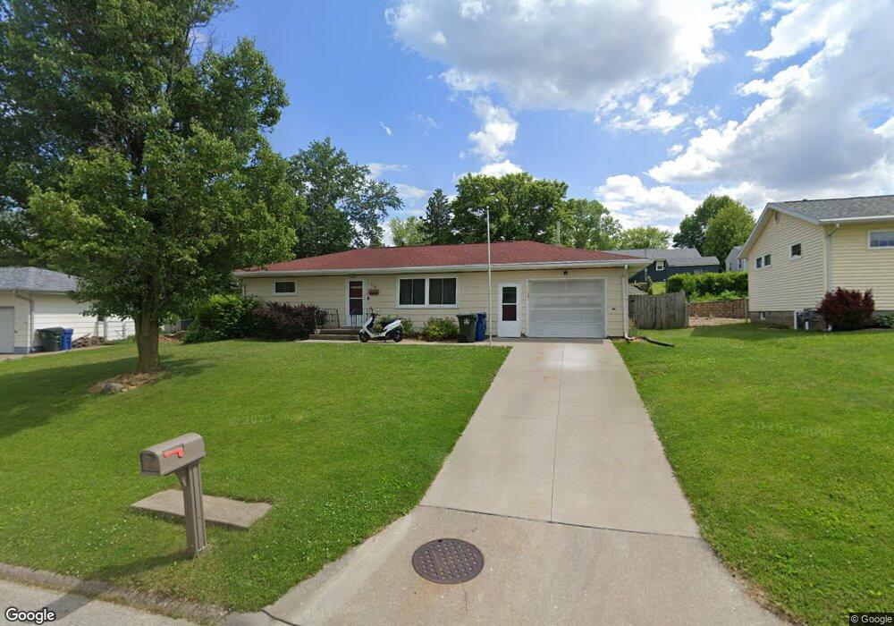
126 Middle Rd Muscatine, IA 52761
Estimated Value: $183,000 - $222,649
2
Beds
2
Baths
988
Sq Ft
$211/Sq Ft
Est. Value
About This Home
This home is located at 126 Middle Rd, Muscatine, IA 52761 and is currently estimated at $208,412, approximately $210 per square foot. 126 Middle Rd is a home located in Muscatine County with nearby schools including Grant Elementary School, Central Middle School, and Susan Clark Junior High School.
Ownership History
Date
Name
Owned For
Owner Type
Purchase Details
Closed on
Nov 18, 2011
Sold by
Miller Ronald D and Miller Lisa
Bought by
Schrock Nathan M and Chambers Maggie E
Current Estimated Value
Home Financials for this Owner
Home Financials are based on the most recent Mortgage that was taken out on this home.
Original Mortgage
$109,160
Outstanding Balance
$74,257
Interest Rate
3.97%
Mortgage Type
FHA
Estimated Equity
$134,155
Create a Home Valuation Report for This Property
The Home Valuation Report is an in-depth analysis detailing your home's value as well as a comparison with similar homes in the area
Home Values in the Area
Average Home Value in this Area
Purchase History
| Date | Buyer | Sale Price | Title Company |
|---|---|---|---|
| Schrock Nathan M | $112,000 | None Available |
Source: Public Records
Mortgage History
| Date | Status | Borrower | Loan Amount |
|---|---|---|---|
| Open | Schrock Nathan M | $109,160 |
Source: Public Records
Tax History Compared to Growth
Tax History
| Year | Tax Paid | Tax Assessment Tax Assessment Total Assessment is a certain percentage of the fair market value that is determined by local assessors to be the total taxable value of land and additions on the property. | Land | Improvement |
|---|---|---|---|---|
| 2025 | $3,040 | $176,990 | $40,390 | $136,600 |
| 2024 | $3,040 | $177,930 | $40,390 | $137,540 |
| 2023 | $2,630 | $161,523 | $40,450 | $121,073 |
| 2022 | $2,370 | $138,950 | $38,160 | $100,790 |
| 2021 | $2,370 | $125,140 | $38,160 | $86,980 |
| 2020 | $2,310 | $124,220 | $38,160 | $86,060 |
| 2019 | $2,370 | $115,800 | $0 | $0 |
| 2018 | $2,278 | $113,290 | $0 | $0 |
| 2017 | $2,278 | $113,290 | $0 | $0 |
| 2016 | $2,364 | $113,290 | $0 | $0 |
| 2015 | $2,364 | $112,730 | $0 | $0 |
| 2014 | $2,368 | $112,730 | $0 | $0 |
Source: Public Records
Map
Nearby Homes
- 108 Middle Rd
- 2126 Bidwell Rd
- 1251 Vista Ct
- 709 Leroy St
- 2020 Bidwell Rd
- 3 Wilson Dr
- 205 Amherst Ave
- 2120 Fareway Dr
- 606 Leroy St
- 35 Colony Dr
- 297 Burnside Ave
- 898 Leroy St
- 1807 Mulberry Ave
- 2618 Anna Elizabeth
- 2623 Anna Elizabeth
- 2612 Anna Elizabeth
- 310 Wood Creek Ln
- 2610 Anna Elizabeth
- 2617 Anna Elizabeth
- 2613 Anna Elizabeth