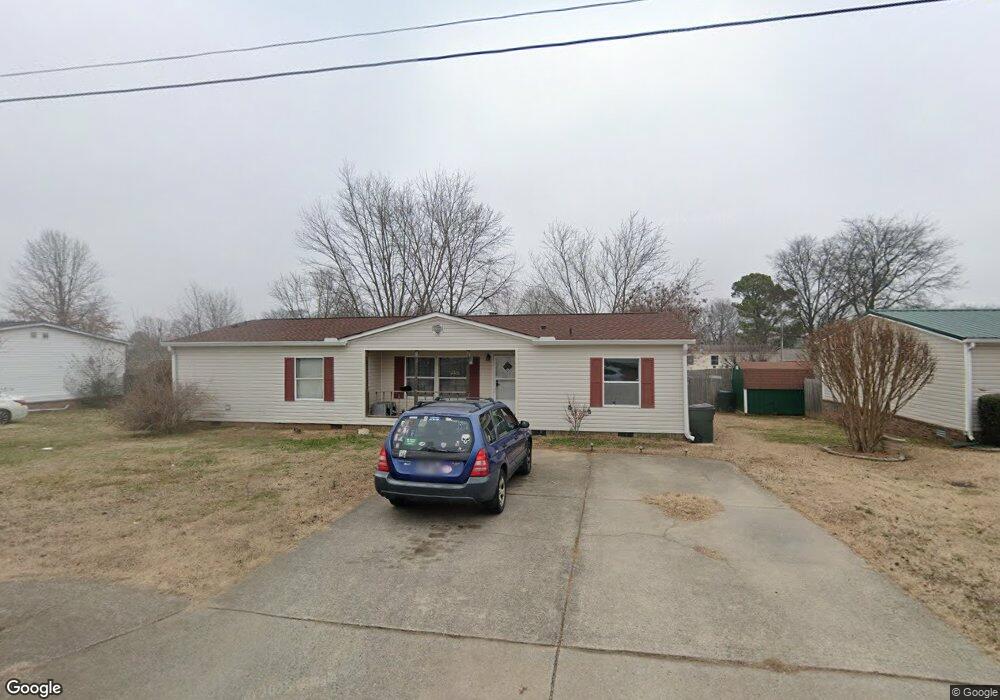
126 Shawn Dr Gallatin, TN 37066
Estimated Value: $246,000 - $287,000
--
Bed
2
Baths
1,448
Sq Ft
$186/Sq Ft
Est. Value
About This Home
This home is located at 126 Shawn Dr, Gallatin, TN 37066 and is currently estimated at $269,599, approximately $186 per square foot. 126 Shawn Dr is a home located in Sumner County with nearby schools including Vena Stuart Elementary School, Rucker Stewart Middle School, and Gallatin Senior High School.
Ownership History
Date
Name
Owned For
Owner Type
Purchase Details
Closed on
May 15, 2008
Sold by
Reynolds Dwayne K and Janeen Reynolds A
Bought by
Smith Kevin M
Current Estimated Value
Home Financials for this Owner
Home Financials are based on the most recent Mortgage that was taken out on this home.
Original Mortgage
$72,758
Outstanding Balance
$46,029
Interest Rate
5.86%
Mortgage Type
FHA
Estimated Equity
$223,570
Purchase Details
Closed on
Jan 9, 2007
Sold by
Webb Michael J and Webb Jennifer M
Bought by
Hud
Purchase Details
Closed on
Feb 28, 2001
Sold by
Southern Energy Homes
Bought by
Webb Michael J
Home Financials for this Owner
Home Financials are based on the most recent Mortgage that was taken out on this home.
Original Mortgage
$85,325
Interest Rate
7.06%
Mortgage Type
FHA
Create a Home Valuation Report for This Property
The Home Valuation Report is an in-depth analysis detailing your home's value as well as a comparison with similar homes in the area
Home Values in the Area
Average Home Value in this Area
Purchase History
| Date | Buyer | Sale Price | Title Company |
|---|---|---|---|
| Smith Kevin M | $73,900 | Benchmark Title Company | |
| Hud | $88,842 | None Available | |
| Webb Michael J | $86,000 | Professional Title & Escrow |
Source: Public Records
Mortgage History
| Date | Status | Borrower | Loan Amount |
|---|---|---|---|
| Open | Smith Kevin M | $72,758 | |
| Previous Owner | Webb Michael J | $85,325 |
Source: Public Records
Tax History Compared to Growth
Tax History
| Year | Tax Paid | Tax Assessment Tax Assessment Total Assessment is a certain percentage of the fair market value that is determined by local assessors to be the total taxable value of land and additions on the property. | Land | Improvement |
|---|---|---|---|---|
| 2024 | $818 | $57,575 | $20,000 | $37,575 |
| 2023 | $1,043 | $34,175 | $14,225 | $19,950 |
| 2022 | $1,046 | $34,175 | $14,225 | $19,950 |
| 2021 | $1,046 | $34,175 | $14,225 | $19,950 |
| 2020 | $1,046 | $34,175 | $14,225 | $19,950 |
| 2019 | $1,046 | $0 | $0 | $0 |
| 2018 | $740 | $0 | $0 | $0 |
| 2017 | $740 | $0 | $0 | $0 |
| 2016 | $530 | $0 | $0 | $0 |
| 2015 | $740 | $0 | $0 | $0 |
| 2014 | $684 | $0 | $0 | $0 |
Source: Public Records
Map
Nearby Homes
- 184 Primrose Ln
- 155 Hale Ave
- 1208 Langwood Dr
- 113 Primrose Ln
- 1008 Bales St
- 119 Coles Ferry Rd
- 227 Hale Ave
- 1190 Bothwell Place
- Roxbury Plan at Windsong - Townhomes
- Caroline Plan at Windsong - Townhomes
- Rosecliff Plan at Windsong - Townhomes
- 124 Glenn Ave
- 126 Glenn Ave
- 185 Stanley Dr
- 1019 Westgate Dr
- 211 Juanita Ave
- 1340 Crescent Ridge Dr
- 1176 Savannah Ave
- 108 Ripplemead Ct
- 1172 Savannah Ave