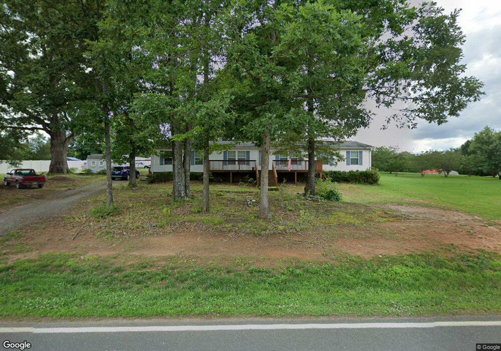
126 Weathers Creek Rd Troutman, NC 28166
Estimated Value: $295,000 - $468,000
3
Beds
3
Baths
2,632
Sq Ft
$145/Sq Ft
Est. Value
About This Home
This home is located at 126 Weathers Creek Rd, Troutman, NC 28166 and is currently estimated at $382,814, approximately $145 per square foot. 126 Weathers Creek Rd is a home with nearby schools including Shepherd Elementary School, Troutman Middle School, and South Iredell High School.
Ownership History
Date
Name
Owned For
Owner Type
Purchase Details
Closed on
Jun 21, 2002
Sold by
Rivera Kimberly C and Rivera Garvin A
Bought by
Labarge Gilbert G and Labarge Sharon L
Current Estimated Value
Home Financials for this Owner
Home Financials are based on the most recent Mortgage that was taken out on this home.
Original Mortgage
$137,500
Outstanding Balance
$57,974
Interest Rate
6.77%
Mortgage Type
Construction
Estimated Equity
$324,840
Create a Home Valuation Report for This Property
The Home Valuation Report is an in-depth analysis detailing your home's value as well as a comparison with similar homes in the area
Home Values in the Area
Average Home Value in this Area
Purchase History
| Date | Buyer | Sale Price | Title Company |
|---|---|---|---|
| Labarge Gilbert G | $27,500 | -- |
Source: Public Records
Mortgage History
| Date | Status | Borrower | Loan Amount |
|---|---|---|---|
| Open | Labarge Gilbert G | $137,500 |
Source: Public Records
Tax History Compared to Growth
Tax History
| Year | Tax Paid | Tax Assessment Tax Assessment Total Assessment is a certain percentage of the fair market value that is determined by local assessors to be the total taxable value of land and additions on the property. | Land | Improvement |
|---|---|---|---|---|
| 2024 | $1,471 | $239,140 | $28,880 | $210,260 |
| 2023 | $1,471 | $239,140 | $28,880 | $210,260 |
| 2022 | $1,002 | $150,060 | $10,000 | $140,060 |
| 2021 | $998 | $150,060 | $10,000 | $140,060 |
| 2020 | $998 | $150,060 | $10,000 | $140,060 |
| 2019 | $983 | $150,060 | $10,000 | $140,060 |
| 2018 | $941 | $148,780 | $20,000 | $128,780 |
| 2017 | $941 | $148,780 | $20,000 | $128,780 |
| 2016 | $941 | $148,780 | $20,000 | $128,780 |
| 2015 | $941 | $148,780 | $20,000 | $128,780 |
| 2014 | $911 | $154,700 | $20,000 | $134,700 |
Source: Public Records
Map
Nearby Homes
- Wagner Plan at Wheatfield Estates
- Declan Plan at Wheatfield Estates
- Huntley Plan at Wheatfield Estates
- Riley Plan at Wheatfield Estates
- Lenox Plan at Wheatfield Estates
- Herald Plan at Wheatfield Estates
- Vale Plan at Wheatfield Estates
- Jasper Plan at Wheatfield Estates
- Wakefield Plan at Wheatfield Estates
- Charlotte Plan at Wheatfield Estates
- Kipling Plan at Wheatfield Estates
- Bayside Plan at Wheatfield Estates
- Inverness Plan at Wheatfield Estates
- Tate Plan at Wheatfield Estates
- Winslow Plan at Wheatfield Estates
- TA4000 Plan at Wheatfield Estates
- Gideon Plan at Wheatfield Estates
- Montcrest Plan at Wheatfield Estates
- Wayne Plan at Wheatfield Estates
- Whitney Plan at Wheatfield Estates
- 111 Trae Ct
- 134 Weathers Creek Rd
- 129 Weathers Creek Rd
- 115 Trae Ct
- 123 Weathers Creek Rd
- 135 Weathers Creek Rd
- 68 Weathers Creek Rd
- 110 Weathers Creek Rd
- 112 Trae Ct
- 140 Weathers Creek Rd
- 115 Weathers Creek Rd Unit 2
- 115 Weathers Creek Rd
- 114 Treetop Ln
- Lot#2 Weathers Creek Rd Unit Lot2
- Lot#1 Weathers Creek Rd Unit Lot1
- 107 Weathers Creek Rd Unit 1
- 107 Weathers Creek Rd
- 108 Treetop Ln
- Lot#37 Fallen Acorn Dr
- Lot#41 Fallen Acorn Dr Unit Lot41