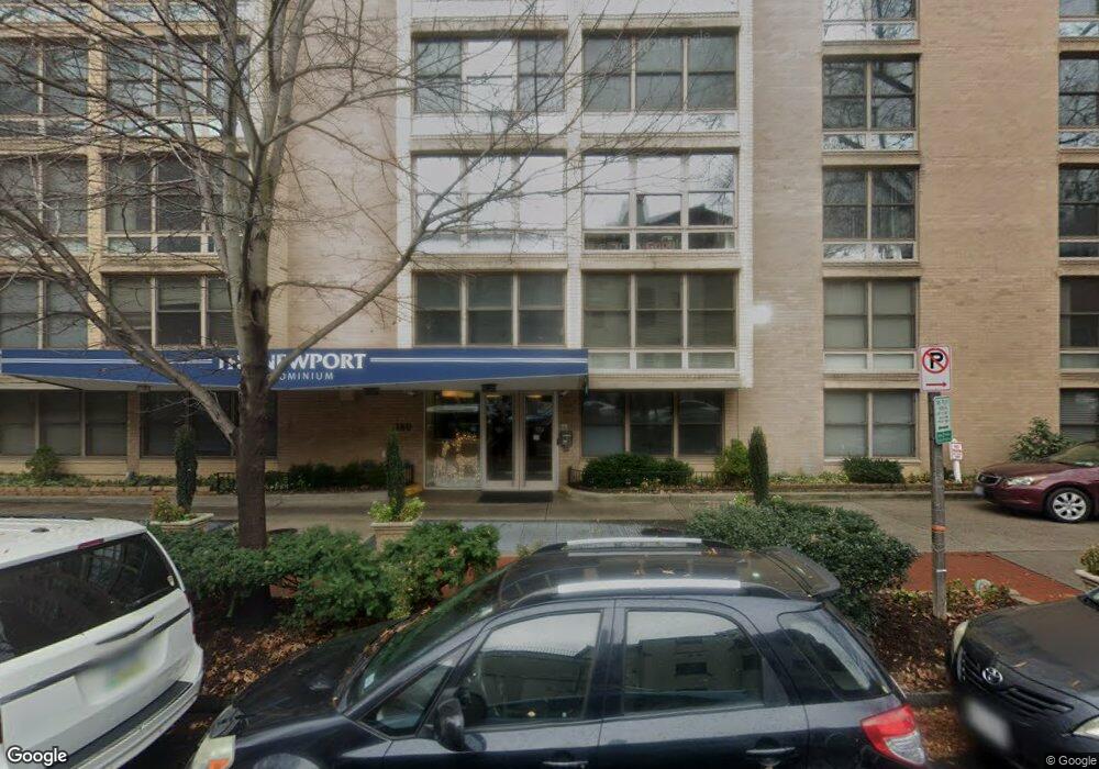
The Newport 1260 21st St NW Unit 101 Washington, DC 20036
Dupont Circle NeighborhoodEstimated Value: $430,000 - $527,000
2
Beds
2
Baths
863
Sq Ft
$536/Sq Ft
Est. Value
About This Home
This home is located at 1260 21st St NW Unit 101, Washington, DC 20036 and is currently estimated at $462,571, approximately $536 per square foot. 1260 21st St NW Unit 101 is a home located in District of Columbia with nearby schools including School Without Walls @ Francis-Stevens, Cardozo Education Campus, and Old Colony Montessori School.
Ownership History
Date
Name
Owned For
Owner Type
Purchase Details
Closed on
Oct 30, 2014
Sold by
Raymond Michael O
Bought by
Amorosa Doreen M
Current Estimated Value
Home Financials for this Owner
Home Financials are based on the most recent Mortgage that was taken out on this home.
Original Mortgage
$375,000
Outstanding Balance
$287,828
Interest Rate
4.21%
Mortgage Type
New Conventional
Estimated Equity
$174,743
Purchase Details
Closed on
Aug 24, 2007
Sold by
Wilson Steven
Bought by
Raymond Michael
Create a Home Valuation Report for This Property
The Home Valuation Report is an in-depth analysis detailing your home's value as well as a comparison with similar homes in the area
Home Values in the Area
Average Home Value in this Area
Purchase History
| Date | Buyer | Sale Price | Title Company |
|---|---|---|---|
| Amorosa Doreen M | $425,000 | -- | |
| Raymond Michael | $385,000 | -- |
Source: Public Records
Mortgage History
| Date | Status | Borrower | Loan Amount |
|---|---|---|---|
| Open | Amorosa Doreen M | $375,000 |
Source: Public Records
Tax History Compared to Growth
Tax History
| Year | Tax Paid | Tax Assessment Tax Assessment Total Assessment is a certain percentage of the fair market value that is determined by local assessors to be the total taxable value of land and additions on the property. | Land | Improvement |
|---|---|---|---|---|
| 2025 | $3,386 | $414,050 | $124,210 | $289,840 |
| 2024 | $3,335 | $407,520 | $122,260 | $285,260 |
| 2023 | $3,457 | $421,370 | $126,410 | $294,960 |
| 2022 | $3,584 | $435,410 | $130,620 | $304,790 |
| 2021 | $3,614 | $438,470 | $131,540 | $306,930 |
| 2020 | $3,723 | $438,010 | $131,400 | $306,610 |
| 2019 | $298 | $428,740 | $128,620 | $300,120 |
| 2018 | $3,645 | $428,880 | $0 | $0 |
| 2017 | $3,705 | $435,870 | $0 | $0 |
| 2016 | $3,540 | $416,490 | $0 | $0 |
| 2015 | $3,445 | $405,250 | $0 | $0 |
| 2014 | -- | $373,060 | $0 | $0 |
Source: Public Records
About The Newport
Map
Nearby Homes
- 1280 21st St NW Unit 109
- 1280 21st St NW Unit 506
- 1260 21st St NW Unit 107
- 1260 21st St NW Unit 1004
- 1260 21st St NW Unit 108
- 1260 21st St NW Unit 709
- 1260 21st St NW Unit 306
- 1260 21st St NW Unit 207
- 2114 N St NW Unit 32
- 2122 N St NW Unit 1
- 2119 N St NW Unit 6
- 2130 N St NW Unit 509
- 2130 N St NW Unit 407
- 2145 N St NW Unit 3
- 1316 New Hampshire Ave NW Unit 503
- 2143 Newport Place NW
- 1330 New Hampshire Ave NW Unit 612
- 1330 New Hampshire Ave NW Unit 215
- 2012 O St NW Unit 12
- 1318 22nd St NW Unit 101
- 1260 21st St NW Unit Newport Apartment
- 1260 21st St NW Unit 411
- 1260 21st St NW Unit 609
- 1260 21st St NW Unit 201
- 1260 21st St NW Unit 105
- 1260 21st St NW Unit 607
- 1260 21st St NW Unit 915
- 1260 21st St NW Unit 209
- 1260 21st St NW Unit 600
- 1260 21st St NW Unit 302
- 1260 21st St NW Unit 311
- 1260 21st St NW Unit 404
- 1260 21st St NW Unit 1008
- 1260 21st St NW Unit 410
- 1260 21st St NW Unit 304
- 1260 21st St NW Unit 502
- 1260 21st St NW Unit 200
- 1260 21st St NW Unit 510
- 1260 21st St NW Unit 610
- 1260 21st St NW Unit 909