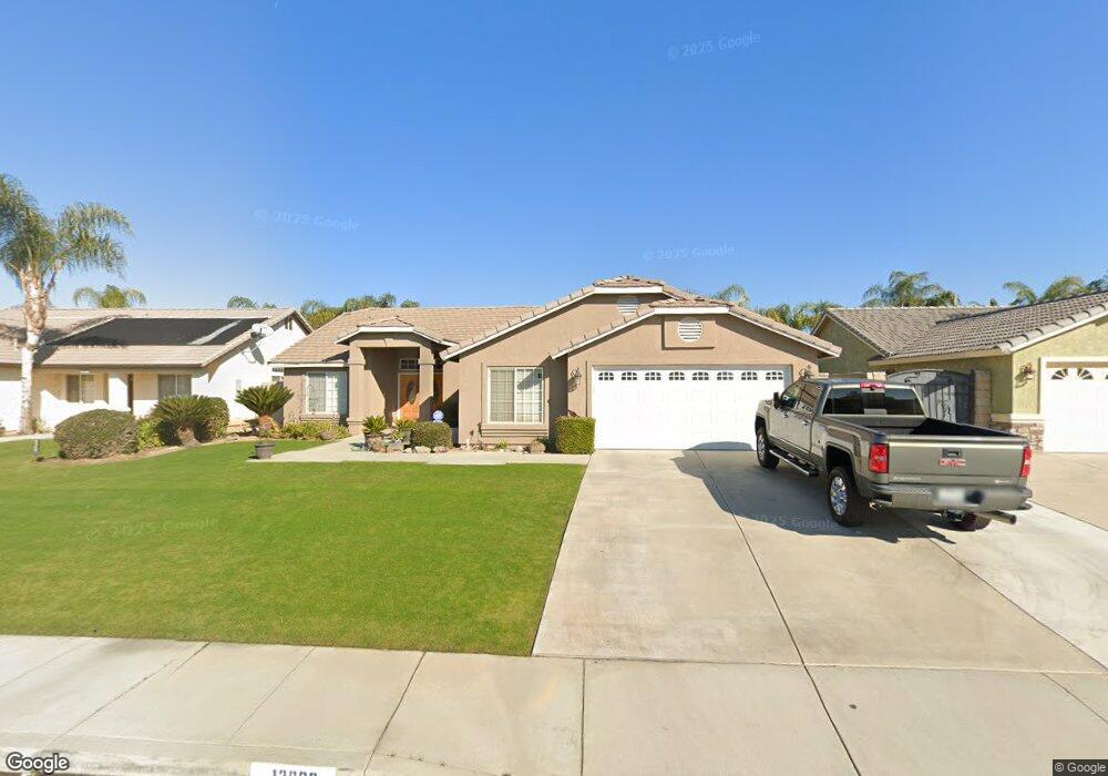
12600 Andes Ave Bakersfield, CA 93312
Emerald Estates NeighborhoodEstimated Value: $395,671 - $423,000
3
Beds
2
Baths
1,774
Sq Ft
$234/Sq Ft
Est. Value
About This Home
This home is located at 12600 Andes Ave, Bakersfield, CA 93312 and is currently estimated at $414,418, approximately $233 per square foot. 12600 Andes Ave is a home located in Kern County with nearby schools including Patriot Elementary School, Freedom Middle School, and Frontier High School.
Ownership History
Date
Name
Owned For
Owner Type
Purchase Details
Closed on
Apr 12, 1999
Sold by
Mahan Robert D
Bought by
Phillips Richard A and Phillips Julie A
Current Estimated Value
Home Financials for this Owner
Home Financials are based on the most recent Mortgage that was taken out on this home.
Original Mortgage
$130,789
Interest Rate
7.2%
Mortgage Type
FHA
Purchase Details
Closed on
Apr 8, 1999
Sold by
Normal Development Corp Retirement Trust
Bought by
Mahan Robert D
Home Financials for this Owner
Home Financials are based on the most recent Mortgage that was taken out on this home.
Original Mortgage
$130,789
Interest Rate
7.2%
Mortgage Type
FHA
Create a Home Valuation Report for This Property
The Home Valuation Report is an in-depth analysis detailing your home's value as well as a comparison with similar homes in the area
Home Values in the Area
Average Home Value in this Area
Purchase History
| Date | Buyer | Sale Price | Title Company |
|---|---|---|---|
| Phillips Richard A | $131,000 | Stewart Title | |
| Mahan Robert D | $21,000 | Stewart Title |
Source: Public Records
Mortgage History
| Date | Status | Borrower | Loan Amount |
|---|---|---|---|
| Previous Owner | Phillips Richard A | $130,789 | |
| Previous Owner | Mahan Robert D | $98,120 |
Source: Public Records
Tax History
| Year | Tax Paid | Tax Assessment Tax Assessment Total Assessment is a certain percentage of the fair market value that is determined by local assessors to be the total taxable value of land and additions on the property. | Land | Improvement |
|---|---|---|---|---|
| 2025 | $3,355 | $199,779 | $33,798 | $165,981 |
| 2024 | $3,278 | $195,863 | $33,136 | $162,727 |
| 2023 | $3,278 | $192,024 | $32,487 | $159,537 |
| 2022 | $3,206 | $188,259 | $31,850 | $156,409 |
| 2021 | $3,084 | $184,569 | $31,226 | $153,343 |
| 2020 | $3,061 | $182,677 | $30,906 | $151,771 |
| 2019 | $2,943 | $182,677 | $30,906 | $151,771 |
| 2018 | $2,911 | $175,585 | $29,706 | $145,879 |
| 2017 | $2,868 | $172,143 | $29,124 | $143,019 |
| 2016 | $2,723 | $168,768 | $28,553 | $140,215 |
| 2015 | $2,684 | $166,234 | $28,125 | $138,109 |
| 2014 | $2,624 | $162,979 | $27,575 | $135,404 |
Source: Public Records
Map
Nearby Homes
- 12420 Paddock Place
- 12211 Flat Iron Ct
- 4813 Smokey Mountain Way
- 55 Allen Rd
- 4303 Bareback Ln
- 0 Rosedale Unit 202511650
- 3600 Piedmont Ave
- 5310 Sweitzer Lake St Unit 3
- 5415 Cherry Creek Ln
- 11613 Presidential Rd
- 13404 Cheyenne Mountain Dr
- 11514 Wrangler Dr
- 11511 Bay Meadows Ln
- 3603 Deslok Dr
- 4812 Churchill Downs Ct
- 13421 Cheyenne Mountain Dr
- 13303 Ascot Ct
- 11703 Revolution Rd
- 12309 Childress St
- 11515 Presidential Rd
- 12514 Andes Ave
- 12604 Andes Ave
- 12603 Sawtooth Ave
- 12607 Sawtooth Ave
- 12510 Andes Ave Unit B
- 12608 Andes Ave
- 12511 Sawtooth Ave
- 12611 Sawtooth Ave
- 12507 Sawtooth Ave
- 12601 Andes Ave
- 12605 Andes Ave
- 12515 Andes Ave
- 12506 Andes Ave
- 12612 Andes Ave
- 12615 Sawtooth Ave
- 12609 Andes Ave
- 12503 Sawtooth Ave Unit B
- 12511 Andes Ave
- 12615 Andes Ave
- 12619 Sawtooth Ave
Your Personal Tour Guide
Ask me questions while you tour the home.