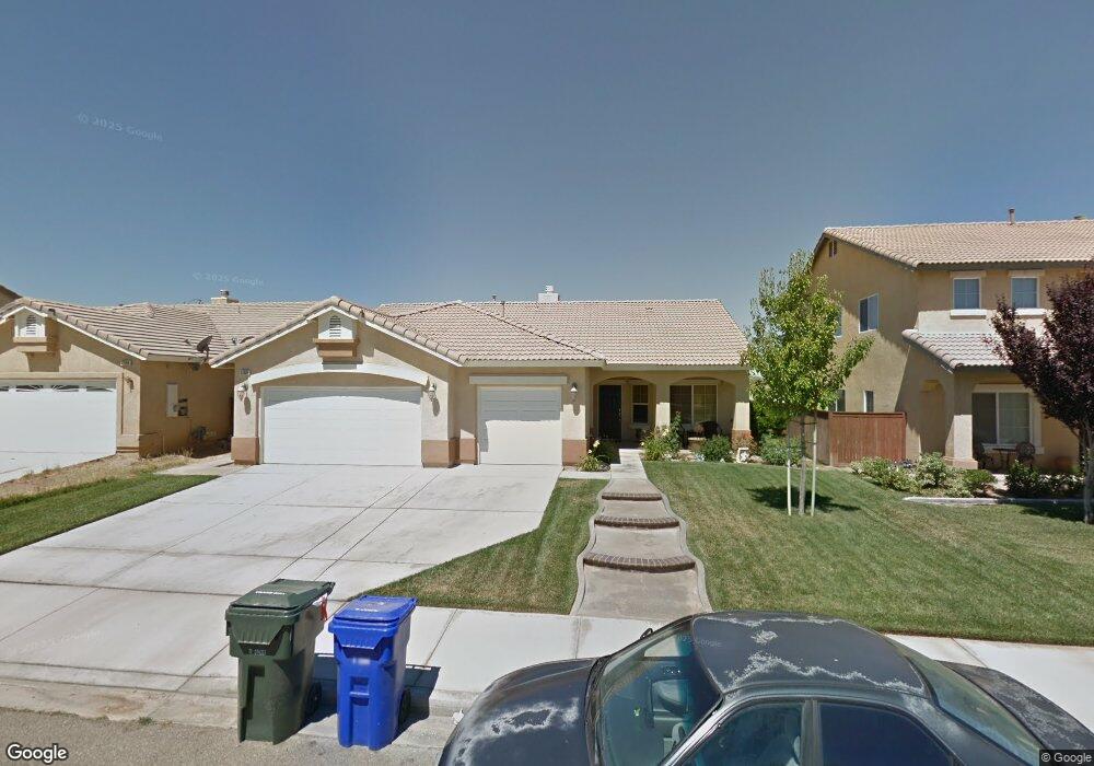
12604 Westway Victorville, CA 92392
Mesa Linda NeighborhoodEstimated Value: $435,764 - $455,000
3
Beds
2
Baths
1,872
Sq Ft
$238/Sq Ft
Est. Value
About This Home
This home is located at 12604 Westway, Victorville, CA 92392 and is currently estimated at $445,441, approximately $237 per square foot. 12604 Westway is a home located in San Bernardino County with nearby schools including Eagle Ranch Elementary School, Silverado High School, and Mojave River Academy - Oro Grande.
Ownership History
Date
Name
Owned For
Owner Type
Purchase Details
Closed on
Nov 10, 2003
Sold by
Eagle Ranch Residential Llc
Bought by
Moran Ricardo and Moran Lisa O
Current Estimated Value
Home Financials for this Owner
Home Financials are based on the most recent Mortgage that was taken out on this home.
Original Mortgage
$200,260
Interest Rate
6.09%
Mortgage Type
Purchase Money Mortgage
Create a Home Valuation Report for This Property
The Home Valuation Report is an in-depth analysis detailing your home's value as well as a comparison with similar homes in the area
Home Values in the Area
Average Home Value in this Area
Purchase History
| Date | Buyer | Sale Price | Title Company |
|---|---|---|---|
| Moran Ricardo | $211,000 | Orange Coast Title Company |
Source: Public Records
Mortgage History
| Date | Status | Borrower | Loan Amount |
|---|---|---|---|
| Previous Owner | Moran Ricardo | $200,260 |
Source: Public Records
Tax History Compared to Growth
Tax History
| Year | Tax Paid | Tax Assessment Tax Assessment Total Assessment is a certain percentage of the fair market value that is determined by local assessors to be the total taxable value of land and additions on the property. | Land | Improvement |
|---|---|---|---|---|
| 2025 | $3,750 | $299,717 | $42,654 | $257,063 |
| 2024 | $3,750 | $293,841 | $41,818 | $252,023 |
| 2023 | $3,713 | $288,079 | $40,998 | $247,081 |
| 2022 | $3,660 | $282,430 | $40,194 | $242,236 |
| 2021 | $3,859 | $276,892 | $39,406 | $237,486 |
| 2020 | $3,773 | $274,053 | $39,002 | $235,051 |
| 2019 | $3,754 | $268,679 | $38,237 | $230,442 |
| 2018 | $3,590 | $246,800 | $49,100 | $197,700 |
| 2017 | $3,355 | $229,600 | $45,700 | $183,900 |
| 2016 | $2,997 | $212,600 | $42,300 | $170,300 |
| 2015 | $2,881 | $196,000 | $39,000 | $157,000 |
| 2014 | $2,286 | $146,100 | $28,800 | $117,300 |
Source: Public Records
Map
Nearby Homes
- 0 395 Hwy Unit HD24067189
- 0 395 Hwy Unit 542190
- 0 Hwy 395 Unit HD24040654
- 12766 Brookdale St
- 12776 Berrydale St
- 0 Highway 395 Unit CV24228214
- 0 Highway 395 Unit HD25120289
- 0 Highway 395 Unit HD25171127
- 12413 Redrock Rd
- 12312 Atoka Ln
- 0 Cantina Dr Unit OC25239997
- 12451 Antelope Dr
- 11952 Olivine Rd
- 12544 Sunbird Ln
- 12373 Albatross St
- 12477 Redrock Ct
- 12960 Leawood St
- 0 U S 395
- 0 Three Flags Hwy
- 0 Eagle Ranch Pkwy
- 12614 Westway
- 12594 Westway
- 12624 Westway
- 12609 Westway
- 12599 Westway
- 12617 Westway
- 12634 Westway
- 12574 Westway
- 12589 Westway
- 12627 Westway
- 12644 Westway
- 12564 Westway
- 12637 Westway
- 12608 Table Rock Ln
- 12618 Table Rock Ln
- 12588 Table Rock Ln
- 12567 Westway
- 12628 Table Rock Ln
- 12647 Westway
- 12656 Westway