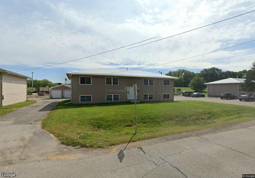
1261 Black Hawk Rd Unit 1 Waterloo, IA 50701
Estimated Value: $89,000 - $169,000
2
Beds
1
Bath
840
Sq Ft
$148/Sq Ft
Est. Value
About This Home
This home is located at 1261 Black Hawk Rd Unit 1, Waterloo, IA 50701 and is currently estimated at $123,934, approximately $147 per square foot. 1261 Black Hawk Rd Unit 1 is a home located in Black Hawk County with nearby schools including Becker Elementary School, Central Middle School, and West High School.
Ownership History
Date
Name
Owned For
Owner Type
Purchase Details
Closed on
Dec 13, 2021
Sold by
Palmer-Leigh Properties Llc
Bought by
30 Something Real Estate Llc
Current Estimated Value
Purchase Details
Closed on
Mar 4, 2005
Sold by
S & A Properties Lc
Bought by
Fank Jeffrey and Fank Dawness
Home Financials for this Owner
Home Financials are based on the most recent Mortgage that was taken out on this home.
Original Mortgage
$21,000
Interest Rate
5.7%
Mortgage Type
Stand Alone Second
Create a Home Valuation Report for This Property
The Home Valuation Report is an in-depth analysis detailing your home's value as well as a comparison with similar homes in the area
Home Values in the Area
Average Home Value in this Area
Purchase History
| Date | Buyer | Sale Price | Title Company |
|---|---|---|---|
| 30 Something Real Estate Llc | $852,000 | None Listed On Document | |
| Fank Jeffrey | $140,000 | None Available |
Source: Public Records
Mortgage History
| Date | Status | Borrower | Loan Amount |
|---|---|---|---|
| Previous Owner | Fank Jeffrey | $21,000 |
Source: Public Records
Tax History Compared to Growth
Tax History
| Year | Tax Paid | Tax Assessment Tax Assessment Total Assessment is a certain percentage of the fair market value that is determined by local assessors to be the total taxable value of land and additions on the property. | Land | Improvement |
|---|---|---|---|---|
| 2025 | $1,138 | $60,860 | $7,080 | $53,780 |
| 2024 | $1,138 | $52,500 | $7,080 | $45,420 |
| 2023 | $1,058 | $52,500 | $7,080 | $45,420 |
| 2022 | $1,030 | $48,190 | $4,250 | $43,940 |
| 2021 | $1,092 | $48,190 | $4,250 | $43,940 |
| 2020 | $1,074 | $48,190 | $4,250 | $43,940 |
| 2019 | $1,074 | $48,190 | $4,250 | $43,940 |
| 2018 | $986 | $44,200 | $4,250 | $39,950 |
| 2017 | $986 | $44,200 | $4,250 | $39,950 |
| 2016 | $960 | $44,200 | $4,250 | $39,950 |
| 2015 | $960 | $42,280 | $4,250 | $38,030 |
| 2014 | $978 | $42,280 | $4,250 | $38,030 |
Source: Public Records
Map
Nearby Homes
- 1107 Downing Ave
- 1221 Downing Ave
- 2621 University Ave
- 2320 University Ave
- 1114 Eleanor Dr
- 1726 Huntington Rd
- 1016 Evergreen Ave
- 1129 Wallgate Ave
- 330 Black Hawk Rd
- 1742 Sager Ave
- 819 Hanna Blvd
- 131 Axlewood Dr
- 915 Alabar Ave
- 124 Axlewood Dr
- 1269 Scott Ave
- 118 Axlewood Dr
- 724 Kirkwood Ave
- 119 Axlewood Dr
- 241 Carrington Ave
- 117 Axlewood Dr
- 1261 Black Hawk Rd Unit 4
- 1261 Black Hawk Rd Unit 3
- 1261 Black Hawk Rd Unit 2
- 1256 Black Hawk Rd
- 1270 Black Hawk Rd
- 1243 Black Hawk Rd
- 1248 Black Hawk Rd
- 1235 Black Hawk Rd
- 1271 Black Hawk Rd Unit 4
- 1271 Black Hawk Rd Unit 3
- 1271 Black Hawk Rd Unit 2
- 1271 Black Hawk Rd Unit 1
- 1271 Black Hawk Rd
- 1240 Black Hawk Rd
- 1251 Black Hawk Rd Unit 4
- 1251 Black Hawk Rd Unit 3
- 1251 Black Hawk Rd Unit 2
- 1251 Black Hawk Rd Unit 1
- 1280 Black Hawk Rd
- 1231 Black Hawk Rd