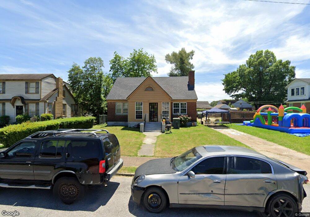
1261 Quinn Ave Memphis, TN 38106
Southeast Memphis NeighborhoodEstimated Value: $86,000 - $140,000
5
Beds
2
Baths
2,853
Sq Ft
$37/Sq Ft
Est. Value
About This Home
This home is located at 1261 Quinn Ave, Memphis, TN 38106 and is currently estimated at $104,520, approximately $36 per square foot. 1261 Quinn Ave is a home located in Shelby County with nearby schools including Hamilton High School, Memphis Delta Preparatory Charter School, and Soulsville Charter School.
Ownership History
Date
Name
Owned For
Owner Type
Purchase Details
Closed on
Feb 27, 2008
Sold by
Parrish Carole Jamison and Crawford Alva Jamison
Bought by
Hale Tommy
Current Estimated Value
Home Financials for this Owner
Home Financials are based on the most recent Mortgage that was taken out on this home.
Original Mortgage
$78,700
Outstanding Balance
$48,712
Interest Rate
5.62%
Mortgage Type
FHA
Estimated Equity
$55,808
Purchase Details
Closed on
May 8, 1998
Sold by
Jamison Ida W and Jamison Harold A
Bought by
Parrish Carole A and Crawford Alva J
Create a Home Valuation Report for This Property
The Home Valuation Report is an in-depth analysis detailing your home's value as well as a comparison with similar homes in the area
Home Values in the Area
Average Home Value in this Area
Purchase History
| Date | Buyer | Sale Price | Title Company |
|---|---|---|---|
| Hale Tommy | $79,950 | None Available | |
| Parrish Carole A | -- | Memphis Title |
Source: Public Records
Mortgage History
| Date | Status | Borrower | Loan Amount |
|---|---|---|---|
| Open | Hale Tommy | $78,700 |
Source: Public Records
Tax History Compared to Growth
Tax History
| Year | Tax Paid | Tax Assessment Tax Assessment Total Assessment is a certain percentage of the fair market value that is determined by local assessors to be the total taxable value of land and additions on the property. | Land | Improvement |
|---|---|---|---|---|
| 2025 | $537 | $23,550 | $2,000 | $21,550 |
| 2024 | $537 | $15,850 | $1,225 | $14,625 |
| 2023 | $966 | $15,850 | $1,225 | $14,625 |
| 2022 | $966 | $15,850 | $1,225 | $14,625 |
| 2021 | $977 | $15,850 | $1,225 | $14,625 |
| 2020 | $1,134 | $15,650 | $1,225 | $14,425 |
| 2019 | $1,134 | $15,650 | $1,225 | $14,425 |
| 2018 | $1,134 | $15,650 | $1,225 | $14,425 |
| 2017 | $643 | $15,650 | $1,225 | $14,425 |
| 2016 | $710 | $16,250 | $0 | $0 |
| 2014 | $710 | $16,250 | $0 | $0 |
Source: Public Records
Map
Nearby Homes
- 1245 Quinn Ave
- 1390 Wilson St
- 1337 Wilson St
- 1333 Wilson St
- 1425 Hemlock St
- 1371 S Parkway E
- 1358 S Parkway E
- 1440 Woodward St
- 1338 Dunnavant St
- 1299 Dunnavant St
- 1345 Gold Ave
- 1260 Greenwood St
- 1372 South Ave
- 0 Dunnavant St Unit 25384372
- 0 Dunnavant St Unit 10199375
- 1301 Englewood St
- 1277 Englewood St
- 1410 South Ave
- 1554 Pillow St
- 1399 South Ave
- 1267 Quinn Ave
- 1249 Quinn Ave
- 1260 Gill Ave
- 1256 Gill Ave
- 1269 Quinn Ave
- 1268 Gill Ave
- 1252 Gill Ave
- 1260 Quinn Ave
- 1254 Quinn Ave
- 1277 Quinn Ave
- 1274 Gill Ave
- 1248 Quinn Ave
- 1272 Quinn Ave
- 1278 Gill Ave
- 1283 Quinn Ave
- 1416 Elvis Presley Blvd
- 1276 Quinn Ave
- 1284 Gill Ave
- 1287 Quinn Ave
- 1282 Quinn Ave