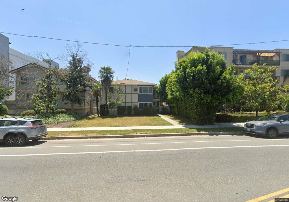
12610 Moorpark St Studio City, CA 91604
Estimated Value: $1,046,640 - $1,844,000
6
Beds
4
Baths
3,308
Sq Ft
$487/Sq Ft
Est. Value
About This Home
This home is located at 12610 Moorpark St, Studio City, CA 91604 and is currently estimated at $1,611,910, approximately $487 per square foot. 12610 Moorpark St is a home located in Los Angeles County with nearby schools including Ulysses S. Grant Senior High School, Dixie Canyon Avenue Elementary School, and Colfax Charter Elementary School.
Ownership History
Date
Name
Owned For
Owner Type
Purchase Details
Closed on
Mar 13, 2024
Sold by
Surkin Eddie E and Surkin Alicia
Bought by
Surkin Family Trust and Surkin
Current Estimated Value
Purchase Details
Closed on
Jan 13, 1995
Sold by
Anderson Carol Ann and The Mildred C Jenson Trust
Bought by
Surkin Eddie E
Home Financials for this Owner
Home Financials are based on the most recent Mortgage that was taken out on this home.
Original Mortgage
$180,600
Interest Rate
9.21%
Create a Home Valuation Report for This Property
The Home Valuation Report is an in-depth analysis detailing your home's value as well as a comparison with similar homes in the area
Home Values in the Area
Average Home Value in this Area
Purchase History
| Date | Buyer | Sale Price | Title Company |
|---|---|---|---|
| Surkin Family Trust | -- | None Listed On Document | |
| Surkin Eddie E | $258,000 | First American Title |
Source: Public Records
Mortgage History
| Date | Status | Borrower | Loan Amount |
|---|---|---|---|
| Previous Owner | Surkin Eddie E | $180,600 |
Source: Public Records
Tax History Compared to Growth
Tax History
| Year | Tax Paid | Tax Assessment Tax Assessment Total Assessment is a certain percentage of the fair market value that is determined by local assessors to be the total taxable value of land and additions on the property. | Land | Improvement |
|---|---|---|---|---|
| 2025 | $5,579 | $433,331 | $167,955 | $265,376 |
| 2024 | $5,579 | $424,835 | $164,662 | $260,173 |
| 2023 | $5,478 | $416,506 | $161,434 | $255,072 |
| 2022 | $5,234 | $408,340 | $158,269 | $250,071 |
| 2021 | $5,154 | $400,334 | $155,166 | $245,168 |
| 2019 | $5,007 | $388,462 | $150,564 | $237,898 |
| 2018 | $4,911 | $380,846 | $147,612 | $233,234 |
| 2016 | $4,666 | $366,059 | $141,881 | $224,178 |
| 2015 | $4,601 | $360,561 | $139,750 | $220,811 |
| 2014 | $4,641 | $353,499 | $137,013 | $216,486 |
Source: Public Records
Map
Nearby Homes
- 4314 Teesdale Ave
- 4326 Babcock Ave Unit 305
- 12504 Woodbridge St Unit 303
- 4424 Whitsett Ave Unit 309
- 4230 Whitsett Ave Unit 9
- 4230 Whitsett Ave Unit 6
- 4322 Alcove Ave
- 12416 Moorpark St Unit A
- 12831 Moorpark St Unit 14
- 12841 Bloomfield St Unit 103
- 12834 Landale St
- 4239 Rhodes Ave
- 4332 Coldwater Canyon Ave Unit 3
- 12420 Milbank St
- 12919 Bloomfield St Unit 1
- 4609 Goodland Ave
- 4519 Coldwater Canyon Ave Unit 10
- 12843 Sarah St
- 4300 Laurelgrove Ave
- 4445 Van Noord Ave
- 12616 Moorpark St
- 12624 Moorpark St
- 12602 Moorpark St
- 4354 Teesdale Ave Unit 401
- 4354 Teesdale Ave Unit 204
- 4354 Teesdale Ave Unit 201
- 4354 Teesdale Ave Unit 203
- 4354 Teesdale Ave Unit 303
- 4354 Teesdale Ave Unit 304
- 4354 Teesdale Ave Unit 404
- 4354 Teesdale Ave
- 4343 Beeman Ave
- 4342 Teesdale Ave
- 4341 Beeman Ave
- 4336 Teesdale Ave
- 4331 Beeman Ave
- 4330 Teesdale Ave
- 12603 Moorpark St Unit 306
- 12603 Moorpark St Unit 206
- 12603 Moorpark St Unit 302