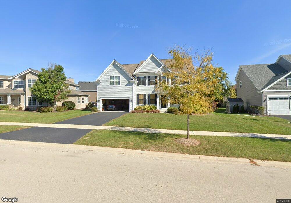
1262 Independence Ave Elburn, IL 60119
Estimated Value: $539,383 - $577,000
4
Beds
3
Baths
2,946
Sq Ft
$190/Sq Ft
Est. Value
About This Home
This home is located at 1262 Independence Ave, Elburn, IL 60119 and is currently estimated at $558,846, approximately $189 per square foot. 1262 Independence Ave is a home located in Kane County with nearby schools including Kaneland Blackberry Creek Elementary School, Harter Middle School, and Kaneland Senior High School.
Ownership History
Date
Name
Owned For
Owner Type
Purchase Details
Closed on
Jul 21, 2017
Sold by
Taylor Morrison Of Illinois Inc
Bought by
Farnum Paul William and Farnum Kristina Mae
Current Estimated Value
Home Financials for this Owner
Home Financials are based on the most recent Mortgage that was taken out on this home.
Original Mortgage
$219,950
Outstanding Balance
$182,791
Interest Rate
3.9%
Mortgage Type
New Conventional
Estimated Equity
$376,055
Purchase Details
Closed on
Jul 18, 2015
Sold by
Orleans Rhil Lp
Bought by
Taylor Morrison Of Illinois Inc
Purchase Details
Closed on
May 18, 2015
Sold by
Bbc Realty Holdings Llc
Bought by
Orleans Rhil Lp
Create a Home Valuation Report for This Property
The Home Valuation Report is an in-depth analysis detailing your home's value as well as a comparison with similar homes in the area
Home Values in the Area
Average Home Value in this Area
Purchase History
| Date | Buyer | Sale Price | Title Company |
|---|---|---|---|
| Farnum Paul William | $293,500 | First American Title | |
| Taylor Morrison Of Illinois Inc | $4,638,000 | First American Title Ins Co | |
| Orleans Rhil Lp | $385,000 | Chicago Title Insurance Co |
Source: Public Records
Mortgage History
| Date | Status | Borrower | Loan Amount |
|---|---|---|---|
| Open | Farnum Paul William | $219,950 |
Source: Public Records
Tax History Compared to Growth
Tax History
| Year | Tax Paid | Tax Assessment Tax Assessment Total Assessment is a certain percentage of the fair market value that is determined by local assessors to be the total taxable value of land and additions on the property. | Land | Improvement |
|---|---|---|---|---|
| 2024 | $12,303 | $151,322 | $17,164 | $134,158 |
| 2023 | $11,862 | $136,572 | $15,491 | $121,081 |
| 2022 | $10,620 | $120,106 | $14,217 | $105,889 |
| 2021 | $10,233 | $114,956 | $13,607 | $101,349 |
| 2020 | $10,047 | $112,262 | $13,288 | $98,974 |
| 2019 | $10,053 | $110,614 | $13,093 | $97,521 |
| 2018 | $9,303 | $98,881 | $13,093 | $85,788 |
| 2017 | $5,069 | $52,683 | $12,944 | $39,739 |
| 2016 | $1,314 | $12,602 | $12,602 | $0 |
| 2015 | -- | $8,711 | $8,711 | $0 |
| 2014 | -- | $11,167 | $11,167 | $0 |
| 2013 | -- | $11,167 | $11,167 | $0 |
Source: Public Records
Map
Nearby Homes
- 1192 Beed Ave
- 1382 Independence Ave
- 1430 Souders Ave
- 1311 Spalding Ave
- 1121 Lance Ave
- 1473 Anderson Rd
- 1122 Motz St
- 1133 Sears Cir
- 951 Kindberg Ct
- 43W556 Kenmar Ct
- ES Aspen Plan at Elburn Station - The Village Homes
- ES Potomac Plan at Elburn Station - The Village Homes
- ES Mackinaw Plan at Elburn Station - The Village Homes
- ES Frisco Plan at Elburn Station - The Village Homes
- 16 Derek Dr
- 12 Derek Dr
- 6 Derek Dr
- 5 Derek Dr
- 4 Derek Dr
- 11 Derek Dr
- 1240 Independence Ave
- 1274 Independence Ave
- 1290 Dodson Ave
- 1555 Settler St
- 1523 Settler St
- 945 Settler St
- 1281 Beed Ave
- 1300 Dodson Ave Unit 12
- 1275 Beed Ave
- 1312 Independence Ave
- 1313 Dodson Ave
- 1295 Beed Ave
- 1311 Beed Ave
- 1540 Settler St
- 1261 Independence Ave
- 1320 Dodson Ave
- 1490 Settler St
- 1190 Independence Ave
- 1303 Dodson Ave
- 1335 Dodson Ave