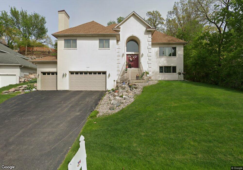
12625 Diamond Dr Burnsville, MN 55337
Estimated Value: $548,000 - $708,000
4
Beds
4
Baths
2,321
Sq Ft
$270/Sq Ft
Est. Value
About This Home
This home is located at 12625 Diamond Dr, Burnsville, MN 55337 and is currently estimated at $626,984, approximately $270 per square foot. 12625 Diamond Dr is a home located in Dakota County with nearby schools including William Byrne Elementary School, Burnsville High School, and Gateway STEM Academy.
Ownership History
Date
Name
Owned For
Owner Type
Purchase Details
Closed on
Oct 17, 2003
Sold by
Tgs Construction & Property Management
Bought by
Lowry Kevin D
Current Estimated Value
Purchase Details
Closed on
Oct 13, 2003
Sold by
Mcinnis Patrick J
Bought by
Tgs Construction
Purchase Details
Closed on
Aug 29, 2002
Sold by
Mcinnis Patrick J
Bought by
Tgs Construction & Property Mtgmt Inc
Purchase Details
Closed on
Jul 3, 2000
Sold by
Fisher Development Co-I and Fisher Ann S
Bought by
Mcinnis Patrick J
Create a Home Valuation Report for This Property
The Home Valuation Report is an in-depth analysis detailing your home's value as well as a comparison with similar homes in the area
Home Values in the Area
Average Home Value in this Area
Purchase History
| Date | Buyer | Sale Price | Title Company |
|---|---|---|---|
| Lowry Kevin D | $425,000 | -- | |
| Tgs Construction | $54,000 | -- | |
| Tgs Construction & Property Mtgmt Inc | $110,000 | -- | |
| Mcinnis Patrick J | $25,000 | -- |
Source: Public Records
Mortgage History
| Date | Status | Borrower | Loan Amount |
|---|---|---|---|
| Closed | Tgs Construction & Property Mtgmt Inc | -- |
Source: Public Records
Tax History Compared to Growth
Tax History
| Year | Tax Paid | Tax Assessment Tax Assessment Total Assessment is a certain percentage of the fair market value that is determined by local assessors to be the total taxable value of land and additions on the property. | Land | Improvement |
|---|---|---|---|---|
| 2024 | $6,194 | $580,000 | $156,800 | $423,200 |
| 2023 | $6,194 | $574,100 | $157,000 | $417,100 |
| 2022 | $5,474 | $566,300 | $156,600 | $409,700 |
| 2021 | $5,390 | $506,800 | $140,400 | $366,400 |
| 2020 | $5,482 | $473,900 | $133,700 | $340,200 |
| 2019 | $5,385 | $464,200 | $127,300 | $336,900 |
| 2018 | $5,504 | $433,100 | $121,300 | $311,800 |
| 2017 | $5,056 | $429,400 | $115,500 | $313,900 |
| 2016 | $5,308 | $386,600 | $107,000 | $279,600 |
| 2015 | $4,938 | $389,300 | $103,800 | $285,500 |
| 2014 | -- | $378,600 | $101,900 | $276,700 |
| 2013 | -- | $351,400 | $93,300 | $258,100 |
Source: Public Records
Map
Nearby Homes
- 12640 Tiffany Ct
- 12625 Sable Dr
- 3017 Rainier Ct
- 101 Hidden Meadow Ct
- 108 Hidden Meadow Rd
- 188 River Woods Ln
- 109 Cimarron Ct
- 146 River Woods Ln
- 145 River Woods Ln
- 247 River Woods Ln
- 221 River Woods Ln
- 55 River Woods Ln
- 2708 Lassen Ct
- 72 River Woods Ln
- 319 River Woods Ln
- 12068 Gantry Ln
- 2400 E 125th St
- 2300 Villaburne Ct W
- 4774 Slater Rd
- 12044 Gantry Ln
- 12629 Diamond Dr
- 12623 Diamond Dr
- 12648 Tiffany Ct
- 12657 Tiffany Ct
- 12624 Diamond Dr
- 12633 Diamond Dr
- 12644 Tiffany Ct
- 12628 Diamond Dr
- 12620 Diamond Dr
- 12653 Tiffany Ct
- 12632 Diamond Dr
- 3409 E Burnsville Pkwy
- 3408 Garnet Ct
- 3313 E Burnsville Pkwy
- 3400 E Burnsville Pkwy
- 12636 Tiffany Ct
- 3413 Garnet Ct
- 12649 Tiffany Ct
- 12700 Diamond Dr
- 3401 Garnet Ct