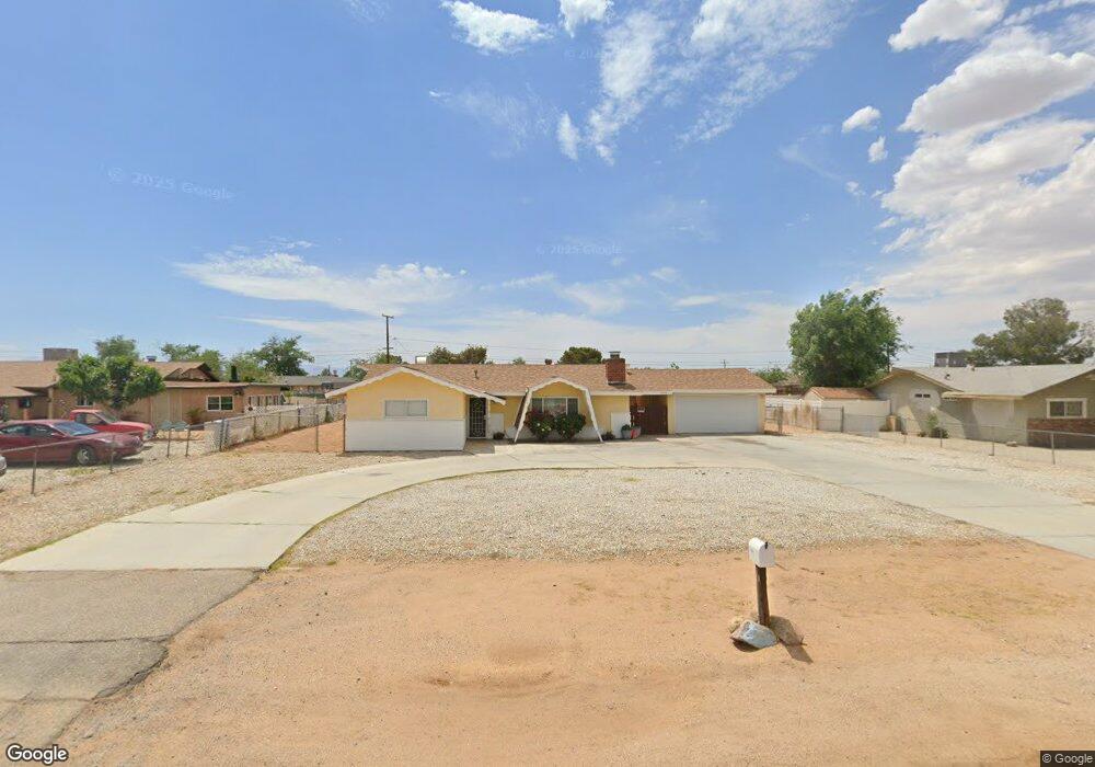
12630 Central Rd Apple Valley, CA 92308
High Desert NeighborhoodEstimated Value: $322,305 - $340,000
3
Beds
2
Baths
1,274
Sq Ft
$260/Sq Ft
Est. Value
About This Home
This home is located at 12630 Central Rd, Apple Valley, CA 92308 and is currently estimated at $331,576, approximately $260 per square foot. 12630 Central Rd is a home located in San Bernardino County with nearby schools including Sandia Elementary School and Apple Valley High School.
Ownership History
Date
Name
Owned For
Owner Type
Purchase Details
Closed on
Nov 29, 2012
Sold by
Nationstar Mortgage Llc
Bought by
Ronald A Crowe Family Trust
Current Estimated Value
Purchase Details
Closed on
Sep 11, 2012
Sold by
Sassenberger Adam Edward
Bought by
Nationstar Mortgage Llc
Purchase Details
Closed on
Apr 20, 2007
Sold by
Sassenberger Adam Edward
Bought by
Sassenberger Adam Edward and Mcclelland Brenda
Home Financials for this Owner
Home Financials are based on the most recent Mortgage that was taken out on this home.
Original Mortgage
$20,000
Interest Rate
6.1%
Mortgage Type
Credit Line Revolving
Purchase Details
Closed on
Apr 14, 2007
Sold by
Sassenberger Adam Edward
Bought by
Sassenberger Adam Edward
Home Financials for this Owner
Home Financials are based on the most recent Mortgage that was taken out on this home.
Original Mortgage
$20,000
Interest Rate
6.1%
Mortgage Type
Credit Line Revolving
Purchase Details
Closed on
Mar 3, 2006
Sold by
Sassenberger Adam Edward
Bought by
Sassenberger Adam Edward and Mcclelland Brenda
Home Financials for this Owner
Home Financials are based on the most recent Mortgage that was taken out on this home.
Original Mortgage
$74,000
Interest Rate
6.12%
Mortgage Type
Fannie Mae Freddie Mac
Purchase Details
Closed on
Jan 10, 2006
Sold by
Rigor Connie
Bought by
Sassenberger Adam Edward
Home Financials for this Owner
Home Financials are based on the most recent Mortgage that was taken out on this home.
Original Mortgage
$74,000
Interest Rate
6.12%
Mortgage Type
Fannie Mae Freddie Mac
Purchase Details
Closed on
Apr 29, 1998
Sold by
Mcclelland Donald R
Bought by
Mcclelland Donald R and The Donald R Mcclelland Revoca
Home Financials for this Owner
Home Financials are based on the most recent Mortgage that was taken out on this home.
Original Mortgage
$48,000
Interest Rate
7.17%
Purchase Details
Closed on
Aug 1, 1994
Sold by
Mcclelland Donald R
Bought by
Mcclelland Donald R and Donald R Mcclelland Revocable
Create a Home Valuation Report for This Property
The Home Valuation Report is an in-depth analysis detailing your home's value as well as a comparison with similar homes in the area
Home Values in the Area
Average Home Value in this Area
Purchase History
| Date | Buyer | Sale Price | Title Company |
|---|---|---|---|
| Ronald A Crowe Family Trust | $63,500 | Spl Title Services | |
| Nationstar Mortgage Llc | $153,493 | Lps Default Title & Closing | |
| Sassenberger Adam Edward | -- | Accommodation | |
| Sassenberger Adam Edward | -- | Chicago Title Pirt | |
| Sassenberger Adam Edward | -- | Accommodation | |
| Sassenberger Adam Edward | $99,000 | Lawyers Title | |
| Mcclelland Donald R | -- | First American Title Co | |
| Mcclelland Donald R | -- | Stewart Title | |
| Mcclelland Donald R | -- | -- | |
| Mcclelland Donald R | -- | -- | |
| Mcclelland Donald R | -- | -- |
Source: Public Records
Mortgage History
| Date | Status | Borrower | Loan Amount |
|---|---|---|---|
| Previous Owner | Sassenberger Adam Edward | $20,000 | |
| Previous Owner | Sassenberger Adam Edward | $74,000 | |
| Previous Owner | Mcclelland Donald R | $48,000 |
Source: Public Records
Tax History
| Year | Tax Paid | Tax Assessment Tax Assessment Total Assessment is a certain percentage of the fair market value that is determined by local assessors to be the total taxable value of land and additions on the property. | Land | Improvement |
|---|---|---|---|---|
| 2025 | $1,534 | $78,195 | $12,314 | $65,881 |
| 2024 | $1,752 | $76,662 | $12,073 | $64,589 |
| 2023 | $1,699 | $75,159 | $11,836 | $63,323 |
| 2022 | $1,942 | $73,685 | $11,604 | $62,081 |
| 2021 | $949 | $72,240 | $11,376 | $60,864 |
| 2020 | $1,165 | $71,499 | $11,259 | $60,240 |
| 2019 | $1,301 | $70,097 | $11,038 | $59,059 |
| 2018 | $897 | $68,723 | $10,822 | $57,901 |
| 2017 | $884 | $67,376 | $10,610 | $56,766 |
| 2016 | $811 | $66,055 | $10,402 | $55,653 |
| 2015 | $799 | $65,063 | $10,246 | $54,817 |
| 2014 | $788 | $63,788 | $10,045 | $53,743 |
Source: Public Records
Map
Nearby Homes
- 10647 Central Rd
- 22665 Little Beaver Rd
- 22241 Nisqually Rd Unit 118
- 22241 Nisqually Rd Unit 169
- 22241 Nisqually Rd Unit 143
- 22241 Nisqually Rd
- 22241 Nisqually Rd Unit 20
- 22241 Nisqually Rd Unit 124
- 22517 Ojai Rd
- 22225 Kayenta Rd
- 22330 Miramot Rd
- 12442 Quinnault Rd
- 22035 Pahute Rd
- 22020 Nisqually Rd Unit 3
- 22020 Nisqually Rd Unit 49
- 0 Pahute Rd Unit HD25164188
- 0 Pahute Rd Unit HD26005960
- 21985 Maumee Rd
- 22838 Bear Valley Rd Unit 63
- 22601 Bear Valley Rd Unit 68
- 12646 Central Rd
- 12616 Central Rd
- 12629 Tonikan Rd
- 12645 Tonikan Rd
- 12660 Central Rd
- 12590 Central Rd
- 12615 Tonikan Rd
- 12659 Tonikan Rd
- 12589 Tonikan Rd
- 12629 Central Rd
- 12647 Central Rd
- 12619 Central Rd
- 12676 Central Rd
- 12576 Central Rd
- 12675 Tonikan Rd
- 12657 Central Rd
- 12575 Tonikan Rd
- 22425 Lone Eagle Rd
- 12575 Central Rd
- 12560 Central Rd
Your Personal Tour Guide
Ask me questions while you tour the home.