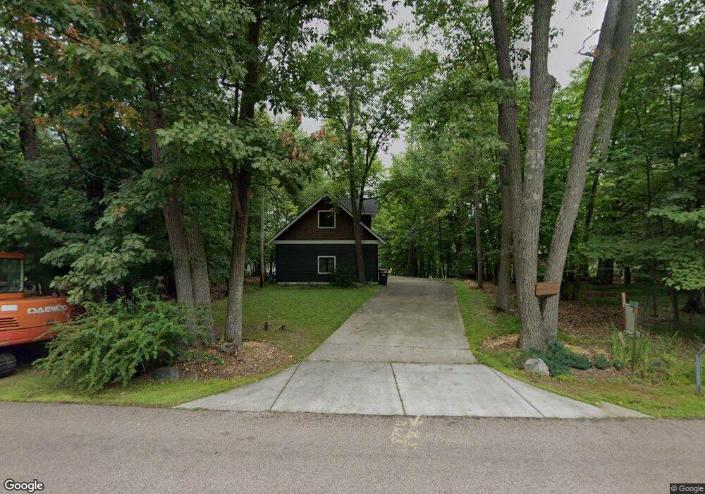
12632 Manhattan Point Blvd Crosslake, MN 56442
Estimated Value: $976,076 - $1,377,000
--
Bed
--
Bath
1,563
Sq Ft
$736/Sq Ft
Est. Value
About This Home
This home is located at 12632 Manhattan Point Blvd, Crosslake, MN 56442 and is currently estimated at $1,150,269, approximately $735 per square foot. 12632 Manhattan Point Blvd is a home located in Crow Wing County with nearby schools including Eagle View Elementary School, Pequot Lakes Middle School, and Pequot Lakes Senior High School.
Ownership History
Date
Name
Owned For
Owner Type
Purchase Details
Closed on
Sep 1, 2005
Sold by
Borys Kathryn G and Borys Daniel P
Bought by
Hartnell Scott W
Current Estimated Value
Purchase Details
Closed on
Aug 1, 2002
Sold by
Lang Patricia
Bought by
Borys Daniel P and Borys Kathryn G
Purchase Details
Closed on
Jul 1, 2002
Sold by
Smith James Sanford and Smith Michell
Bought by
Lang Patricia
Purchase Details
Closed on
Oct 1, 1998
Sold by
Larson Raymond K
Bought by
Smith James Sanfor
Purchase Details
Closed on
Dec 1, 1993
Sold by
Schumacher Jame
Bought by
Larson Raymond
Create a Home Valuation Report for This Property
The Home Valuation Report is an in-depth analysis detailing your home's value as well as a comparison with similar homes in the area
Home Values in the Area
Average Home Value in this Area
Purchase History
| Date | Buyer | Sale Price | Title Company |
|---|---|---|---|
| Hartnell Scott W | $670,000 | -- | |
| Borys Daniel P | $480,000 | -- | |
| Lang Patricia | $430,000 | -- | |
| Smith James Sanfor | $245,000 | -- | |
| Larson Raymond | $55,000 | -- |
Source: Public Records
Tax History Compared to Growth
Tax History
| Year | Tax Paid | Tax Assessment Tax Assessment Total Assessment is a certain percentage of the fair market value that is determined by local assessors to be the total taxable value of land and additions on the property. | Land | Improvement |
|---|---|---|---|---|
| 2025 | $5,586 | $1,026,200 | $685,000 | $341,200 |
| 2024 | $5,476 | $836,900 | $530,900 | $306,000 |
| 2023 | $5,130 | $857,200 | $519,500 | $337,700 |
| 2022 | $4,886 | $727,700 | $398,100 | $329,600 |
| 2021 | $4,688 | $555,800 | $341,400 | $214,400 |
| 2020 | $4,620 | $508,600 | $306,100 | $202,500 |
| 2019 | $4,346 | $494,200 | $294,500 | $199,700 |
| 2018 | $4,298 | $461,400 | $276,400 | $185,000 |
| 2017 | $4,460 | $462,400 | $282,400 | $180,000 |
| 2016 | $4,504 | $474,800 | $299,500 | $175,300 |
| 2015 | $4,344 | $467,000 | $294,200 | $172,800 |
| 2014 | $2,276 | $478,700 | $304,800 | $173,900 |
Source: Public Records
Map
Nearby Homes
- 38738 Windsor Ave
- 38720 South Landing
- 12125 Whitefish Ave
- 12463 White Island Dr
- 11959 Northgate Ln
- 13374 Cabin Cove Trail
- 37639 Forest Lodge Rd
- 37713 Forest Lodge Rd
- 38277 Moccasin Dr
- 13380 Rush Harbor Dr
- 12391 Anchor Point Rd
- 37310 Silver Peak Rd
- 37301 2nd St
- 39687 Swanberg Rd
- 40220 S Fox Lake Dr
- TBD-Parcel C Staley Ln
- 40550 W Fox Lake Rd
- 10596 Wabigoniss Shores
- 36937 Sundance Loop Unit 821
- 36937 Sundance Loop Unit 831
- 12604 Manhattan Point Blvd
- 12596 Manhattan Point Blvd
- 12670 Manhattan Point Blvd
- 12690 Manhattan Point Blvd
- 12708 Manhattan Point Blvd
- 12564 Manhattan Point Blvd
- 12554 Manhattan Point Blvd
- 12530 Manhattan Point Blvd
- 12730 Manhattan Point Blvd
- XXX Whitefish Ave
- 12724 Manhattan Point Blvd
- 12533 Whitefish Ave
- 12522 Manhattan Point Blvd
- 12736 Manhattan Point Blvd
- 12514 Manhattan Point Blvd
- 12508 Manhattan Point Blvd
- 12748 Manhattan Point Blvd
- 12482 Whitefish Ave
- 12778 Manhattan Point Blvd
- 12772 Manhattan Point Blvd