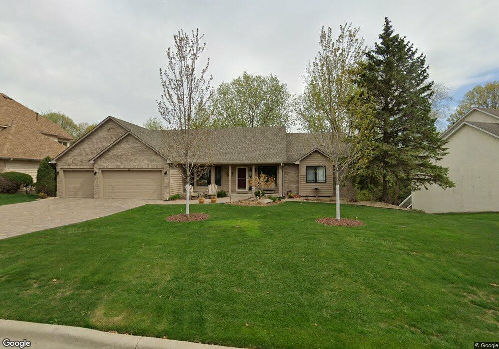
12633 Sable Dr Burnsville, MN 55337
Estimated Value: $543,000 - $692,000
3
Beds
3
Baths
1,794
Sq Ft
$338/Sq Ft
Est. Value
About This Home
This home is located at 12633 Sable Dr, Burnsville, MN 55337 and is currently estimated at $606,663, approximately $338 per square foot. 12633 Sable Dr is a home located in Dakota County with nearby schools including William Byrne Elementary School, Burnsville High School, and Gateway STEM Academy.
Ownership History
Date
Name
Owned For
Owner Type
Purchase Details
Closed on
Mar 16, 2018
Sold by
Cocchiarella Dean M and Cocchiarella Patricia A
Bought by
Cocchiarella Dean M and Cocchiarella Patricia A
Current Estimated Value
Purchase Details
Closed on
May 2, 2000
Sold by
Blakley Daniel L and Blakley Genna N
Bought by
Cocchiarella Dean M and Cocchiarella Patricia A
Purchase Details
Closed on
Oct 3, 1997
Sold by
Kapalka Thaddeus J and Kapalka Mary A
Bought by
Blakley Daniel L and Blakley Genna N
Create a Home Valuation Report for This Property
The Home Valuation Report is an in-depth analysis detailing your home's value as well as a comparison with similar homes in the area
Home Values in the Area
Average Home Value in this Area
Purchase History
| Date | Buyer | Sale Price | Title Company |
|---|---|---|---|
| Cocchiarella Dean M | -- | None Available | |
| Cocchiarella Dean M | $318,900 | -- | |
| Blakley Daniel L | $277,600 | -- |
Source: Public Records
Tax History Compared to Growth
Tax History
| Year | Tax Paid | Tax Assessment Tax Assessment Total Assessment is a certain percentage of the fair market value that is determined by local assessors to be the total taxable value of land and additions on the property. | Land | Improvement |
|---|---|---|---|---|
| 2024 | $5,772 | $545,100 | $173,300 | $371,800 |
| 2023 | $5,772 | $540,500 | $173,500 | $367,000 |
| 2022 | $4,696 | $537,900 | $173,100 | $364,800 |
| 2021 | $4,550 | $435,900 | $116,800 | $319,100 |
| 2020 | $4,776 | $401,000 | $111,200 | $289,800 |
| 2019 | $4,688 | $405,100 | $105,900 | $299,200 |
| 2018 | $4,786 | $379,500 | $100,900 | $278,600 |
| 2017 | $4,414 | $376,100 | $96,100 | $280,000 |
| 2016 | $4,745 | $342,800 | $91,500 | $251,300 |
| 2015 | $4,408 | $346,985 | $87,411 | $259,574 |
| 2014 | -- | $336,739 | $85,583 | $251,156 |
| 2013 | -- | $310,361 | $77,761 | $232,600 |
Source: Public Records
Map
Nearby Homes
- 12625 Sable Dr
- 12640 Tiffany Ct
- 3017 Rainier Ct
- 188 River Woods Ln
- 146 River Woods Ln
- 145 River Woods Ln
- 55 River Woods Ln
- 72 River Woods Ln
- 2708 Lassen Ct
- 247 River Woods Ln
- 221 River Woods Ln
- 108 Hidden Meadow Rd
- 319 River Woods Ln
- 101 Hidden Meadow Ct
- 2400 E 125th St
- 109 Cimarron Ct
- 2300 Villaburne Ct W
- 12232 Oak Leaf Cir
- 4774 Slater Rd
- 11921 Baypoint Dr
- 12629 Sable Dr
- 12637 Sable Dr
- 12632 Sable Dr
- 12628 Sable Dr
- 12641 Sable Dr
- 12624 Sable Dr
- 12636 Sable Dr
- 12640 Sable Dr
- 12621 Sable Dr
- 12620 Sable Dr
- 12644 Sable Dr
- 12645 Sable Dr
- 3301 E Burnsville Pkwy
- 12648 Sable Dr
- 3305 E Burnsville Pkwy
- 12705 Sable Dr
- 12709 Sable Dr
- 3309 E Burnsville Pkwy
- 12652 Sable Dr
- 3113 E 126th St