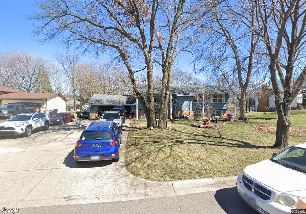
12641 Hummingbird St NW Coon Rapids, MN 55448
Estimated Value: $379,000 - $405,000
5
Beds
2
Baths
1,284
Sq Ft
$305/Sq Ft
Est. Value
About This Home
This home is located at 12641 Hummingbird St NW, Coon Rapids, MN 55448 and is currently estimated at $391,790, approximately $305 per square foot. 12641 Hummingbird St NW is a home located in Anoka County with nearby schools including Morris Bye Elementary School, Coon Rapids Middle School, and Coon Rapids Senior High School.
Ownership History
Date
Name
Owned For
Owner Type
Purchase Details
Closed on
Jan 11, 2019
Sold by
Kath Roger R and Kath Mary Kaye
Bought by
Cruikshank Roland
Current Estimated Value
Home Financials for this Owner
Home Financials are based on the most recent Mortgage that was taken out on this home.
Original Mortgage
$265,109
Outstanding Balance
$231,665
Interest Rate
4.5%
Mortgage Type
FHA
Estimated Equity
$160,125
Create a Home Valuation Report for This Property
The Home Valuation Report is an in-depth analysis detailing your home's value as well as a comparison with similar homes in the area
Home Values in the Area
Average Home Value in this Area
Purchase History
| Date | Buyer | Sale Price | Title Company |
|---|---|---|---|
| Cruikshank Roland | $270,000 | Old Masters Title |
Source: Public Records
Mortgage History
| Date | Status | Borrower | Loan Amount |
|---|---|---|---|
| Open | Cruikshank Roland | $265,109 |
Source: Public Records
Tax History Compared to Growth
Tax History
| Year | Tax Paid | Tax Assessment Tax Assessment Total Assessment is a certain percentage of the fair market value that is determined by local assessors to be the total taxable value of land and additions on the property. | Land | Improvement |
|---|---|---|---|---|
| 2025 | $4,903 | $369,300 | $94,500 | $274,800 |
| 2024 | $4,903 | $357,400 | $91,400 | $266,000 |
| 2023 | $4,025 | $351,700 | $75,600 | $276,100 |
| 2022 | $3,125 | $363,000 | $75,600 | $287,400 |
| 2021 | $3,022 | $286,100 | $58,800 | $227,300 |
| 2020 | $2,978 | $271,200 | $58,800 | $212,400 |
| 2019 | $2,885 | $257,200 | $58,800 | $198,400 |
| 2018 | $2,683 | $242,900 | $0 | $0 |
| 2017 | $2,422 | $221,000 | $0 | $0 |
| 2016 | $2,465 | $197,700 | $0 | $0 |
| 2015 | -- | $197,700 | $50,000 | $147,700 |
| 2014 | -- | $167,700 | $35,400 | $132,300 |
Source: Public Records
Map
Nearby Homes
- 12554 Grouse St NW
- 1593 126th Ln NW
- 1450 126th Ln NW
- 1625 124th Ave NW
- 12365 Jay St NW
- 1930 127th Cir NW
- 1520 129th Ave NW
- 12796 Bluebird St NW
- 12463 Drake St NW
- 12859 Grouse St NW
- 2068 124th Ln NW
- 1234 128th Cir NW
- 2147 125th Ln NW
- 1727 121st Ln NW
- 1687 131st Ln NW
- 12760 Raven St NW
- 1776 133rd Ave NW
- 12488 Unity St NW
- 12010 Eagle St NW
- 899 123rd Ln NW
- 12651 Hummingbird St NW
- 12565 Hummingbird St NW
- 12640 Hummingbird St NW
- 12640 Grouse St NW
- 12650 Grouse St NW
- 1656 127th Ave NW
- 12564 Hummingbird St NW
- 12555 Hummingbird St NW
- 12564 Grouse St NW
- 12650 Hummingbird St NW
- 1644 127th Ave NW
- 1644 1644 127th Ave NW
- 12660 Grouse St NW
- 12554 Hummingbird St NW
- 12660 Hummingbird St NW
- 12545 Hummingbird St NW
- 12544 Grouse St NW
- 12641 Grouse St NW
- 12544 Hummingbird St NW
- 12651 Grouse St NW