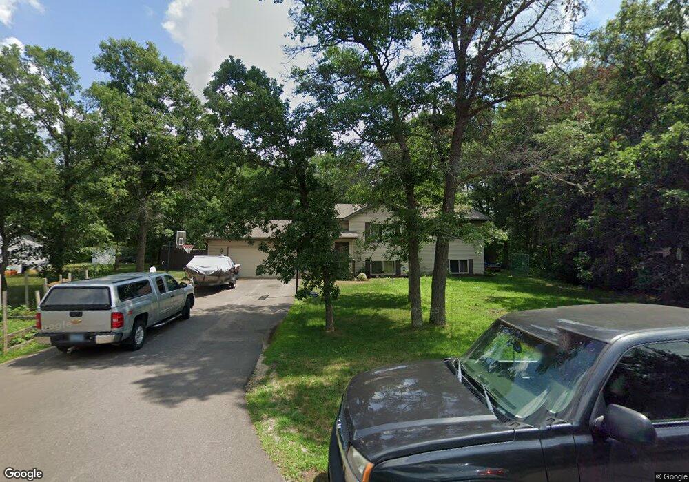
12646 Chestnut Dr S Baxter, MN 56425
Estimated Value: $290,000 - $362,000
4
Beds
2
Baths
2,350
Sq Ft
$136/Sq Ft
Est. Value
About This Home
This home is located at 12646 Chestnut Dr S, Baxter, MN 56425 and is currently estimated at $320,402, approximately $136 per square foot. 12646 Chestnut Dr S is a home located in Crow Wing County with nearby schools including Riverside Elementary School, Forestview Middle School, and Brainerd Senior High School.
Ownership History
Date
Name
Owned For
Owner Type
Purchase Details
Closed on
Oct 1, 2012
Sold by
Bartell Mary Ellen
Bought by
Hennessey Jason D
Current Estimated Value
Purchase Details
Closed on
Sep 1, 2009
Sold by
Vandrasek Kelly A and Vandrasek Nicolaas
Bought by
Bartell Mary Ellen
Purchase Details
Closed on
Jun 1, 2008
Sold by
Macejkovic Nathan J and Macejkovic Jessica
Bought by
Vandrasek Kelly A and Vandrasek Nicolaas
Purchase Details
Closed on
Apr 1, 2000
Bought by
Macejkovic Nathan
Create a Home Valuation Report for This Property
The Home Valuation Report is an in-depth analysis detailing your home's value as well as a comparison with similar homes in the area
Home Values in the Area
Average Home Value in this Area
Purchase History
| Date | Buyer | Sale Price | Title Company |
|---|---|---|---|
| Hennessey Jason D | $172,300 | -- | |
| Bartell Mary Ellen | $164,900 | -- | |
| Vandrasek Kelly A | $157,100 | -- | |
| Macejkovic Nathan | $112,000 | -- |
Source: Public Records
Tax History
| Year | Tax Paid | Tax Assessment Tax Assessment Total Assessment is a certain percentage of the fair market value that is determined by local assessors to be the total taxable value of land and additions on the property. | Land | Improvement |
|---|---|---|---|---|
| 2025 | $4,134 | $329,400 | $50,500 | $278,900 |
| 2024 | $4,134 | $318,000 | $50,200 | $267,800 |
| 2023 | $3,862 | $296,900 | $57,300 | $239,600 |
| 2022 | $3,576 | $273,600 | $38,000 | $235,600 |
| 2021 | $3,566 | $210,800 | $40,100 | $170,700 |
| 2020 | $2,412 | $205,200 | $41,000 | $164,200 |
| 2019 | $2,244 | $198,200 | $39,100 | $159,100 |
| 2018 | $1,982 | $189,800 | $39,100 | $150,700 |
| 2017 | $1,824 | $158,524 | $34,953 | $123,571 |
| 2016 | $1,818 | $140,100 | $26,600 | $113,500 |
| 2015 | $1,680 | $126,800 | $21,800 | $105,000 |
| 2014 | $740 | $114,200 | $15,500 | $98,700 |
Source: Public Records
Map
Nearby Homes
- 12665 Chestnut Dr
- 8378 Red Pine Cir
- TBD Eagle Ridge
- 2508 Woodridge Ln
- 11 AC Minnesota 371
- Outlot B Falcon Dr
- 152 Pineview Dr
- 0 Elder Dr Unit 4746577
- 7084 Glory Rd S Unit 309
- 11293 Town Hall St
- 2514 Greenwood St SW
- 11793 Forestview Dr S
- 11775 Forestview Dr S
- Outlot C Hwy 210
- Outlot A Hwy 210
- (Lot 1) 11205 Tabor Trail
- (Lot 3) 11103 Tabor Trail
- (Lot 15) 11212 Tabor Trail
- (Lot 5) 11067 Tabor Trail
- (Lot 4) 11087 Tabor Trail
- 12646 Chestnut Dr
- Lot 11 Chestnut Dr
- XXX Chestnut Dr S
- 12627 Chestnut Dr
- 12609 Chestnut Dr
- 12584 Chestnut Dr
- 12690 Chestnut Dr
- 12689 Chestnut Dr
- 12581 Chestnut Dr
- 7749 7749 Highland Scenic Dr
- 7749 Highland Scenic Rd
- 12648 Camwood Trail
- 12556 Chestnut Dr
- 12705 Chestnut Dr
- 12666 Camwood Trail
- 12610 Camwood Trail
- 12743 Chestnut Dr
- TBD Chestnut Dr
- 12604 Camwood Trail
- 12707 Camwood Trail
Your Personal Tour Guide
Ask me questions while you tour the home.